FREE! Click here to Join FunTrivia. Thousands of games, quizzes, and lots more!
Quiz about Keep the Red Flag Flying Here

Keep the Red Flag Flying Here Trivia Quiz


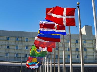
Red is the most popular colour on flags, with about 155 national banners containing at least some red. Here we visit ten countries that have red as the primary colour on their flag. Identify our destination from the photo and the clues.

A photo quiz by EnglishJedi. Estimated time: 6 mins.
  1. Home
  2. »
  3. Quizzes
  4. »
  5. World Trivia
  6. »
  7. Flags and Symbols
  8. »
  9. World Flags

Author
EnglishJedi
Time
6 mins
Type
Photo Quiz
Quiz #
385,199
Updated
May 22 23
# Qns
10
Difficulty
Average
Avg Score
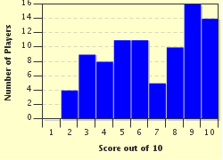
7 / 10
Plays
428
Awards
Top 20% Quiz
Last 3 plays: Kabdanis (10/10), jibberer (9/10), DeepHistory (9/10).
-
Question 1 of 10
1. The photo shows a beautiful World Heritage Site from a country whose flag is a blue cross fimbriated in white on a red background. The country's national anthem is 'Kongesangen' ("The King's Song") and one of its two official languages is Sami. It originally unified as a country in the 9th century, and again became an independent kingdom in 1814. Where on Earth is this? Hint


Question 2 of 10
2. The photo shows the famous Jemaa el-Fnaa market in the heart of a major city in a country whose flag is a centrally-situated black-bordered green pentagram on a dark red background. A major regional power under the Idrisid dynasty (established in 788) it has been a protectorate of both France and Spain and an independent kingdom was re-established in 1956. You can spend dirham here. Where on Earth are we? Hint


Question 3 of 10
3. The photo shows the imposing Rozafa Castle, which stands 430 feet above sea level near to the historic city of Shkoder. This country's flag has a black, double-headed eagle centrally located on a red background and its national anthem is 'Himni i Flamurit' ("Hymn to the Flag"). Its single-chamber parliament is called the 'Kuvendi'. Where on Earth are we? Hint


Question 4 of 10
4. In the background is the skyline of the national capital, whose name translates to "place of dreams", whilst the marina in the foreground screams "money". This country's flag consists of a horizontal white band on the left of a wider red band, separated by five triangles forming a serrated edge. With an area of just 295 sq miles, it gained independence in 1971. Where on Earth are we? Hint


Question 5 of 10
5. The Juche Tower dominates the skyline of the national capital, as seen across the Taedong River. This country's flag consists of a wide red horizontal band with narrow blue bands at top and bottom, and a red five-pointed star in a white circle offset to the left. The language here is written in the Chosŏn'gŭl script and the Anglicized name of the national anthem is 'Aegukka' ("The Patriotic Song"). Where on Earth are we? Hint


Question 6 of 10
6. The picture shows the remains of a famous 15th century city located 8,000 feet up in the mountains. The flag of the modern-day country is of simple design with three vertical bands of red-white-red. Two of the three official languages spoken here are Quechua and Aymara, and tourists will need to swap their dollars and pounds for Sol to make their purchases. Where of Earth are we? Hint


Question 7 of 10
7. Although not open to the public, the Royal Palace (pictured) in the northwest of the capital Nukuʻalofa is easily viewed from the waterfront. The country's flag is all red except for a white rectangle containing a red Greek cross in the upper hoist corner. The only Pacific island nation that was never officially colonized, its currency is the Pa'anga. Where on Earth are we? Hint


Question 8 of 10
8. The photo shows the Tian Shan Mountains, just an hour's drive south of Bishkek, the capital of this rugged, mountainous, landlocked country. Adopted in 1992, the national flag retained the colours of their former Russian overlords: a red background with a centrally located Sun with 40 uniformly-spaced rays. The country's national hero is Manas, who led the united tribes against the Mongols in the 10th century. Where on Earth are we? Hint


Question 9 of 10
9. The photograph shows the historic fishing port of Hoi An, a World Heritage Site since 1999. This country's flag is all red with a yellow five-pointed star in the centre. Historically, this was part of Imperial China for more than a millennia, and an independent state was formed in 939 AD. Similar in size to Germany, its national anthem is 'Tiến Quân Ca' ("Army March"). Where on Earth are we? Hint


Question 10 of 10
10. The photograph shows the beautiful Lake Ohrid, one of Europe's deepest and oldest lakes, which straddles the southwestern border of this landlocked country. This unusual national flag design has a red background with a stylized yellow sun radiating in eight directions from the centre to the edge. The capital is situated on the Vardar River. In 2014, it was home to about 25% of the two million population of this country of mountains, valleys and rivers. Where on Earth are we? Hint


(Optional) Create a Free FunTrivia ID to save the points you are about to earn:

arrow Select a User ID:
arrow Choose a Password:
arrow Your Email:


View Image Attributions for This Quiz

Most Recent Scores
Apr 21 2024 : Kabdanis: 10/10
Apr 18 2024 : jibberer: 9/10
Apr 11 2024 : DeepHistory: 9/10
Apr 03 2024 : Guest 99: 4/10
Mar 30 2024 : Southendboy: 10/10
Mar 23 2024 : Guest 91: 10/10
Mar 17 2024 : federererer: 5/10
Mar 03 2024 : genoveva: 8/10
Feb 29 2024 : Goodfellali: 9/10

Score Distribution

quiz
Quiz Answer Key and Fun Facts
1. The photo shows a beautiful World Heritage Site from a country whose flag is a blue cross fimbriated in white on a red background. The country's national anthem is 'Kongesangen' ("The King's Song") and one of its two official languages is Sami. It originally unified as a country in the 9th century, and again became an independent kingdom in 1814. Where on Earth is this?

Answer: Norway

The photograph shows the spectacular Geiranger Fjord, one of the most visited sites in Norway, with cruise ships regularly travelling along the ten-mile long waterway to reach the village of the same name. Jointly with the Nærøyfjorden, it was named as a UNESCO World Heritage Site in 2005.

The Norwegian flag, adopted in 1821, is officially described as "a white-fimbriated blue Nordic cross on a red field". King Harald Fairhair (reigned 872-930) is credited with unifying the various regions of Norway into a single nation. Norway joined the Kalmar In ion in 1397 and in 1524 became a joint state with Denmark. It became an independent kingdom again in early 1814, but almost immediately joined an alliance with Sweden, which lasted until 1905. The two official languages are Norwegian and Sami, a Uralic language spoken by the Sami people in the Arctic regions of northern Norway, Finland and Sweden and northwestern Russia.
2. The photo shows the famous Jemaa el-Fnaa market in the heart of a major city in a country whose flag is a centrally-situated black-bordered green pentagram on a dark red background. A major regional power under the Idrisid dynasty (established in 788) it has been a protectorate of both France and Spain and an independent kingdom was re-established in 1956. You can spend dirham here. Where on Earth are we?

Answer: Morocco

The photograph shows an aerial view of the Jemaa el-Fnaa square and market, popular with both locals and tourists and located in the Medina quarter (the old city) of Marrakesh in central Morocco.

Located in the Maghreb region of North Africa, Morocco is a country of vast deserts and rugged mountains bordered by both the Mediterranean Sea and the Atlantic Ocean. Idris ibn Abdullah (King Idris I), a many-times-great grandson of the Prophet Mohammed, reigned only from 788 until 791 but is the founder of the dynasty that made Morocco a centre of Islam culture. Both France and Spain enjoyed dominion over the region throughout much of the 19th century, and Morocco became an official French protectorate in 1912, which lasted until independence in 1956. The Moroccan dirham replaced the franc as the official currency in 1960. There are 100 santim to the dirham.
3. The photo shows the imposing Rozafa Castle, which stands 430 feet above sea level near to the historic city of Shkoder. This country's flag has a black, double-headed eagle centrally located on a red background and its national anthem is 'Himni i Flamurit' ("Hymn to the Flag"). Its single-chamber parliament is called the 'Kuvendi'. Where on Earth are we?

Answer: Albania

The site of Rozafa Castle was captured by the Romans in 167BC and has been the site of numerous famous sieges, notably by the Ottomans in the 15th century and by the Montenegrins in 1912. The nearby city of Shkoder in northwestern Albania is one of the oldest and most historic places on the Balkan peninsular.

Known as the 'Kuvendit Popullor' ("People's Assembly") during the period of the People's Socialist Republic of Albania (1947-1999), the country's legislature has been known simply as 'Kuvendi' since 1997. The modern Albanian flag dates back only to 1992, although the basic design has changed little since 1912. Indeed, the central element, the double-headed eagle, dates back much further, to the Palaiologos dynasty, which ruled the Byzantine Empire from 1261 until 1453.
4. In the background is the skyline of the national capital, whose name translates to "place of dreams", whilst the marina in the foreground screams "money". This country's flag consists of a horizontal white band on the left of a wider red band, separated by five triangles forming a serrated edge. With an area of just 295 sq miles, it gained independence in 1971. Where on Earth are we?

Answer: Bahrain

Situated in the extreme north of Bahrain, Manama is both the island's capital and its largest city. Oil has made Bahrain one of the world's richest countries.

The world's 173rd largest country by area, Bahrain would fit more than five times into Rhode Island, the smallest U.S. state. Home to the Semitic-speaking Dilmun civilization as long ago as 3,000 BC, Bahrain was later ruled by the Assyrians, the Babylonians and the Persians. More recently, Britain established dominance of the region in the 1890s and in 1971 Bahrain became an independent state. Bahrain's flag is similar to that of its near neighbour, Qatar, but the 'red' in the Qatari version is closer to maroon, there are nine triangles (rather than five) in the serrated edge between the colours, and the Bahrain version is much squarer. The current flag was adopted in 2002, replacing a similar version (instead with eight triangles) that had been used since independence.
5. The Juche Tower dominates the skyline of the national capital, as seen across the Taedong River. This country's flag consists of a wide red horizontal band with narrow blue bands at top and bottom, and a red five-pointed star in a white circle offset to the left. The language here is written in the Chosŏn'gŭl script and the Anglicized name of the national anthem is 'Aegukka' ("The Patriotic Song"). Where on Earth are we?

Answer: North Korea

Completed in 1982, the Tower of the Juche Idea (commonly known as Juche Tower) was built to commemorate Kim Il-sung's 70th birthday. It stands in the centre of North Korea's capital, Pyongyang on the east bank of the Taedong River, directly across from Kim Il-sung Square.

Adopted in 1948, the description of the North Korean flag is officially defined in the country's constitution: "a central red panel, bordered both above and below by a narrow white stripe and a broad blue stripe. The central red panel bears a five-pointed red star within a white circle near the hoist". Dating back to the 15th century, the Korean alphabet is called Chosŏn'gŭl in North Korea and in China's Jilin Province and Hangul in South Korea.
6. The picture shows the remains of a famous 15th century city located 8,000 feet up in the mountains. The flag of the modern-day country is of simple design with three vertical bands of red-white-red. Two of the three official languages spoken here are Quechua and Aymara, and tourists will need to swap their dollars and pounds for Sol to make their purchases. Where of Earth are we?

Answer: Peru

Located high in the Andes mountains, the remains of what is sometimes called "The Lost City of the Incas", Machu Picchu has been a UNESCO World Heritage Site since 1983. Although locals knew of its existence, the Spanish conquistadors never discovered the 15th-century Incan city and is was only unveiled to the wider world by an American historian in the early 20th century.

The official flag of Peru, adopted when the country declared independence from Spain in 1824, 'El Pendón Bicolor' ("The Bicolor Banner"), is a vertical triband with a white centre and red at the two extremities. Depending on its use, the centre white band may 'defaced' by various emblems, most commonly the national coat of arms. The three official languages of Peru are Spanish, Quechua and Aymara, (the languages of the two major groups of indigenous peoples of the same names living in the Andes mountains). The sol was the basic unit of currency used in Peru from the early 19th century until 1985, when it was replaced by the Peruvian inti. That new currency lasted just six years, and in 1991 the 'Neuvo Sol' was introduced. The 'new' aspect of the name was officially dropped in 2015.
7. Although not open to the public, the Royal Palace (pictured) in the northwest of the capital Nukuʻalofa is easily viewed from the waterfront. The country's flag is all red except for a white rectangle containing a red Greek cross in the upper hoist corner. The only Pacific island nation that was never officially colonized, its currency is the Pa'anga. Where on Earth are we?

Answer: Tonga

The Dutch were the first Europeans to reach Tonga, in 1616. Abel Tasman stopped here in 1643 and James Cook, who named the archipelago The Friendly Isles, visited in 1773. The Spanish stopped here in 1793 and the first missionaries, from London, came four years later. In 1900, the kingdom signed a Treaty of Friendship with Britain which lasted 70 years, although it is the only Pacific Ocean nation to have always been officially self-governing.

Consisting of 169 islands of which 36 are inhabited, Tonga (meaning 'south') is the southernmost archipelago in central Polynesia. Around 70% of the 103,000 population (2011 Census) live on the main island Tongatapu, a third of those in the capital. Although the kingdom has a land area of only 290 square miles (slightly less than the Mediterranean island of Malta) its territory is spread over an area of 270,000 square miles (the size of New Zealand).

The design of the Tongan flag was officially enshrined into the kingdom's constitution in 1875, including a stipulation that it can never be changed. For most of the period under British protection, Tongans used the pound sterling as their currency -- the pa'anga (which literally translated means 'money') was introduced in 1967.
8. The photo shows the Tian Shan Mountains, just an hour's drive south of Bishkek, the capital of this rugged, mountainous, landlocked country. Adopted in 1992, the national flag retained the colours of their former Russian overlords: a red background with a centrally located Sun with 40 uniformly-spaced rays. The country's national hero is Manas, who led the united tribes against the Mongols in the 10th century. Where on Earth are we?

Answer: Kyrgyzstan

The highly mountainous terrain of Kyrgyzstan has been a major factor in preserving the ancient culture of the Kyrgyz peoples, which dates back more than 2,000 years. The Great Silk Road leading from China to the West crossed Kyrgyzstan, so the region has long been dominated by various foreign powers. Indeed, only since 1991, when it escaped from the Soviet Union, has it officially gained the status of a sovereign state.

The red background of the Kyrgyzstan flag represents bravery, whilst the yellow Sun stands for peace and wealth. The 40 individual rays (which point clockwise on the front of the flag and counter-clockwise on the obverse) each represent one of the 40 Kyrgyz tribes that untied under the hero Manas against the Mongol invasion. A statue of Manas stands in the centre of the capital, Bishkek, which honoured the 1,000th anniversary of his heroics in 1995.
9. The photograph shows the historic fishing port of Hoi An, a World Heritage Site since 1999. This country's flag is all red with a yellow five-pointed star in the centre. Historically, this was part of Imperial China for more than a millennia, and an independent state was formed in 939 AD. Similar in size to Germany, its national anthem is 'Tiến Quân Ca' ("Army March"). Where on Earth are we?

Answer: Vietnam

The easternmost country on Southeast Asia's Indochina Peninsular, Vietnam was part of Imperial China from 111 BC until it gained independence following the Battle of Bạch Ðằng River in 939. After China and North Korea, it is the world's oldest remaining one-party communist state, the Communist Party of Vietnam having taken power in 1956 when the country was still part of the colony of French Indochina and continued following independence after the Vietnam War. (Laos and Cuba are the world's only other countries that still have this form of government.)

Previously called Fai-Fo, the city of Hội An (meaning "peaceful meeting place") is centrally located on the country's east coast. An important trading port from the 15th until the 19th century, the historic district is exceptionally well-preserved.

The design of the Vietnamese flag dates to 1940, when it was used first to oppose French rule and then Japanese occupation during WWII. It remained as the flag of North Vietnam during the Vietnam War, and was then adopted by the reunified country in 1976.
10. The photograph shows the beautiful Lake Ohrid, one of Europe's deepest and oldest lakes, which straddles the southwestern border of this landlocked country. This unusual national flag design has a red background with a stylized yellow sun radiating in eight directions from the centre to the edge. The capital is situated on the Vardar River. In 2014, it was home to about 25% of the two million population of this country of mountains, valleys and rivers. Where on Earth are we?

Answer: North Macedonia

With a history dating back into antiquity, Macedonia has been invaded and occupied by just about everyone over the last two millennia. It was part of the Roman (and later Byzantine Eastern Roman) Empire and then the Ottoman Empire before becoming a constituent in the Serb-dominated Kingdom of Yugoslavia following WWI. Even when it declared independence in 1991, an ongoing dispute with Greece over the name 'Macedonia' meant that it was admitted to the UN in 1993 using the name "Former Yugoslav Republic of Macedonia"; in 2019 the name was changed to North Macedonia.

North Macedonia's colourful national flag was adopted only in 1995 when the Greeks forced them to replace their former flag, a red background with a centrally-located "Vergina Sun", a symbol which the Greeks considered belonged to them.

Evidence of human habitation in the region around the Macedonian capital, Skopje (known as Scupi to the Romans) dates back to at least Neolithic times, more than 6,000 years ago. For a period in the later 10th-century, it was the capital of the Bulgarian Empire, and in the 14th century performed the same function for the Serbian Empire.
Source: Author EnglishJedi

This quiz was reviewed by FunTrivia editor Pagiedamon before going online.
Any errors found in FunTrivia content are routinely corrected through our feedback system.
Related Quizzes
1. Fun Flags From the Past Average
2. The Union Jack Tough
3. Flags of the Pacific Easier
4. The Most! Difficult
5. Flags From the Past Average
6. Whose Flag Is It, Anyway? Average
7. Pastime with Symmetrical Flags Tough
8. Odd Flag Out Again Difficult
9. Wavin' Flag Average
10. Ten Flag Terms Tough
11. The Flags of South America Easier
12. A Royal Standard Average

4/23/2024, Copyright 2024 FunTrivia, Inc. - Report an Error / Contact Us