FREE! Click here to Join FunTrivia. Thousands of games, quizzes, and lots more!
Quiz about Rivers of Australian Life

Rivers of Australian Life Trivia Quiz


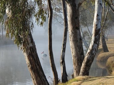
Welcome to the world of Australian rivers, the life blood of our very dry nation. Read the questions carefully for possible clues - and have fun.

A multiple-choice quiz by Creedy. Estimated time: 3 mins.
  1. Home
  2. »
  3. Quizzes
  4. »
  5. Geography Trivia
  6. »
  7. Australia
  8. »
  9. Australian Bodies of Water

Author
Creedy
Time
3 mins
Type
Multiple Choice
Quiz #
394,586
Updated
Dec 03 21
# Qns
10
Difficulty
Easy
Avg Score
8 / 10
Plays
434
Awards
Top 5% quiz!
Last 3 plays: Guest 54 (10/10), zartog (7/10), Guest 149 (10/10).
- -
Question 1 of 10
1. Three rivers in the Northern Territory in Australia are all named after a ferocious creature not even native to this country. What is their one name? Hint


Question 2 of 10
2. With a name similar to a man who jumped out of a plane, which famous Australian river is referred to as a creek?
Hint


Question 3 of 10
3. On which graceful bird-filled river in Western Australia is the capital city of Perth located?
Hint


Question 4 of 10
4. Found in the Kimberley region of Western Australia, which briefly named river features Western Australia's most northerly estuarine system? Hint


Question 5 of 10
5. In which regal Australian state is the Flinders the longest river? Hint


Question 6 of 10
6. Is it true, really true, that Melbourne's Yarra River was once historically known as the Yarra Yarra River?


Question 7 of 10
7. Which meteorologically named river in south eastern Australia gave birth to the country's huge hydro electricity scheme? Hint


Question 8 of 10
8. Which affectionately named river in New South Wales is the third longest river in Australia?
Hint


Question 9 of 10
9. Can you name the river on which Hobart, the capital of Tasmania, is located? Hint


Question 10 of 10
10. Is it true that the Endeavour River in the far north-east of Queensland is the site where Captain Cook's famous ship was beached in 1770?


(Optional) Create a Free FunTrivia ID to save the points you are about to earn:

arrow Select a User ID:
arrow Choose a Password:
arrow Your Email:


Most Recent Scores
Mar 31 2024 : Guest 54: 10/10
Mar 17 2024 : zartog: 7/10
Mar 15 2024 : Guest 149: 10/10
Feb 27 2024 : Guest 1: 8/10
Feb 27 2024 : Clubnite: 7/10
Feb 27 2024 : Guest 49: 8/10
Feb 22 2024 : Guest 1: 4/10

Quiz Answer Key and Fun Facts
1. Three rivers in the Northern Territory in Australia are all named after a ferocious creature not even native to this country. What is their one name?

Answer: Alligator Rivers

Found in the Arnhem Land of the Northern Territory in Australia are the East, West and South Alligator Rivers. Very unimaginative use of names I must say - not to mention the fact that we don't actually have alligators in this country. What we do have, particularly in that part of Australia, are ferociously huge crocodiles. The East Alligator River flows northwest and is about 160 kilometres long. It enters the sea at Van Diemen Gulf. The South Alligator is around the same length and also flows northwest - passing through disused uranium mines along the way - and again enters the sea at Van Diemen Gulf. The West Alligator is only eighty kilometres long and, although my map doesn't say, it probably ends up in the same area of the sea as well.

Just in passing, there is a huge hotel in Jabiru, a town right up the top of the Northern Territory. It is called the Crocodile Hotel, and, rather creepily, it is built in the shape of one of those horrifying beasts. The architecture, though, is really impressive.
2. With a name similar to a man who jumped out of a plane, which famous Australian river is referred to as a creek?

Answer: Cooper Creek

At some 1,300 kilometres long, Cooper Creek is also frequently referred to as the Barcoo River, but that's actually the name of one of the misnamed Cooper Creek's tributaries. Both are part of three major drainage systems that flow way down south into the Lake Eyre basin. All that however depends on whether we get rain in this part of the world or not. Cooper Creek, once known as Cooper's Creek, but referred to as a river in its early days (Oh this is so confusing) rises is the far north east of Queensland, west of the Great Dividing Range, crosses down into South Australia, and then makes its weary way into Lake Eyre, a lake that is sometimes full and teeming with fish and beautiful birds, but sometimes as dry as a bone.

Because of the instability of the weather, Cooper Whatever is often absorbed into the ground of the several deserts through which it passes, leaving just a few waterholes to show where it has passed. Australia can break your heart if you let it. This water system is famous for one other tragedy. It is where, in 1860-61, two of our early explorers, Burke and Wills, died of hunger and thirst on their attempt to cross this unforgiving continent from south to north, a distance of some 3,250 kilometres.

(D.B. Cooper was a man who hijacked an American Boeing 727 in November, 1971 - parachuted out of the plane in the middle of nowhere, and was never seen again)
3. On which graceful bird-filled river in Western Australia is the capital city of Perth located?

Answer: Swan River

Located in the south west of Western Australia, the beautiful Swan River runs right through the heart of Perth. It's not a very long river as such, measuring only 72 kilometres, but it drains several catchment areas of 121,000 square kilometres. Its three major tributaries are the Avon, the Canning and the Helena rivers.

When the sea levels were much lower than they are today, the Swan River once flowed all the way out to Rottnest Island, which is nineteen kilometres off the coast of Fremantle, but now the river drains directly into the Indian Ocean at Fremantle itself.

The gorge the water carved out on that long ago trip, now all under water, is approximately the size of America's Grand Canyon. The Swan River was so named because of the beautiful graceful black swans which dwell on its banks and water.
4. Found in the Kimberley region of Western Australia, which briefly named river features Western Australia's most northerly estuarine system?

Answer: Ord River

The Ord River rises in the Kimberley Plateau of Western Australia before making its way over a distance of 650 kilometres to discharge into the Timor Sea at Cambridge Gulf. It was named after the then governor of Western Australia, Harry Ord (and a lot of letters after his name) by the river's initial European explorer, Alexander Forrest. Who was Harry Ord when he was home? Who cares.

The Ord River, Irrigation Scheme, which features two massive dams and irrigation systems, is said - so far - not to have damaged the quality of the water in the lower reaches of the river, but that remains to be seen. Murmurs of salinity and erosion issues are beginning to be heard in the area.

The protected estuarine section of the river is famous for its forests, lagoons, creeks, and beautiful birds and wildlife. Let us pray it remains that way.
5. In which regal Australian state is the Flinders the longest river?

Answer: Queensland

Queensland's Flinders River is just over one thousand kilometres long. It rises on the north western side of the Great Dividing Range (which runs practically the entire length of the east coast of the continent) before making its leisurely way through largely flat terrain way up north to empty out at the Gulf of Carpentaria. Australia is a very flat country in its great heart, and thus unfortunately, when rain occurs in larger amounts than normal, sees not particularly dramatic rivers easily spilling over their banks to spread like great wet blankets across the land.

Along the slow journey of the Flinders to the northern waters of the nation, it passes by several well known country towns and settlements, collects 36 tributaries, carves out a gorge at the Porcupine National Park, nods at two dams that had the impertinence to be built on its waters, and, just before it empties into the sea, flows through a very important wildlife area called, wait for it, the Gulf Plains Important Bird Area. Truly, the people who named many of the important and glorious geographical areas of our nation had all the creativity and imagination of a dry cracker. That area is replete with some of the loveliest and unique birds in the world - and look at the dopey name they called it.
6. Is it true, really true, that Melbourne's Yarra River was once historically known as the Yarra Yarra River?

Answer: Yes

The beautiful and elegant city of Melbourne grew around the lower stretches of the 242 kilometre long Yarra River after it made its way from its source in the Yarra Ranges, down through the Yarra Valley, before emptying out into Hobsons Bay at Port Phillip.

This part of the river was a major source of food for the local indigenous people who had lived there for thousands of years before the arrival of Europeans, but in the blink of a tear filled eye, this all changed, and the tribes melted away as the trees fell and the land was cleared.

Originally known as Birrarung by the Wurundjeri people, that word translated into English as "ever flowing" and this is what this lovely river has always delivered through its thousands of years of history.
7. Which meteorologically named river in south eastern Australia gave birth to the country's huge hydro electricity scheme?

Answer: Snowy River

With its source on Mount Kosciuszko (the highest mountain in Australia), the Snowy River drains the eastern half of the Snowy Mountains in New South Wales before flowing down through Victoria's Snowy River National Park and emptying into Bass Strait at the bottom of mainland Australia. It's a wonder they didn't name it Snowy Strait as well. All the snow melting from the southern alps in south eastern Australia contributes to the rapid and powerful flow of this 352 kilometre long river - and it was this that drew the eyes of an energy hungry nation seeking a cheap and reliable source of power for its expanding population.

The Snowy Mountains Hydroelectric Scheme, and its associated irrigation project, has completed altered the destiny of the Snowy River. This project, constructed between 1949 and 1974, consists of 16 major dams and seven power stations, and hundreds of kilometres of tunnels and pipes built along the course of the Snowy River and its tributaries, so that, while providing its cheap and reliable hydropower, much of the waters of the Snowy have been diverted through two huge tunnels driven through the Great Dividing Range to the water hungry farmlands of the west. Initially, with 99 per cent of the river's flow diverted, the ecosystem of the deprived natural areas of the water's flow were drastically affected. Over time, 15 per cent of the natural flow of the river was returned to its ageless course, and in 2017, it was announced that this would soon increase to 21 per cent.
8. Which affectionately named river in New South Wales is the third longest river in Australia?

Answer: Darling

The Darling River, at 1,472 kilometres long, rises in northern New South Wales and makes its long way south before linking up with the powerful Murray River at the town of Wentworth in New South Wales. Together with its tributaries, and now known as the Murray-Darling, they form the longest river system in the country. Once a thriving, beautiful and healthy river, the Darling has been abused for years by man's overuse and insecticide pollution. Put those two deadly forces together with Australia's eternal battles with drought, and you have one very sick little darling indeed.

In recent years, a reluctant federal government has tried to repair at least some of the damage caused to this abused and neglected river, but there is still a long, long way to go.

It's heartbreaking.
9. Can you name the river on which Hobart, the capital of Tasmania, is located?

Answer: Derwent

The Derwent River, on which Hobart, the capital of Tasmania, is located, flows south-east from the Central Highlands of that diminutive State over 200 kilometres before finally emptying into the Tasman Sea. This little river is one of the most hard working in Australia and supplies its waters to the industries of agriculture, forestry and hydroelectric power, as well as providing irrigation for other growers, and lending its waters to assorted marine and recreation industries such as boating, transportation, and fishing.

When Tasmania was first settled by Europeans in the early 1800s, the Derwent flowed through large she-oak forests, but over time these have been heavily depleted on the lower reaches of this valiant little river in particular. Indeed, the name Derwent itself is derived from the old Celtic language and translates to "valley thick with oaks". Prior to the devastating impact of that settlement, local indigenous people lived by the banks of the Derwent for thousands of years in complete harmony with nature. Incredibly so, for such a short body of water, twenty dams and reservoirs are built across the course of this river. These, along with agricultural run off, heavy industries waste, and the relentless depletion of the forests along its banks, are beginning to signal irreversible damage to the waters of this valiant stream. Unless governments are prepared to act, and soon, it will be too late.
10. Is it true that the Endeavour River in the far north-east of Queensland is the site where Captain Cook's famous ship was beached in 1770?

Answer: Yes

Once again Australia is notable for a deficiency in the imagination realm, for the Endeavour comprises not one, but three rivers all named after Captain Cook's famous ship. These all combine to form the one lovely body of water in the far north-east of Queensland - but be warned though. Crocodiles also inhabit its waters. Originally named Endeavours River by botanist Joseph Banks, the ultimately tasty Captain Cook (who met his demise and was dished up for dinner in the Sandwich Islands in 1779), referred to the river as the Endeavour, and that is the name by which we know it today.

It was at the mouth of this river that Cook beached his famous ship, the HMS Endeavour, for repairs to be carried out on its hull after it had sustained considerable damage by striking a reef off the Queensland coast in 1770. Today, the modern township of Cooktown, one of the most northerly towns on Australia's east coast, is built around the mouth of the Endeavour River.
Source: Author Creedy

This quiz was reviewed by FunTrivia editor agony before going online.
Any errors found in FunTrivia content are routinely corrected through our feedback system.
4/19/2024, Copyright 2024 FunTrivia, Inc. - Report an Error / Contact Us