FREE! Click here to Join FunTrivia. Thousands of games, quizzes, and lots more!
Quiz about Rivers of North America

Rivers of North America Trivia Quiz


Put your knowledge of running water to the test! Distances shown are as close to accurate as possible, given that every reference text and map seems to differ a little.

A multiple-choice quiz by bigred62. Estimated time: 4 mins.
  1. Home
  2. »
  3. Quizzes
  4. »
  5. Geography Trivia
  6. »
  7. Physical Geography
  8. »
  9. Rivers

Author
bigred62
Time
4 mins
Type
Multiple Choice
Quiz #
1,367
Updated
Dec 03 21
# Qns
10
Difficulty
Tough
Avg Score
6 / 10
Plays
2690
Last 3 plays: Guest 66 (8/10), Guest 73 (6/10), Guest 37 (4/10).
- -
Question 1 of 10
1. Partially ice-bound in the winter, this river is a major shipping artery out of the Great Lakes. Hint


Question 2 of 10
2. Formed at the confluence of the Monongahela and Allegheny rivers, this river flows mostly southwest into the Mississippi river. Hint


Question 3 of 10
3. Originating in West Virginia, this river flows 287 miles in an easterly direction, into the Chesapeake Bay. Hint


Question 4 of 10
4. Rising in the Adirondack mountains, this river flows generally south for 315 miles, before emptying into the Atlantic ocean. Hint


Question 5 of 10
5. Rising in the Rocky mountains near the Alberta- British Columbia border, this river flows northwest, then southwest, for a distance of 850 miles, where it empties into the Strait of Georgia. Hint


Question 6 of 10
6. Double Trouble! This river rises in central North Dakota, and flows 710 mi. southeast into the Missouri river. Another river of the same name rises in western Virginia, and travels 340 mi. easterly, into Chesapeake Bay. Hint


Question 7 of 10
7. Originating in the San Juan mountains of Colorado, this river flows south and southeast into the Gulf of Mexico - a distance of approx. 1885 miles. Hint


Question 8 of 10
8. This river rises west of Mexico City, and flows 350 miles to the west to form Mexico's largest natural lake. Hint


Question 9 of 10
9. Flowing from Great Slave Lake north into the Arctic ocean, this river is navigable from June to October. Together with the Peace and Finlay rivers, it is Canada's longest, at 2635 miles. Hint


Question 10 of 10
10. Travelling northward for 545 miles, this river forms at the confluence of the Otter Tail and Bois de Sioux rivers near Breckenridge, Minn. It empties into the southern end of Lake Winnipeg, and is very prone to flooding. Hint


(Optional) Create a Free FunTrivia ID to save the points you are about to earn:

arrow Select a User ID:
arrow Choose a Password:
arrow Your Email:


Most Recent Scores
Apr 16 2024 : Guest 66: 8/10
Apr 09 2024 : Guest 73: 6/10
Mar 30 2024 : Guest 37: 4/10
Mar 25 2024 : Guest 75: 7/10
Mar 19 2024 : kyleisalive: 9/10
Mar 09 2024 : Guest 174: 4/10
Mar 08 2024 : Guest 73: 6/10
Mar 05 2024 : redbrick0108: 4/10
Mar 02 2024 : Guest 90: 7/10

Score Distribution

quiz
Quiz Answer Key and Fun Facts
1. Partially ice-bound in the winter, this river is a major shipping artery out of the Great Lakes.

Answer: St. Lawrence

From Lake Ontario to Anticosti Island in the Gulf of St. Lawrence, this river is 750 mi. in length.
2. Formed at the confluence of the Monongahela and Allegheny rivers, this river flows mostly southwest into the Mississippi river.

Answer: Ohio

The Ohio River originates in the area of Pittsburgh, and is approx. 980 mi. long.
3. Originating in West Virginia, this river flows 287 miles in an easterly direction, into the Chesapeake Bay.

Answer: Potomac

Washington, D.C. is its highest navigable point. This River starts out with north and south branches, confluencing southeast of Cumberland, MD.
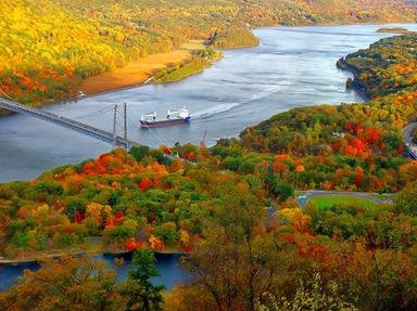
4. Rising in the Adirondack mountains, this river flows generally south for 315 miles, before emptying into the Atlantic ocean.

Answer: Hudson

Navigable all year up to Albany, NY, and except for winter months, barge traffic can reach the Great Lakes via Erie Canal.
5. Rising in the Rocky mountains near the Alberta- British Columbia border, this river flows northwest, then southwest, for a distance of 850 miles, where it empties into the Strait of Georgia.

Answer: Fraser

This river is world-famous for its salmon spawning, and its delta is a very fertile agricultural area.
6. Double Trouble! This river rises in central North Dakota, and flows 710 mi. southeast into the Missouri river. Another river of the same name rises in western Virginia, and travels 340 mi. easterly, into Chesapeake Bay.

Answer: James

--
7. Originating in the San Juan mountains of Colorado, this river flows south and southeast into the Gulf of Mexico - a distance of approx. 1885 miles.

Answer: Rio Grande

Much of this river's length forms the border between the USA and Mexico.
8. This river rises west of Mexico City, and flows 350 miles to the west to form Mexico's largest natural lake.

Answer: Rio Lerma

Forms Lake Chapala. Water from the Lerma is tunneled eastward through mountains, to help supply Mexico City's water needs.
9. Flowing from Great Slave Lake north into the Arctic ocean, this river is navigable from June to October. Together with the Peace and Finlay rivers, it is Canada's longest, at 2635 miles.

Answer: Mackenzie

The Mackenzie river basin is the largest in Canada, and is second in North America only to the Mississippi Missouri system.
10. Travelling northward for 545 miles, this river forms at the confluence of the Otter Tail and Bois de Sioux rivers near Breckenridge, Minn. It empties into the southern end of Lake Winnipeg, and is very prone to flooding.

Answer: Red

For approx. 440 miles this river forms the boundary between North Dakota and Minnesota.
Source: Author bigred62

This quiz was reviewed by FunTrivia editor spanishliz before going online.
Any errors found in FunTrivia content are routinely corrected through our feedback system.
4/23/2024, Copyright 2024 FunTrivia, Inc. - Report an Error / Contact Us