FREE! Click here to Join FunTrivia. Thousands of games, quizzes, and lots more!
Quiz about The Jemez Mountains

The Jemez Mountains Trivia Quiz


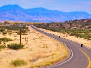
The Jemez Mountains of north-central New Mexico are a place of long history and great beauty. Let me take you on a journey there, through space and time . . .

A multiple-choice quiz by CellarDoor. Estimated time: 5 mins.
  1. Home
  2. »
  3. Quizzes
  4. »
  5. Geography Trivia
  6. »
  7. States N-O
  8. »
  9. New Mexico

Author
CellarDoor
Time
5 mins
Type
Multiple Choice
Quiz #
219,825
Updated
Dec 03 21
# Qns
10
Difficulty
Average
Avg Score
7 / 10
Plays
554
Awards
Top 10% Quiz
Last 3 plays: Guest 38 (6/10), Guest 98 (10/10), marianjoy (10/10).
- -
Question 1 of 10
1. About 1.6 million years ago, the Jemez Mountains as we now know them were formed in a cataclysmic volcanic eruption that released some 50 cubic miles of ash. Is the region still geologically active?


Question 2 of 10
2. Many, many years passed. Flowing water easily carved caves and canyons in the soft volcanic rock that coated the surrounding mesas. What is the name for this type of rock, made up of compacted ash? Hint


Question 3 of 10
3. In the eastern part of the Jemez Mountains, one of the mightiest Western rivers flows through a deep rift valley. What is the U.S. name of this river, which begins in Colorado and forms the border between Texas and Mexico? Hint


Question 4 of 10
4. From the eastern foothills of the Jemez Mountains, the traveler is treated to a spectacular view over much of north-central New Mexico. Looking east, you can see mountains towering over Santa Fe; they're a range of the Rockies. What name does this mountain range have, given in tribute to its glorious red color during some sunrises and sunsets? Hint


Question 5 of 10
5. The Jemez Mountains were once home to an ancient people whose cliff dwellings are found all over the Southwest. Although they were probably the ancestors of the modern Pueblo peoples, we don't know what this ancient group called themselves, so we commonly call them by what name given to them by ancient Navajos? Hint


Question 6 of 10
6. These ancient cliff-dwellers left behind a large number of pictures carved into the rock. In some cases, these pictures stand out dramatically: the artists pecked through the dark patina of volcanic rock to reveal the lighter stone underneath. What is this type of art called? Hint


Question 7 of 10
7. Some of the best-preserved, most accessible archaeological sites in New Mexico are found in a 33,000 acre national monument centered on Frijoles Canyon in the Jemez Mountains. Paved trails running along the cliffside take visitors through cliff dwellings and to a "ceremonial cavern" with a reconstructed kiva. What is the name of this monument, named for a 19th-century anthropologist? Hint


Question 8 of 10
8. In the southern Jemez Mountains lies the Jemez Pueblo, a sovereign indigenous nation with about 3,400 tribal members. This pueblo, whose roots in the region go back to the late 1200s, is one of how many federally recognized pueblos in the state of New Mexico? Hint


Question 9 of 10
9. Despite the beauty of the Jemez Mountains, this region is strongly associated with one of the most destructive moments of human history: the development of the atomic bomb. In 1943, Oppenheimer, Fermi, Teller, and other scientists of the Manhattan Project moved their operations here, in hopes that the remote location would improve security and secrecy. The laboratory they founded outlasted the war, and still conducts scientific research for the government to this day. What is the name of this lab? Hint


Question 10 of 10
10. In the year 2000, Congress purchased 89,000 acres of ranchland in the volcanic caldera in the center of the Jemez Mountains. This land now comprises the beautiful Valles Caldera National Preserve, where herds of elk roam and where visitors can hike, fish, cycle, or even ride horseback. But what happened to the cattle who grazed there in the summer? Hint


(Optional) Create a Free FunTrivia ID to save the points you are about to earn:

arrow Select a User ID:
arrow Choose a Password:
arrow Your Email:


Most Recent Scores
Mar 07 2024 : Guest 38: 6/10
Mar 06 2024 : Guest 98: 10/10
Feb 28 2024 : marianjoy: 10/10
Feb 24 2024 : Kankurette: 8/10

Score Distribution

quiz
Quiz Answer Key and Fun Facts
1. About 1.6 million years ago, the Jemez Mountains as we now know them were formed in a cataclysmic volcanic eruption that released some 50 cubic miles of ash. Is the region still geologically active?

Answer: Yes

This volcano will erupt again, but it will be a long time coming because it must rebuild its cone. The Jemez Mountains form a ring around the crater, a set of valleys called the Valles Caldera. The caldera now contains several valleys (instead of just the one original crater) because mountains are rising from the crater floor, riding the upswelling magma beneath; the largest of these is Redondo Peak at 11,254 feet. Hot springs may be found in several places in these mountains, and there are even occasional, small earthquakes. Definitely still active!
2. Many, many years passed. Flowing water easily carved caves and canyons in the soft volcanic rock that coated the surrounding mesas. What is the name for this type of rock, made up of compacted ash?

Answer: tuff

The cliffsides made of tuff have so many small, natural caves that they resemble Swiss cheese. Many of these caves were later enlarged by the Anasazi to make their vertiginous cliffside dwellings.
3. In the eastern part of the Jemez Mountains, one of the mightiest Western rivers flows through a deep rift valley. What is the U.S. name of this river, which begins in Colorado and forms the border between Texas and Mexico?

Answer: Rio Grande

In Mexico, this river is known as Río Bravo del Norte. Nineteen hundred miles long, flowing through a canyon that's 800 feet deep in places, it's truly a "grand" river, even if it runs a bit dry most of the year by east-coast standards.

The Rio Grande Rift Valley is a popular destination for fishers, whitewater rafters (during the spring and summer months when the snowmelt swells the river), and hikers. There's an incredible view from the mesas above the valley.
4. From the eastern foothills of the Jemez Mountains, the traveler is treated to a spectacular view over much of north-central New Mexico. Looking east, you can see mountains towering over Santa Fe; they're a range of the Rockies. What name does this mountain range have, given in tribute to its glorious red color during some sunrises and sunsets?

Answer: Sangre de Cristo Mountains

Spanish colonists -- Santa Fe was the second Spanish settlement in New Mexico -- saw this color and thought of the blood of Christ, so that's what they named the mountain range (in Spanish, of course). The Sangres are generally taller than the Jemez Mountains (in fact, every single New Mexican peak above 13,000 feet is located in this range), and several of them have some snowpack all year round.

The Sangres are about 40 miles east of the Jemez Mountains. On a clear day, from the same foothills, you can see as far as the watermelon-shaped Sandia Peak on the east side of Albuquerque, 70 miles to the south.
5. The Jemez Mountains were once home to an ancient people whose cliff dwellings are found all over the Southwest. Although they were probably the ancestors of the modern Pueblo peoples, we don't know what this ancient group called themselves, so we commonly call them by what name given to them by ancient Navajos?

Answer: Anasazi

"Anasazi" translates to "ancient enemies." For this reason -- as well as because it is a Navajo and not a Pueblo word -- the use of this term is controversial. Some groups insist on using "Ancestral Puebloan" or Hisatsinom (Hopi for "ancestors" or "people of long ago"), but Anasazi is still a favored choice in archaeological literature and in popular culture.

The height of the Anasazi ascendance was in the period 1100-1300 AD; this was when their famous cliff dwellings were constructed and when they spread throughout the Southwest (their culture seems to have been centered in the Four Corners region). At the end of this period, the population shifted further east into larger cliff settlements that contained thousands of people.
6. These ancient cliff-dwellers left behind a large number of pictures carved into the rock. In some cases, these pictures stand out dramatically: the artists pecked through the dark patina of volcanic rock to reveal the lighter stone underneath. What is this type of art called?

Answer: petroglyph

A pictograph is painted onto the rock, a geoglyph is carved into the ground (by removing turf or rocks on the surface), and lithography is a modern printing method.

Anasazi petroglyphs are numerous and varied. They depict animals, alone and being hunted. Some feature people, faces, or hands; others portray gods such as Kokopelli, the hunch-backed, flute-playing, mischievous fertility god. In the Jemez region, there are plenty of places to see petroglyphs; I particularly enjoyed the ones in Tsankawi, an unexcavated Anasazi village off State Road 4 near Los Alamos.
7. Some of the best-preserved, most accessible archaeological sites in New Mexico are found in a 33,000 acre national monument centered on Frijoles Canyon in the Jemez Mountains. Paved trails running along the cliffside take visitors through cliff dwellings and to a "ceremonial cavern" with a reconstructed kiva. What is the name of this monument, named for a 19th-century anthropologist?

Answer: Bandelier National Monument

Bandelier National Monument was named for Adolph Bandelier, who was the first white man to make it known to the world (he was guided there by a local, yet still got credit for the "discovery"). Frijoles Creek runs through a deep canyon to reach the Rio Grande beyond. In the cliffs lining the canyon are the ruins of a settlement that was once the home of a few thousand people. It's an easy climb to many of the dwellings, and well worth the trip; it must have been a difficult thing to haul up food and water on a regular basis, though. The park also features many miles of backcountry trails through the canyons.

Santa Fe National Forest covers much of the land surrounding Bandelier. Petroglyph National Monument is located just west of Albuquerque, covering a long volcanic escarpment with hundreds of petroglyphs. Chaco Culture National Historical Park is located in Chaco Canyon, site of one of the largest Anasazi settlements yet found, but is much less accessible to tourists due to its isolated location (at the end of over 20 miles of dirt road).
8. In the southern Jemez Mountains lies the Jemez Pueblo, a sovereign indigenous nation with about 3,400 tribal members. This pueblo, whose roots in the region go back to the late 1200s, is one of how many federally recognized pueblos in the state of New Mexico?

Answer: 19

The Jemez Pueblo is the only one of New Mexico's nineteen pueblos that speaks the Towa language (in which the name of the pueblo is pronounced "Hemish"; English speakers tend to pronounce the name "HEM-ase", as the Spanish would have, or "HEM-ez"). The other Pueblo languages are Tiwa, Tewa, Keres, and Zuni. New Mexico is also home to reservations belonging to the Apache, Hopi, Navajo and Ute peoples.

Because of the Rio Grande, the Jemez Mountains area contains no fewer than five pueblos: Santa Clara, San Ildefonso, Cochiti, and Santo Domingo, in addition to Jemez. Another ten pueblos are within a hundred-mile radius. Many of the highways in the area run through pueblo land, so speeders are stopped by the local tribal police and pay or contest their tickets in the particular pueblo's independent court system. This can work out to their advantage, because a traffic offense handled in pueblo court does not always lead to points on a New Mexico state driver's license!
9. Despite the beauty of the Jemez Mountains, this region is strongly associated with one of the most destructive moments of human history: the development of the atomic bomb. In 1943, Oppenheimer, Fermi, Teller, and other scientists of the Manhattan Project moved their operations here, in hopes that the remote location would improve security and secrecy. The laboratory they founded outlasted the war, and still conducts scientific research for the government to this day. What is the name of this lab?

Answer: Los Alamos National Laboratory

Although the bombs were tested a two hundred miles further south in the desert at Alamogordo, it was at Los Alamos (Spanish for "the cottonwoods") that the technology was developed. Before the war, Los Alamos was a sleepy town that was home to an outdoorsy boarding school for boys from the East Coast; the land that the boarding school sat on was appropriated by the government and never returned. The lab still conducts weapons research (including maintenance of aging nuclear stockpiles), as well as other research of strategic importance: conventional explosives, cryptography, epidemiology, and even methods for detecting biological attacks.

Of the other three answers, Sandia has locations in Albuquerque and in Livermore, California (where its across-the-street neighbor is Lawrence Livermore National Laboratory). The Fermi National Accelerator Laboratory, Fermilab for short, is located in Illinois.
10. In the year 2000, Congress purchased 89,000 acres of ranchland in the volcanic caldera in the center of the Jemez Mountains. This land now comprises the beautiful Valles Caldera National Preserve, where herds of elk roam and where visitors can hike, fish, cycle, or even ride horseback. But what happened to the cattle who grazed there in the summer?

Answer: Nothing: by law, the National Preserve remains a working ranch.

The Valles Caldera remain an important summer grazing location for ranchers in the area; as far as anyone can tell, the cattle and the elk co-exist fairly peacefully. The numbers are not huge; Preserve management generally brings in about 1500 head of cattle, although in some years persistent drought makes it impossible to sustain grazing in the area.

The park itself is deceptively peaceful, considering that it was the site of a cataclysmic eruption just 1.6 million years ago. It's a beautiful place to visit, as are the rest of the surrounding mountains. I've hoped you've enjoyed this quiz, and make sure you consider the Jemez area when you next have spare time in New Mexico!
Source: Author CellarDoor

This quiz was reviewed by FunTrivia editor LilahDeDah before going online.
Any errors found in FunTrivia content are routinely corrected through our feedback system.
4/19/2024, Copyright 2024 FunTrivia, Inc. - Report an Error / Contact Us