FREE! Click here to Join FunTrivia. Thousands of games, quizzes, and lots more!
Quiz about Blazing a Nullarbor Trail

Blazing a Nullarbor Trail Trivia Quiz


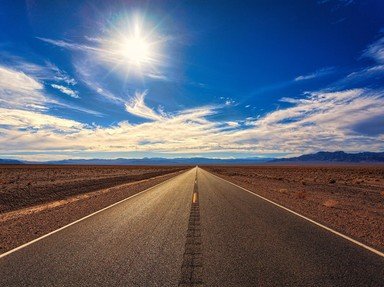
For many Australians crossing the Nullarbor is a rite of passage. To do so you have little option but to drive across the Eyre Highway. Come and take a ride with me on this amazing stretch of road.

A multiple-choice quiz by Team Phoenix Rising. Estimated time: 4 mins.
  1. Home
  2. »
  3. Quizzes
  4. »
  5. World Trivia
  6. »
  7. Transport
  8. »
  9. Roads & Highways

Author
pollucci19
Time
4 mins
Type
Multiple Choice
Quiz #
357,506
Updated
Dec 03 21
# Qns
10
Difficulty
Average
Avg Score
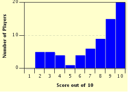
8 / 10
Plays
282
Awards
Top 10% Quiz
- -
Question 1 of 10
1. The Eyre Highway was named after Edward John Eyre. What was his claim to fame?

Hint


Question 2 of 10
2. Running across the bottom of the continent, the Eyre Highway crosses which two Australian states?

Hint


Question 3 of 10
3. Which of the following is a distinction the Eyre Highway in Australia holds?

Hint


Question 4 of 10
4. Are there any towns between Norseman, the start of the Eyre Highway, and the Western Australian border?


Question 5 of 10
5. Apart from providing a means of conveyance for motorists and hauliers which of the following is a recognised (authorised) purpose of the Eyre Highway?

Hint


Question 6 of 10
6. Your first stop on the Eyre Highway as you head east is Balladonia, which came to international attention when debris from which space station landed on it?

Hint


Question 7 of 10
7. Which community on the Eyre Highway, with a name that sounds like an old woman's seashell, is home to one of the largest cave systems in the world?

Hint


Question 8 of 10
8. What is the name of the coastal recess on Australia's southern coast that runs, almost in line, with the Eyre Highway and the Nullarbor Plain?

Hint


Question 9 of 10
9. The town of Poochera on Australia's Eyre Highway caused a stir amongst entomologist when a colony of Nothomyrmecia macrops was discovered there in 1977. By what name is this creature better known?

Hint


Question 10 of 10
10. Which town's name is a corruption of the Aboriginal word "Chedoona" and is the last major stop heading east, before Port Augusta, on the Eyre Highway?

Hint


(Optional) Create a Free FunTrivia ID to save the points you are about to earn:

arrow Select a User ID:
arrow Choose a Password:
arrow Your Email:


Most Recent Scores
Mar 24 2024 : PurpleComet: 7/10
Feb 27 2024 : Mommakat: 8/10

Score Distribution

quiz
Quiz Answer Key and Fun Facts
1. The Eyre Highway was named after Edward John Eyre. What was his claim to fame?

Answer: He was the first European to cross the Nullarbor Plain

Edward John Eyre (1815-1901) was one of Australia's premier land explorers. When the colony of South Australia was founded (1836), he drove a large herd of cattle and sheep from Monaro in New South Wales to the new colony. He sold the lot for a very tidy profit and then used these funds to help fund his endeavours in exploring the interior of South Australia. In 1840 he set out with fellow explorer John Baxter and three aboriginal guides. The aim was to make the western crossing beyond Ceduna and into Western Australia. Midway through the trip two of the aborigines killed Baxter and stole the majority of Eyre's supplies. Eyre and his guide, Wylie, managed to survive by employing clever bushcraft techniques. They also enjoyed some good fortune when they sighted a French whaling ship in what Eyre later named Rossiter Bay. Late in 1841, after some 2,000 torturous miles, they reached Albany in Western Australia.

Eyre's contributions to mapping Australia as well as his administrative abilities has seen him honoured by having his portrait grace an Australian postage stamp and his name attached to places such as Lake Eyre, which, on the rare occasions it fills, is the largest lake in Australia, the Eyre Peninsula, Eyre Creek and, of course, the Eyre Highway.
2. Running across the bottom of the continent, the Eyre Highway crosses which two Australian states?

Answer: Western Australia & South Australia

Forming part of Highway 1 of the Australian National Highway network, the Eyre Highway has its origins in the goldmining town of Norseman in Western Australia (WA). Norseman, once seen as the second richest goldfield in WA, only Kalgoorlie's Golden Mile outstrips it, considers itself as "the crossroads to everywhere". Situated 742 kilometres east of Perth and with a population of 857 (2006 census) it also provides access to the Great Eastern Highway and the Coolgardie - Esperance Highway.

At the other end of the Eyre Highway, 1675 kilometres away, is Port Augusta, which is South Australia's seventh most populous city. Port Augusta is 322 kilometres north of Adelaide; it sits in a natural harbour and provides valuable port facilities to the state. With a population of 13,257 (2006 census) it is a stopping point for the Indian Pacific train service that crosses the country from west to east and the Ghan train, which runs south to north from Adelaide to Darwin.
3. Which of the following is a distinction the Eyre Highway in Australia holds?

Answer: It contains one of the longest straight stretches of road in the world

There is a stretch of highway between Balladonia and Caiguna that runs for 146.6 kilometres without turning. Yes, you heard correctly, 91.1 miles of road without a hint of a bend. It sounds mind-numbing. Consider also that this stretch of road sits on the Nullarbor Plain, which is Latin for "no trees", and this drive has the potential to destroy the motorist's concentration. Apart from the occasional ridge the countryside around the driver is generally flat, covered in saltbush and, for the most part, unchanging. Boredom and fatigue can become serious concerns for tourists.

It also makes one wonder how Edward Eyre must have felt when he made the initial crossing through this region on foot. The mind could easily have convinced him that he'd walked for weeks without ever having left the same spot.
4. Are there any towns between Norseman, the start of the Eyre Highway, and the Western Australian border?

Answer: Yes

But only just. The distance from Norseman to the West Australian/South Australian border is 720 kilometres. Eucla, with a population of 86 people (2006 census) is the only town on that stretch and it is only eleven (11) kilometres from the border. The remaining 709 kilometres are dotted with a series of roadhouses which will offer motorists the essential services such as fuel, water and food.

The danger here to the unwary traveller is that these roadhouses are spread out in distances that range from 200 to 300 kilometres. Drivers need to be certain that they are able to reach the next service point before contemplating passing one entirely.

Another consideration is that not all of these roadhouses offer a twenty four hour service.
5. Apart from providing a means of conveyance for motorists and hauliers which of the following is a recognised (authorised) purpose of the Eyre Highway?

Answer: An emergency landing strip for the Royal Flying Doctor Service

The Royal Flying Doctor Service (RFDS) is one of the largest aeromedical operations in the world. It was the brainchild of the missionary, Reverend John Flynn who sought a method to provide medical services to the vast areas of Australia's outback. From its humble beginnings the service now incorporates in excess of sixty aircraft, operates more than 21 bases, employs over 1,100 people and travels in excess of 70,000 kilometres per day by air.
One of issues that have hampered their operation is the lack of suitable landing facilities in these remote sites. The Eyre Highway with its long stretches of straight road has provided one alternative. To this end four separate areas on the strip have been designated as emergency landing zones. All of these zones are well signposted and have a set of markings painted on the road known as "runway piano keys". In addition, turnaround bays have been built on the roadsides to accommodate these craft.
6. Your first stop on the Eyre Highway as you head east is Balladonia, which came to international attention when debris from which space station landed on it?

Answer: Skylab

Leaving Norseman in your quest to cross the Nullarbor you will need to travel some 219 kilometres to reach Balladonia. The site is a roadhouse that provides fuel and essentials. Attached to the roadhouse is a pub (bar) that offers meals and some motel style accommodation.
In the early hours of July 12, 1979, the US space station Skylab crashed to Earth and scattered debris in a 150 kilometre radius around Balladonia. The standing joke amongst the locals is that you can scatter space debris all over Balladonia and still not hit anyone. Pieces of Skylab are on display at the roadhouse and there are also newspaper articles spread across the walls that highlight the event.
Twenty eight kilometres east of the roadhouse you'll find the Balladonia homestead, a stone structure that was built in the 1880's and it serves as a reminder, or a testament, to the character of the early settlers that tried to scratch out an existence from this flat and desolate landscape that receives very little in the way of rainfall during the course of a year.
7. Which community on the Eyre Highway, with a name that sounds like an old woman's seashell, is home to one of the largest cave systems in the world?

Answer: Cocklebiddy

Cocklebiddy is yet another roadhouse on your way east across the Nullarbor Plain. This would be your third stop on the Eyre Highway after leaving Norseman and for most people it would be nothing more than a welcome stop. The place, however, can surprise you. Cocklebiddy is the southern edge of Western Australia's sheep grazing country and is the host to some very large properties. Arubiddy Station, for example, covers some 3,200 square kilometres.
Cocklebiddy Cave sits about ten kilometres northwest of the roadhouse and lies underground. Most of it is underwater. Finding a passage through the system can only be done with an organised team and with the use of scuba diving equipment. In 1983 a French team completed what was then the world's longest cave dive, traversing a distance of some 6.4 kilometres. This mark has since been extended a number of times and the caves have now been mapped using high-tech re-breather technology and radio location "pingers".
For those not partial to those confined spaces, fifty kilometres away is the Eyre Bird Observatory, home to some 230 bird species, which also provides excellent camping facilities.
8. What is the name of the coastal recess on Australia's southern coast that runs, almost in line, with the Eyre Highway and the Nullarbor Plain?

Answer: The Great Australian Bight

The Bight runs a distance of 1160 kilometres from Cape Pasley in Western Australia through to Cape Carnot in South Australia. The coastline here is highlighted by some spectacular cliff faces, as high as 60 metres, that stretch for miles on end and represents one of the longest cliff faces in the world.

In the region from the Head of the Bight through to Eucla the Bight is at its closest to the Eyre Highway. This makes it quite accessible and provides visitors with a great opportunity to sightsee and take photographs.

There are also some great surfing beaches along this stretch though their access can be difficult and it may not be wise without a four wheel drive. The area has also become a popular spot for migrating Southern Right Whales and the cliffs are great vantage point to observe them.
9. The town of Poochera on Australia's Eyre Highway caused a stir amongst entomologist when a colony of Nothomyrmecia macrops was discovered there in 1977. By what name is this creature better known?

Answer: Dinosaur Ant

Poochera is a small grain town on the Eyre Highway that is sixty kilometres north of Streaky Bay and 53 kilometres away from the Gawler Ranges in South Australia. With its population of 186 residents (2006 census) its main purpose is to serve as a grain exchange point for the farmers in the area. That is until the Dinosaur Ant was discovered.

The Dinosaur Ant is the only species of its genus that still exists today and scientists have dubbed it a "living fossil". Initially a solitary worker ant was discovered by an entomological team that came from Canberra under the direction of Dr Bob Taylor.

It wasn't long before they discovered an entire colony. A little while later the team found another colony in Penong, which is about 180 kilometres west of Poochera. Until then it was believed that the species had been wiped out.

A colony had been discovered in Balladonia (also on the Eyre Highway) in Western Australia in 1931 but the records of the site were not recorded and it was never again re-discovered.
10. Which town's name is a corruption of the Aboriginal word "Chedoona" and is the last major stop heading east, before Port Augusta, on the Eyre Highway?

Answer: Ceduna

In comparison to all the other towns that you would have driven through from west to east on the Eyre Highway Ceduna, with its population of 2,304 (2006 census), would almost feel like a metropolis. Situated on the coast at Murat Bay, Ceduna sits some 786 kilometres from South Australia's capital city Adelaide and has led a varied existence.

It was initially set up in the 1850's as a support to the whaling station that was built on nearby St Peter's Island, which no longer exists (the whaling station that is, not the island). Ceduna then became the hub for a major telecommunications satellite operated by the Overseas Telecommunications Commission (OTC), which became the major source of employment for the town's residents. By 1984 over half of Australia's telecommunications traffic was passing through Ceduna's Earth Station. Ten years later improved technologies and rationalisations saw the station shut down.

Some major mining projects are now being developed in the area, in particular by Iluka Resources, which has seen strong growth and development revitalise the town.
Source: Author pollucci19

This quiz was reviewed by FunTrivia editor stedman before going online.
Any errors found in FunTrivia content are routinely corrected through our feedback system.
4/16/2024, Copyright 2024 FunTrivia, Inc. - Report an Error / Contact Us