8. About 80% of the terrain of Chile is mountainous. What mountain range, which runs the length of the continent, stretches through the entire country of Chile, forming its eastern boundary?
From Quiz A Chilean Challenge
Answer:
Andes
The Andes are the world's longest continental mountain range, extending over 7,000 km (4,300 mi) from Venezuela, Colombia and Ecuador in the north, through Bolivia and Peru to the southern section in Argentina and Chile. The Caribbean islands of Aruba, Bonaire and Curacao off the coast of Venezuela are actually submerged peaks of the extreme northern end of the Andes. The southern end of the Andes is located at Cape Horn.
The Himalayas are in Asia, the Urals are often considered the boundary between Europe and Asia, and the Southern Alps are in Australia.

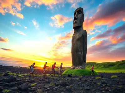 On a remote Pacific island, towering stone figures stand watch over centuries of change. Beneath their gaze lies a rich cultural legacy. This quiz explores the voices, traditions, and mysteries behind Rapa Nui's legendary guardians.


 Quick Question
 Top 10% Rated Quiz,