FREE! Click here to Join FunTrivia. Thousands of games, quizzes, and lots more!
Quiz about Superlative South America

Superlative South America Trivia Quiz


South America is a continent entirely in the western Hemisphere and mostly in the southern. It includes twelve sovereign states which I am focusing on in this quiz. Each state has at least one thing that makes a geographical top of the world list.

by Midget40. Estimated time: 3 mins.
  1. Home
  2. »
  3. Quizzes
  4. »
  5. Geography Trivia
  6. »
  7. South America

Author
Midget40
Time
3 mins
Type
Quiz #
414,905
Updated
Dec 25 23
# Qns
15
Difficulty
Average
Avg Score
12 / 15
Plays
191
Last 3 plays: Guest 99 (11/15), Guest 123 (11/15), Guest 45 (5/15).
I am giving you the country and the clue - you need to match them with the pictures. Some pictures/clues are a bit harder so I have included the country outline. A couple of these photos could match other clues but there is only one way that they all fit correctly.
Drag-Drop or Click from Right
Options
Chile: Driest non-polar place on earth Guyana: Largest single-drop waterfall in the world by volume Bolivia: Largest salt flat on earth Brazil: Largest rainforest in the world Suriname: Highest percentage of forest cover in the world. Bolivia: Highest capital city in the world Paraguay: Largest navy of any landlocked country anywhere General: World's largest river by volume Venezuela: World's tallest uninterrupted waterfall Peru: World's highest commercially navigable lake Colombia: Wettest country on earth Ecuador: Most northerly species of penguins in the world Argentina: World's southernmost city General: Longest mountain range in the world Uruguay: Most electricity from renewable sources in the world


Most Recent Scores
Apr 19 2024 : Guest 99: 11/15
Apr 12 2024 : Guest 123: 11/15
Mar 31 2024 : Guest 45: 5/15
Mar 01 2024 : PurpleComet: 15/15

Quiz Answer Key and Fun Facts
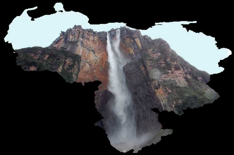
1. Venezuela: World's tallest uninterrupted waterfall

Venezuela is located on the northern coast of South America with Caracas the capital and largest city. It is known for its diverse and stunning landscapes including the Andes Mountains, the Amazon Rainforest and Angel Falls. It is one of the most biodiverse countries in the world because of these features.

Angel Falls is one of its natural wonders. It's the world's tallest uninterrupted waterfall cascading from the Auyan-Tepuí table mountain in the Canaima National Park. The falls plunge approximately 979 meters (3,212 feet) creating a breathtaking spectacle.

Please note: Classifications of waterfalls are very specific. Uninterrupted drop refers to how far the water falls in one flow before it hits an obstacle. At 4 metres higher, Tugela Falls in South Africa is the highest uninterrupted waterfall. This refers to its actual height. Angel Falls has a taller uninterrupted water drop. This does not affect the two questions I have on here about waterfalls as they are two different types of falls.
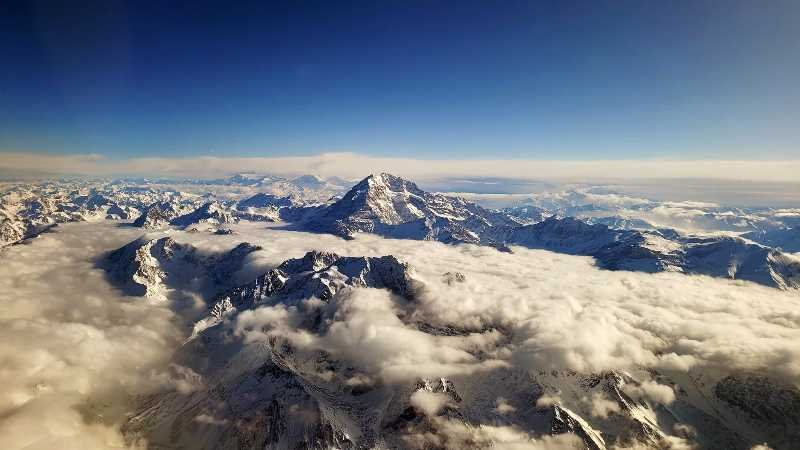
2. General: Longest mountain range in the world

The Andes is the longest mountain range in the world stretching approximately 7,000 kms (4,300 miles) along the western edge of South America. They run through seven South American countries: Venezuela, Colombia, Ecuador, Peru, Bolivia, Chile and Argentina. The range is characterized by diverse landscapes including high peaks, plateaus, deep valleys and volcanic zones.

The Andes is part of the Pacific Ring of Fire, a zone known for its high volcanic activity. Volcanoes are scattered along the range with notable ones like Cotopaxi in Ecuador and Villarrica in Chile.

They are home to some of the highest peaks in the Americas including Aconcagua in Argentina, Huascaran in Peru and Chimborazo in Ecuador. Aconcagua, in the province of Mendoza, Argentina, is the highest peak in both the southern and western Hemispheres. Towering at 6,961 meters (22,841 feet) it is the highest peak in the world outside of Asia.
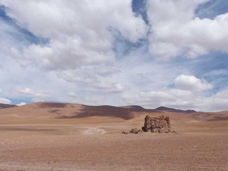
3. Chile: Driest non-polar place on earth

Chile is a long and narrow country stretching along the western edge of South America. With Santiago as its capital and largest city it is known for its geographical diversity. The country spans a wide range of climates and landscapes from the arid Atacama Desert in the north to the pristine fjords and glaciers of Patagonia in the south.

The Andes Mountains run along the eastern border of Chile while the west is bordered by a lengthy Pacific coastline. Chile's diverse landscape include salt flats, volcanoes, lakes and glaciers.

Not including the polar regions, the Atacama Desert is the driest and most arid place on earth. The desert stretches for about 1,000 kms (600 miles) along the Pacific coast. Some weather stations in the region have recorded years without any significant rainfall.

It also contains the Laguna Cejar, a saltwater lagoon known for its high salt concentration, that allows people to float effortlessly, and ancient geoglyphs and archaeological sites.
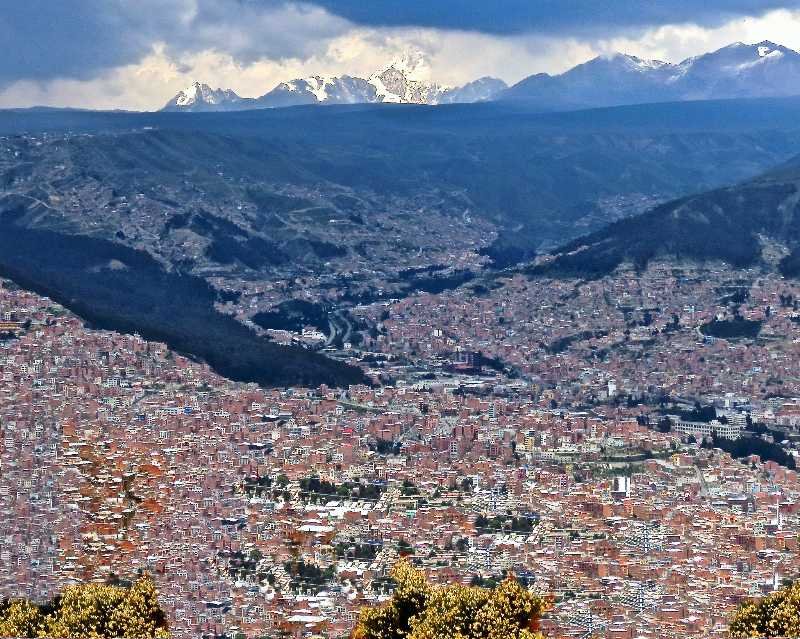
4. Bolivia: Highest capital city in the world

Bolivia is a landlocked country located in western-central South America. Sucre is the constitutional capital and seat of the judiciary, while La Paz is the seat of government and executive capital.

It is characterized by diverse landscapes, including the Andes Mountains, the Altiplano (high plateau), the Amazon Rainforest and the Gran Chaco lowlands.

La Paz holds the title of the world's highest capital city situated at an elevation of about 3,650 meters (11,975 feet) above sea level. Its unique topography and stunning mountainous backdrop make it a favoured travel destination.
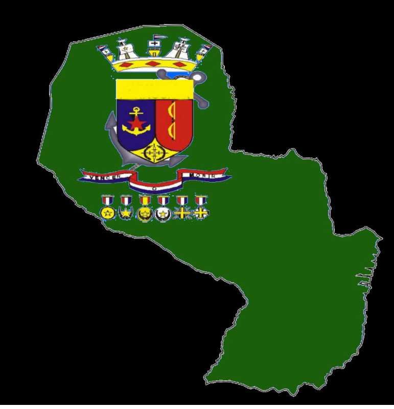
5. Paraguay: Largest navy of any landlocked country anywhere

Paraguay is a landlocked country in the middle of South America with Asuncion the capital and largest city. It shares borders with Argentina, Brazil and Bolivia, forming what is known as the Triple Frontier.

The Río Paraguay divides the country in two and the Itaipu Dam located on it is one of the largest hydroelectric power plants in the world. It is a joint project between Paraguay and Brazil, supplying energy to both countries.

The Gran Chaco, a vast and sparsely populated region, covers a significant portion of western Paraguay. It is known for its semi-arid landscapes, indigenous communities and wildlife.

Despite being a landlocked country Paraguay has a navy, making it unique among landlocked nations. The Paraguayan Navy operates on the Paraguay River. It primarily focuses on patrolling and maintaining security on this inland waterway.

The navy's historical roots date back to the War of the Triple Alliance (1864-1870), where Paraguay faced Argentina, Brazil and Uruguay. Paraguay's naval forces played a role in that conflict and today the country maintains a small navy to safeguard its navigable waterways.
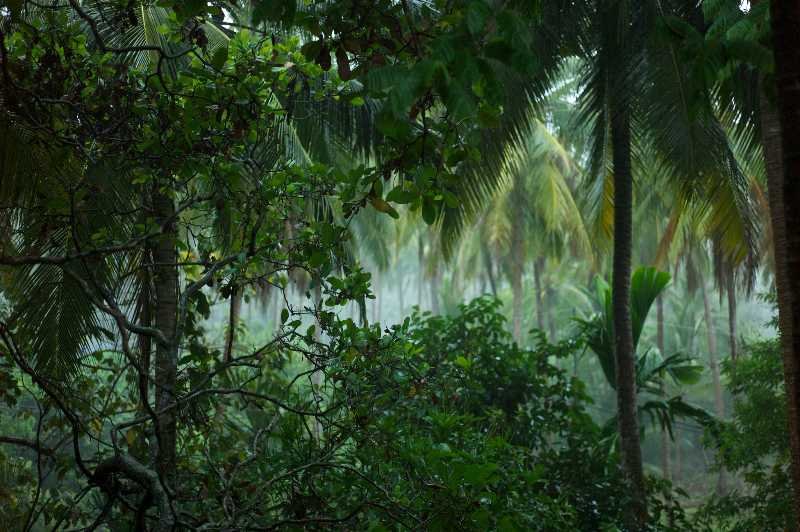
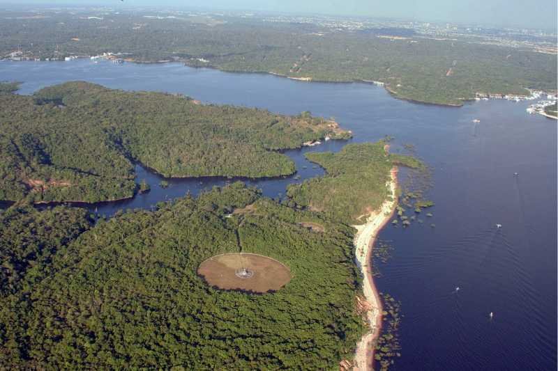
6. Brazil: Largest rainforest in the world

Brazil is the largest country in South America and the fifth-largest in the world. Bordered by the Atlantic Ocean on the east, Brazil has a coastline of 7,491 kms (4,655 miles). It covers roughly half of the continent's land area and borders all other countries and territories in South America except for Ecuador and Chile. Its capital is Brasília, but Rio de Janeiro and Sao Paulo are its major cultural and economic hubs.

Besides the Amazon River and the Amazon Rainforest, it is also famous for the world's largest tropical wetland area known as the Pantanal Wetlands. Iguazu Falls also sits on its border with Argentina.

The Amazon rainforest covers most of the Amazon basin of South America with 60% of it in Brazil which is why I have identified it with this country. The rest of it is in Peru with 13%, Colombia with 10% and minor amounts in Bolivia, Ecuador, French Guiana, Guyana, Suriname, and Venezuela.

The Amazon Rainforest, often referred to as the 'Lungs of the Earth,' is the largest tropical rainforest on the planet. It is home to an astonishing array of plant and animal species, many of which are not found anywhere else in the world.

Between the Amazon rainforest and Mata Atlantica forest, the woody savanna-like cerrado, the massive inland swamp known as the Pantanal and a range of other terrestrial and aquatic ecosystems, Brazil is also the world's number one in biodiversity leading the world in plant and amphibian species counts.
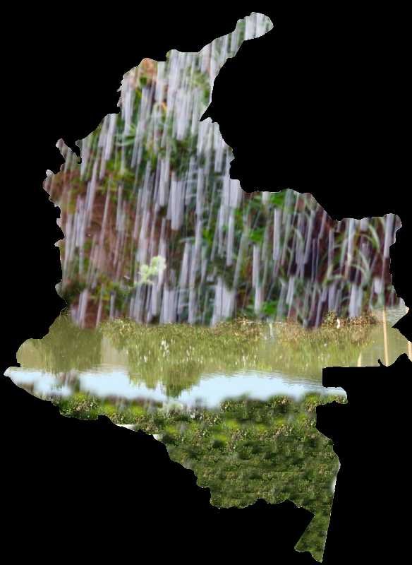
7. Colombia: Wettest country on earth

Colombia is located in the north-western part of South America with coastlines on the Pacific Ocean and Caribbean Sea. It is also home to the Andes Mountains, Amazon Rainforest and the vast Orinoco Plains. The Capital District of Bogota is also the country's largest city hosting its main financial and cultural hub.

Colombia has the world's highest precipitation rate, estimated at 3,240 millimetres per year (127 inches). Due to frequent and intense rainfall, several portions of the state are permanently flooded.

Lopez de Micay, a municipality located in the Cauca Department of Colombia, used to hold the record for the wettest town in the world but Mawsynram, a village in the north-eastern state of Meghalaya in India, surpassed that record.

They are also trying to edge Colombia out of the 'wettest place on earth' by querying Colombia's rainfall numbers but as they are only a state they can't claim the 'country' title either way.
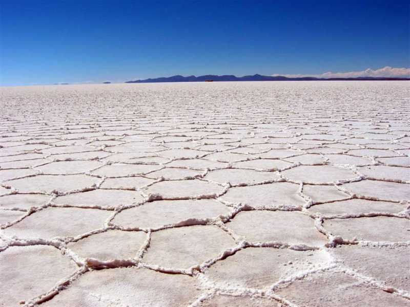
8. Bolivia: Largest salt flat on earth

Yes, Bolivia is getting two spots! This time for Salar de Uyuni, a massive salt flat located in southwest Bolivia. It was formed as a result of the transformation of prehistoric lakes and spans over 10,000 square kilometres (3861 square miles). The salt crust can be anywhere up to 10 metres (33 feet) thick and makes up a significant amount of the world's lithium reserves.

During the rainy season a thin layer of water transforms the salt flat into a massive natural mirror. This creates a surreal and breathtaking reflection of the sky, clouds and surrounding landscape making it a photographer's paradise.

In the middle of Salar de Uyuni lies Incahuasi Island, also known as 'Isla del Pescado' (Fish Island). The island is covered with giant cacti and offers panoramic views of the salt flat.
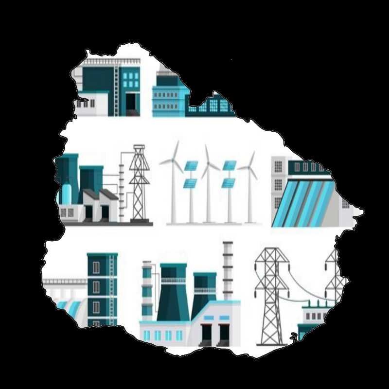
9. Uruguay: Most electricity from renewable sources in the world

Uruguay is located in the south-eastern part of South America and is the only country in the continent that is situated entirely south of the Tropic of Capricorn. It has 660 km (410 miles) of coastline with the Atlantic Ocean to the southeast and the Río de la Plata, the estuary of the Uruguay River, to the south.

The capital city of Montevideo, which is also the largest city, is the southernmost capital city in the Americas. Only Canberra and Wellington (Australia and New Zealand) are further south than it globally. The landscape is mostly rolling plains and low hill ranges with a fertile coastal lowland.

It holds the world record with 98% of the energy used to run its power grid coming from renewable resources. The majority is in hydropower and wind power but they also have biomass and solar power. This amazing decrease in the country's carbon footprint only took ten years and was done without government funding.
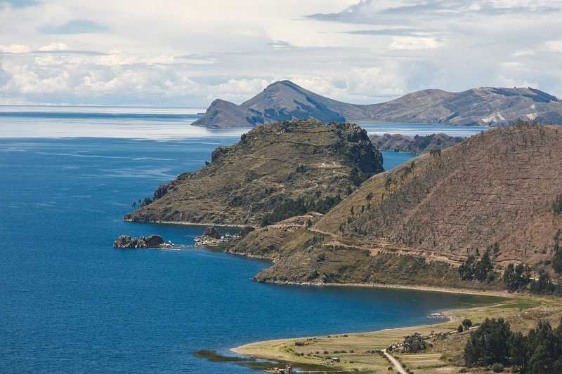
10. Peru: World's highest commercially navigable lake

Peru is located on the central western coast of South America with the Pacific Ocean to the west and south. Its capital and largest city is Lima. Its geography is incredibly diverse encompassing the Andes Mountains, the Amazon Rainforest and the arid plains of the Pacific coastline. The country has high-altitude regions and deep canyons.

Lake Titicaca, situated in the Andes on the border between Peru and Bolivia, is the largest lake in South America by volume and the highest navigable lake in the world.

It sits at approximately 3,812 meters (12,507 feet) above sea level and spans an area of about 8,372 square kms (3,232 square miles) and is surrounded by the Andean mountain range.
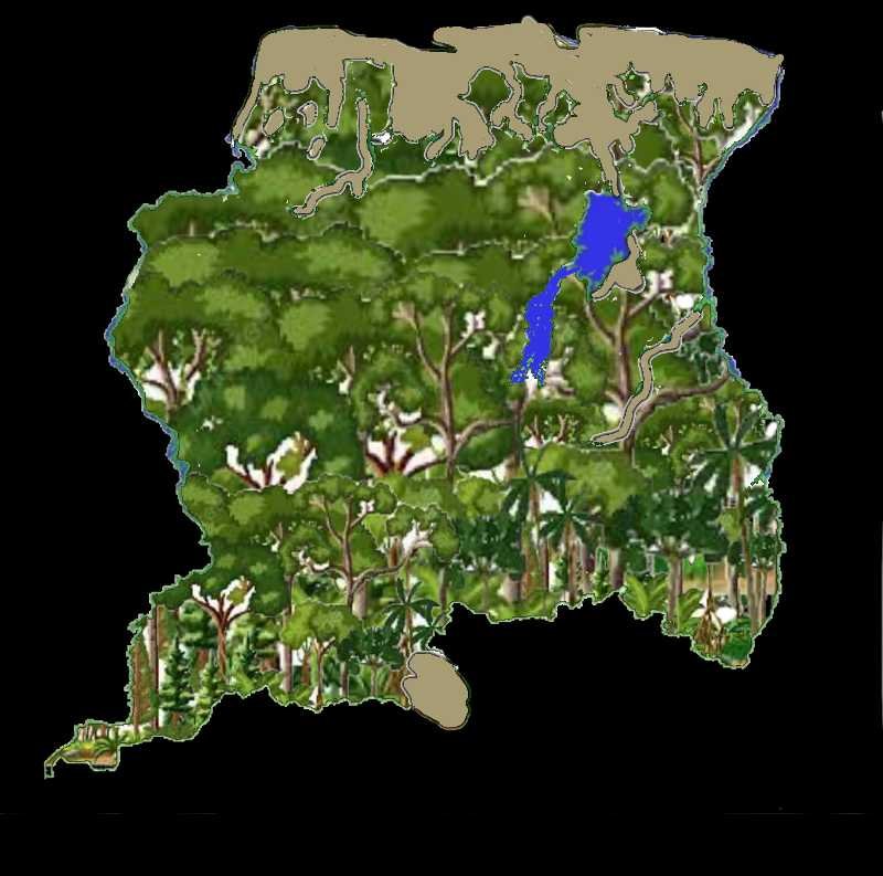
11. Suriname: Highest percentage of forest cover in the world.

Suriname is a sovereign state in northern South America. It is situated slightly north of the equator, within the tropics, and has the Atlantic Ocean coastline to the north. It is known for its pristine rainforests, rivers, and diverse ecosystems.

It is the smallest independent country in South America by both territory and population size. Paramaribo is the country's capital and largest city.

Over 90% of its territory is covered by rainforests, the highest proportion of forest cover in the world.
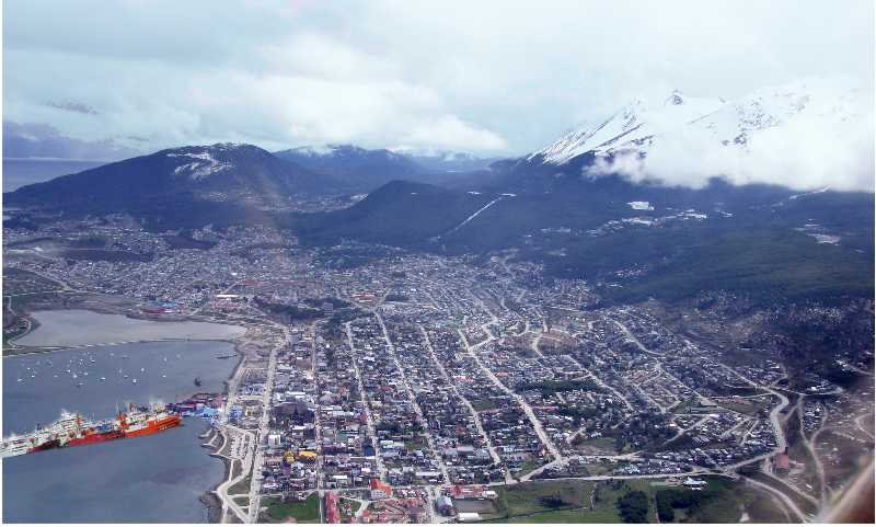
12. Argentina: World's southernmost city

Argentina is located in the southern part of South America and is its second-largest country. Buenos Aires is both its capital and largest city.

The Andes Mountains run along the western border and the Drake Passage is to the south. Aconcagua, the highest peak in the Americas, is located in the Argentine Andes. It is also the highest peak in the southern and western hemispheres. If you view the picture of the Andes in question 2 you can see Aconcagua rising above the rest of the range. It is also known for the Pampas, a vast fertile plain, with expansive grasslands.

Southern Argentina is characterized by the region of Patagonia, known for its glaciers, mountains and vast steppes. The Tierra del Fuego archipelago, shared with Chile, is here at the southern tip bordered by the Beagle Channel. It is not the most southern in the continent though - across the channel lies Navarino Island, a province of Chile.

Puerto Toro on Navarino Island, is the southernmost permanently inhabited community in the world. I mention this because it was the original question but there are not many photos taken there!

At the southern end of The Tierra del Fuego (in Argentina) lies Ushuaia which is the world's southernmost city. It is situated on the Beagle Channel surrounded by the Martial Mountains and the southernmost peaks of the Andes.

With a subpolar oceanic climate with cool temperatures throughout the year it is home to majestic snow-capped mountains and famous glaciers. Due to its strategic location, Ushuaia is a common starting point for cruises to Antarctica

As to any confusion between the two city pictures. I didn't think you could mistake Ushuaia for a capital city but I added some cruise ships for you if you look close enough. The picture of La Paz is most definitely a large city and is set in a canyon surrounded by the high mountains of the Altiplano.
13. General: World's largest river by volume

The Amazon River is a colossal waterway flowing through South America, renowned as the second-longest river globally after the Nile, it is the largest by volume. The river runs east to west stretching approximately 6,400 kms (4,000 miles). Originating in the Andes Mountains of Peru and travelling through Ecuador, Colombia, Venezuela, Bolivia and Brazil before emptying into the Atlantic Ocean.

It is a vital component of the Amazon Rainforest, often referred to as the 'lungs of the Earth' due to its role in producing oxygen and absorbing carbon dioxide. The Amazon River itself is a lifeline for countless communities providing water, transportation and sustenance.

The Amazon Basin which is drained by this mighty river, is one of the most biodiverse regions on Earth hosting an incredible variety of plant and animal species.
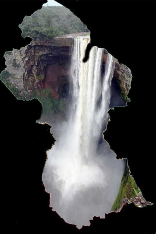
14. Guyana: Largest single-drop waterfall in the world by volume

Guyana is located on the northern coast of South America with an Atlantic Ocean coastline. With Georgetown as the capital and largest city, it is one of the least densely populated countries on Earth. The interior is sparsely populated and rich in biodiversity.

Guyana is known for its lush rainforests, savannas and the powerful Kaieteur Falls. The falls are the largest single-drop waterfall in the world by volume. Single drop refers to it literally having one fall of water as compared to the wide falls which have multitude drops.

They are part of the Kaieteur Plateau, a sandstone formation that contributes to the unique character of the waterfall. The plateau itself is surrounded by dense rainforest making it hard to visit easily. The waterfall plunges approximately 226 meters (741 feet) from the top of the sandstone plateau into the Potaro River below.
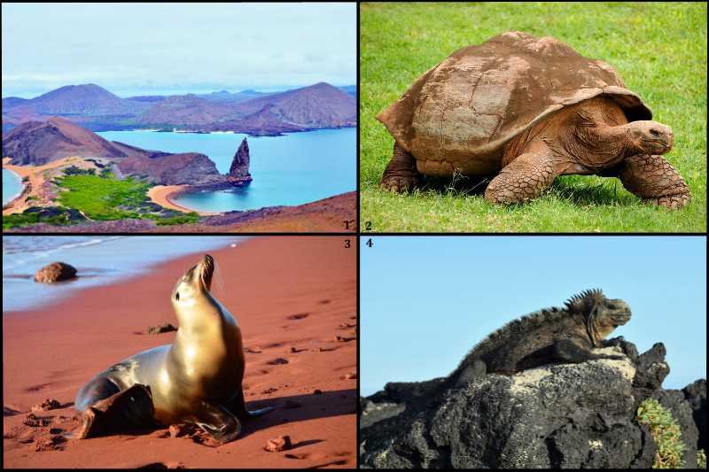
15. Ecuador: Most northerly species of penguins in the world

Ecuador is home to the Galapagos Islands, a UNESCO World Heritage Site known for its unique and diverse wildlife. The islands played a crucial role in Charles Darwin's theory of evolution.

The Islands, located about 1,000 kms (621 miles) off the coast of Ecuador in the Pacific Ocean, are a unique and iconic archipelago known for their incredible biodiversity.

They are home to an extraordinary variety of wildlife, much of which is found nowhere else on Earth. This includes giant tortoises, marine iguanas, blue-footed boobies, Galapagos penguins and many more species.

Their volcanic origins are evident in their stark landscapes. Lava formations, craters and geological features showcase the ongoing processes of volcanic activity.
Source: Author Midget40

This quiz was reviewed by FunTrivia editor spanishliz before going online.
Any errors found in FunTrivia content are routinely corrected through our feedback system.
4/27/2024, Copyright 2024 FunTrivia, Inc. - Report an Error / Contact Us