FREE! Click here to Join FunTrivia. Thousands of games, quizzes, and lots more!
Quiz about The Amazing Amazon

The Amazing Amazon Trivia Quiz


Join me on a journey along one of the world's most iconic rivers - the mighty Amazon.
This is a renovated/adopted version of an old quiz by author sealifesshedd1

A multiple-choice quiz by LadyNym. Estimated time: 4 mins.
  1. Home
  2. »
  3. Quizzes
  4. »
  5. Geography Trivia
  6. »
  7. South America
  8. »
  9. South American Rivers and Oceans

Author
LadyNym
Time
4 mins
Type
Multiple Choice
Quiz #
11,680
Updated
Aug 21 22
# Qns
10
Difficulty
Average
Avg Score
8 / 10
Plays
206
Awards
Top 5% quiz!
Last 3 plays: Guest 65 (7/10), Mikeytrout44 (10/10), Xanadont (7/10).
- -
Question 1 of 10
1. In what western South American country would you find the headwaters of the Amazon River ? Hint


Question 2 of 10
2. Twenty-first century geological studies have suggested that the Amazon originally flowed from east to west. True or false?


Question 3 of 10
3. Which of these rivers, whose name might remind you of a kind of alcoholic beverage, is the longest of the Amazon's more than 1,100 tributaries? Hint


Question 4 of 10
4. Many of the Amazon's tributaries are blackwater rivers. What is responsible for the dark colour of their waters? Hint


Question 5 of 10
5. The Solimões, the main stem of the Amazon, joins the Rio Negro at Manaus. What natural resource made this large Brazilian city wealthy and famous during the 19th century? Hint


Question 6 of 10
6. The Portuguese word "várzea" describes what kind of ecosystem, very common in the Amazon basin?

Hint


Question 7 of 10
7. What is the main reason why no bridges have been built across the Amazon?


Question 8 of 10
8. Located at the mouth of the Amazon, Marajó Island is the second-largest island in South America. With a land area of 40,100 km² (15,500 sq mi), it is approximately the size of which affluent European country? Hint


Question 9 of 10
9. What kind of aquatic animal of the Amazon basin is the boto, or Inia geoffrensis, known for its distinctive pink coloration? Hint


Question 10 of 10
10. What human activity (widespread in Argentina and Uruguay) has been the main driver of deforestation in the Amazon basin? Hint


(Optional) Create a Free FunTrivia ID to save the points you are about to earn:

arrow Select a User ID:
arrow Choose a Password:
arrow Your Email:


Most Recent Scores
Apr 24 2024 : Guest 65: 7/10
Apr 01 2024 : Mikeytrout44: 10/10
Mar 20 2024 : Xanadont: 7/10
Mar 16 2024 : Trufflesss: 7/10
Mar 13 2024 : Steelflower75: 6/10
Mar 11 2024 : Liz5050: 7/10
Mar 05 2024 : CardoQ: 9/10
Feb 28 2024 : bopeep: 6/10

Quiz Answer Key and Fun Facts
1. In what western South American country would you find the headwaters of the Amazon River ?

Answer: Peru

The source of the Amazon River has been the object of speculation for hundreds of years, although modern resources have allowed scientists to determine the origin of what is considered the world's second-longest river with a reasonable level of accuracy. Based on recent findings, the Amazon has a number of headstream areas rather than a single source: these are the headwaters of three rivers that rise in the Peruvian Andes - the Marañón, the Apurimac, and the Mantaro.

The source of the Marañón at Lake Lauricocha, in central Peru, was considered the origin of the Amazon from the early 18th century to the mid-20th century, when the Apurimac was instead identified as the Amazon's main source. However, in 2014, the Mantaro - which is about 75 km longer than the Apurimac - was acknowledged as the most distant source of the mighty river, though its flow, unlike that of the other two rivers, is not continuous throughout the year. The Mantaro's headwaters are found at Lake Junin, in central Peru, while the Apurimac rises at Nevado Mismi, a 5,597-m (18,363-ft) peak of volcanic origin; a simple wooden cross on a mountain cliff marks the origin of the river. The Apurimac, the Mantaro and other rivers form the Ucayali, the main headstream of the Amazon, which joins the Marañón at Iquitos, the largest city in the Peruvian Amazon. The waterway created by the confluence of these rivers, known in Brazil as the Solimões, is the main stem of the Amazon.
2. Twenty-first century geological studies have suggested that the Amazon originally flowed from east to west. True or false?

Answer: True

According to a study conducted at the University of North Carolina in 2006, during the Cretaceous period, over 100 million years ago, South America and Africa were joined in a continent known as Western Gondwana, and present-day Amazon and Congo rivers formed a single river system. When the two continents broke apart, a raised highland was created along South America's eastern coast, tilting the waters of the Amazon westward. At the end of the Cretaceous, the growth of the Andes pushed the waters back towards the centre of the continent. There they formed a large inland sea that eventually worked its way free of the stone, and flowed unimpeded eastward. The analysis of sedimentary rocks found in central South America led the UNC researchers to the conclusion that the "ancient mineral grains" found in the rocks originally came from those eastern highlands.

However, a more recent theory (2014) by Dr Victor Sacek, a geologist of the University of São Paulo posits erosion as the main cause of the reversal of the Amazon's flow. This is supposed to have occurred at a much more recent date - about 10 million years ago, when the newly-formed Andes intercepted rain clouds, boosting the rate of erosion. Accumulation of sediment built up a downhill slope that allowed the waters of the lakes formed by the Amazon east of the Andes to drain towards the Atlantic.
3. Which of these rivers, whose name might remind you of a kind of alcoholic beverage, is the longest of the Amazon's more than 1,100 tributaries?

Answer: Madeira

While the main stem of the Rio Madeira measures 1,450 km (900 mi), the overall length of the Madeira-Mamoré river system - one of the world's ten largest rivers in terms of discharge - is about 3,250 km (2,019 mi), making it by far the longest tributary of the Amazon, and accounting for over 15% of the water in the Amazon basin. Named "Cuyari" by the indigenous peoples of the area, the Madeira ("wood" in Portuguese) is formed by the confluence of the Madre de Dios and the Mamoré; the latter flows north from the Bolivian Andes, while the Madre de Dios originates in the Peruvian Andes.

The Madeira flows through Bolivia and Brazil, forming part of the border between the two countries, before emptying into the Amazon River; Porto Velho, the capital of the Brazilian state of Rondônia, lies on the river's eastern shore. The river is an active waterway, mostly used for transporting large quantities of grain to be exported to Asia and Europe.

The Atlantic island of Madeira, an autonomous region of Portugal known for the production of the eponymous fortified wine, is also named after the Portuguese word for "wood".
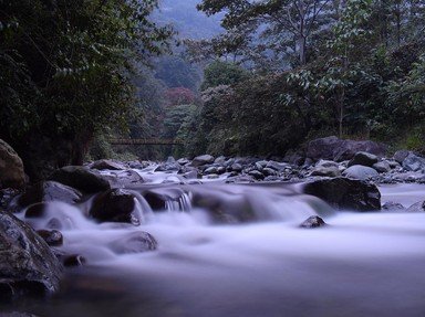
4. Many of the Amazon's tributaries are blackwater rivers. What is responsible for the dark colour of their waters?

Answer: decaying vegetation

Blackwater rivers typically flow through swampy, densely forested areas, where tannins from decaying vegetation leach into the slow-moving water, turning it the colour of strong black tea. Unlike black mud rivers, which owe their colour to black loam, blackwater rivers have transparent waters, though more acidic and lower in nutrients than those of whitewater rivers, which carry a lot of suspended sediment. This impacts the flora and fauna of the regions through which these rivers flow: for instance, animals that need calcium for their shells (such as snails and other molluscs) are less likely to be found in blackwater rivers.

The majority of the world's blackwater rivers are found in the Amazon and Orinoco basins, as well as in the Southern US. The largest of them, the Rio Negro ("black river"), meets the Solimões, a pale, sandy-coloured whitewater river, at Manaus to form the Amazon. The two rivers run side by side for about 6 km (3.7 mi) almost without mixing - a popular tourist attraction called "Encontro das Aguas" ("Meeting of Waters"). This phenomenon is due to the differences between the two rivers in terms of speed, temperature, and sediment load - the Rio Negro, which flows south from eastern Colombia, being slower and warmer than the sediment-rich Solimões.
5. The Solimões, the main stem of the Amazon, joins the Rio Negro at Manaus. What natural resource made this large Brazilian city wealthy and famous during the 19th century?

Answer: rubber

The capital of Amazonas, Brazil's largest state by area, Manaus is home to a population of over 2 million, spread over a land area of 11,401 km² (4,402 sq mi). Founded in 1669 by the Portuguese, the city was named after the indigenous Manaós people: its name means "Mother of the Gods". The rubber boom of the mid-19th century led to the growth of Manaus, which acquired imposing buildings such as its famed opera house, the Teatro Amazonas, as well as the nickname of "Paris of the Tropics". The city's moment of glory, however, did not last long: when the seeds of the rubber tree (Hevea brasiliensis) - endemic to the Amazon region - were smuggled out of South America to Southeast Asia, the rubber boom came to an abrupt end, causing loss of population and widespread poverty. This sorry state of affairs lasted until the late 1950s: then, the introduction of the Manaus free trade zone in 1960 led to robust demographic and economic growth.

Though two highways connect Manaus with the capitals of the neighbouring states of Roraima and Rondônia, most of the transportation from the city occurs by plane or boat because of the lack of a true road link with other parts of the vast country of Brazil. The port of Manaus is an important hub for vessels sailing down the Amazon to the Atlantic Ocean, and a thriving commercial centre for the import and export of goods. The city's cultural heritage and its unique rainforest environment also attract many tourists from all over the world. Manaus was also one of the host cities of the 2014 FIFA World Cup and the 2016 Summer Olympics.
6. The Portuguese word "várzea" describes what kind of ecosystem, very common in the Amazon basin?

Answer: flooded forest

In Brazil, "várzea" refers to a freshwater swamp forest seasonally flooded by whitewater, pale-coloured and rich in sediments; the term used to describe a forest flooded by blackwater is "igapó" (Tupi for "root forest"). The inundation is caused by the abundant rains that fall in the region, especially from March to July. Though the term várzea covers a variety of habitats, about 75% of a várzea area consists of the dense canopy forest that characterizes much (about 180,000 km²/69,000 sq mi) of the Amazon basin. Annual flooding by nutrient-rich whitewater encourages the growth of plant and animal species, and provides important breeding grounds for the Amazon basin's rich wildlife, which has adapted to this unique environment in a variety of ways. Várzea areas are also favourable to human occupation, as the fertile soil of the floodplains is conducive to agriculture, and offers plenty of natural pasture to livestock.

Savanna, a mixed woodland-grassland ecosystem, is found in large parts of South America, though very rarely in the Amazon Basin. The xeric shrubland is a kind of desert, which in South America is mainly present on the Pacific coast (Peru and Chile), while the taiga, or boreal forest, is only found in the Northern Hemisphere.
7. What is the main reason why no bridges have been built across the Amazon?

Answer: there are few roads in the Amazon rainforest

Although the Amazon River can reach a width of 48 km (30 mi) during the wet season, building a bridge across it would be perfectly feasible for modern civil engineering. The river, however, flows for most of its course through very dense rainforest, with very few roads or significant urban centres - which makes it more practical to use ferries for crossing. In addition, road construction in the Amazon basin is a very controversial topic, due to its adverse impact on the delicate ecosystems of the region.

The only major bridge built in the Amazon basin so far, the Journalist Phelippe Daou Bridge (named after the founder of the largest TV station in the north of Brazil), spans the Rio Negro at Manaus just before its confluence with the Amazon. Opened on 24 October 2011, the bridge has a length of about 3.6 km (2.2 mi), and carries four lanes of roadway, connecting Manaus with the nearby city of Iranduba. Construction of the bridge, started in 2007, was marked by controversy regarding the amount of deforestation that it caused. In spite of that, the bridge - standing at a height of 190 m (623 ft) above the waters of the Rio Negro - has become one of the architectural symbols of the city of Manaus.
8. Located at the mouth of the Amazon, Marajó Island is the second-largest island in South America. With a land area of 40,100 km² (15,500 sq mi), it is approximately the size of which affluent European country?

Answer: Switzerland

Comparable in size to Switzerland, whose total surface area is 41,285 km² (15,940 sq mi), Marajó Island lies almost directly on the Equator. It is separated from the mainland of the Brazilian state of Pará by Marajó Bay, which receives the waters of the huge distributary channel known as Pará River, as well as a number of smaller rivers; all of these bodies of water are part of the Amazon delta. Most of this almost completely flat island, with its 20 large rivers, is flooded during the rainy season: because of that, many settlements are built on stilts, called "palafitas" in Portuguese. Comprising both savanna and flooded forest ecosystems, Marajó is home to a number of large "fazendas" (ranches) where domestic animals are raised - notably water buffaloes, introduced into the Amazon basin from Asia at the end of the 19th century, which now outnumber humans on the island.

For over 2000 years (approximately from 400 BC to 1600 AD), Marajó was the site of a pre-Columbian society known as Marajoara culture, which collapsed for reasons that are still unclear. Extensive archaeological research on the island has revealed artifacts (especially pottery) of a high level of sophistication.

Though all the countries listed as wrong answers could be labeled as affluent, they are either much larger (as in the case of France and Finland) or smaller (Andorra) than Switzerland.
9. What kind of aquatic animal of the Amazon basin is the boto, or Inia geoffrensis, known for its distinctive pink coloration?

Answer: dolphin

"Boto" is the name given in Portuguese to various species of dolphin native to the Amazon and Orinoco rivers and their tributaries. The Amazon river dolphin (Inia geoffrensis geoffrensis) is the largest species of river dolphin: males (which are considerably larger than females, a unique case among river dolphins) can reach a length of 2.5 m (8.2 ft), and weigh as much as 185 kg (408 lb). Like all toothed whales (dolphins, porpoises, and larger cetaceans such as sperm whales), they possess an organ located in the forehead, known as melon, used for communication and echolocation. The adults of the species - particularly the males - acquire a distinctive pink or mottled pink colour - hence their Portuguese nickname of "boto cor-de-rosa", or "pink river dolphin".

Amazon river dolphins feed primarily on fish, crustaceans, and other water-dwelling animals, which they grab with their distinctive long, thin snout. Found in most aquatic habitats of the Amazon basin, they often compete with local fishermen for the same fish species - a conflict that is often fatal to the dolphins. Because of this, as well as threats to its habitat, the species is listed by IUCN as Endangered (2018).

In the folklore of the peoples of the Amazon basin, river dolphins are believed to be shapeshifters who can turn into beautiful young men and women in order to seduce humans.

The Amazon River and its tributaries are home to all the animals listed as wrong answers - though none of them are pink.
10. What human activity (widespread in Argentina and Uruguay) has been the main driver of deforestation in the Amazon basin?

Answer: cattle ranching

In the 21st century, cattle ranching is by far the human activity that poses the most danger to the Amazon rainforest. Of course, other activities (such as road construction, mining, logging, and agriculture) have also been the cause of extensive deforestation, but none of them has reached the extent of the damage done by cattle ranching, which amounts to about 80% of the deforestation in the region.

Unfortunately, the activities that have led to the destruction of vast swathes of the rainforest - often referred to as the "lungs of the Earth" because of its function as an absorber of carbon dioxide - are frequently subsidized by local governments. In recent years, the cattle sector has taken the lion's share of these subsidies - especially in Brazil, where recent decisions that encourage deforestation to promote economic activity have caused friction between the government and indigenous peoples. The practice of slash-and-burn agriculture, the production of charcoal for industrial use, and soybean cultivation have also been major causes of deforestation in the Amazon basin, though on a much smaller scale if compared to cattle ranching.

The extensive deforestation in the Amazon basin and other rainforest areas (such as Indonesia and Central Africa) has caused the disappearance of many animal and plant species, altering the delicate balance of this complex environment, and affecting in particular the quality of the soil. The rate of forest loss, which peaked in the early 2000s, slowed down considerably in the 2010s, but has more recently been on the increase.
Source: Author LadyNym

This quiz was reviewed by FunTrivia editor spanishliz before going online.
Any errors found in FunTrivia content are routinely corrected through our feedback system.
4/27/2024, Copyright 2024 FunTrivia, Inc. - Report an Error / Contact Us