FREE! Click here to Join FunTrivia. Thousands of games, quizzes, and lots more!
Lesotho Quizzes, Trivia and Puzzles
Lesotho Quizzes, Trivia

Lesotho Trivia

Lesotho Trivia Quizzes

  1. Home
  2. »
  3. Quizzes
  4. »
  5. Geography Trivia
  6. »
  7. Africa

Fun Trivia
4 Lesotho quizzes and 40 Lesotho trivia questions.
1.
  The Landlocked Kingdom of Lesotho   best quiz  
Multiple Choice
 10 Qns
Basutoland was renamed the Kingdom of Lesotho upon independence from the United Kingdom in 1966. Its name means 'land of the people who speak Sesotho', a Bantu language spoken by 90% of the Basotho. Come explore their land.
Average, 10 Qns, looney_tunes, Mar 31 20
Average
looney_tunes editor
Mar 31 20
4624 plays
2.
  Lesotho, Her Land and Her People    
Multiple Choice
 10 Qns
What do you know about the Kingdom of Lesotho, one of the smallest countries in Africa? Let's take a look at the Kingdom of Lesotho, the land it occupies, and the people who live in it.
Average, 10 Qns, gracious1, Jan 12 18
Average
gracious1 gold member
Jan 12 18
303 plays
3.
  The Kingdom of Lesotho    
Multiple Choice
 10 Qns
How much do you know about the world's southernmost landlocked country?
Average, 10 Qns, EnglishJedi, Dec 21 19
Average
EnglishJedi gold member
Dec 21 19
782 plays
4.
  Lesotho    
Multiple Choice
 10 Qns
What do you know about this African country?
Average, 10 Qns, Vermic, Nov 11 16
Average
Vermic
2198 plays
trivia question Quick Question
What is the main health problem in Lesotho?

From Quiz "Lesotho"


Lesotho Trivia Questions

1. Lesotho had a previous name when it was a protectorate of the UK. What was it?

From Quiz
Lesotho, Her Land and Her People

Answer: Basutoland

Various Bantu-speaking peoples settled the area now known as Lesotho long before the Europeans colonized Africa. They called themselves the Basotho and were united under King Moshoeshoe I in 1822 amid exploration by the Dutch and British. When Boers settled in Basotho lands after the British pulled out, the Basotho lost much of their land in a series of wars. King Moshoshoe appealed to Queen Victoria, who made Basutoland a British protectorate. Unfortunately, after Moshoeshoe's death, Britain treated Basutoland like a colony for a decade or so until its protectorate status was restored. Basutoland declared independence from the UK in 1966 and called itself the Kingdom of Lesotho. It remains a member of the Commonwealth of Nations.

2. In 2006, Lesotho celebrated 40 years of independence with a new flag. What unusual symbol is found on this flag?

From Quiz The Landlocked Kingdom of Lesotho

Answer: Black hat, representing the indigenous Basotho people

Lesotho's new flag has three horizontal stripes: blue on top, white in the middle, and green on the bottom, with the white stripe one-third wider than the others. These stripes represent rain, peace and prosperity, all of which, unfortunately, are not always plentiful in Lesotho. The central stripe bears a black Basotho hat, representing the indigenous people of the country.

3. What does the word Lesotho mean?

From Quiz Lesotho, Her Land and Her People

Answer: People who speak the language of the Sotho

The Sotho and Tswana clans were among the Bantu-speaking people who settled Lesotho and displaced the indigenous hunter-gatherers, the Khoisans, who consist of people formerly known as Bushmen (San) and Hottentots (Khoi). People who live in Lesotho refer to themselves as the Basotho -- or Mosotho in the singular. The majority of the populace are descendants of the Sotho clans, with very few Europeans or Asians, but the majority religion is Christianity. The official languages are Sesotho and English, but Zulu and Xhosa among the working languages.

4. What is the unit of currency in Lesotho?

From Quiz The Kingdom of Lesotho

Answer: Loti

Introduced into circulation in 1980, the Lesotho loti is pegged 1:1 with the South African rand and both currencies are legal tender within the kingdom. A loti is subdivided into 100 lisente. The plural of loti is maloti, and banknotes in circulation are in the denominations are 10, 20, 50, 100 and 200 maloti. The pula is the currency of nearby Botswana.

5. Lesotho is the southernmost landlocked country in the world, being completely surrounded by South Africa. What is the name given to a country which is completely surrounded by another country?

From Quiz The Landlocked Kingdom of Lesotho

Answer: Enclave

An enclave is a country that is completely surrounded by another country, while an exclave is a piece of a country that is physically separated from the rest of the country. Inclaves and outclaves don't exist! Basutoland (as it was then known) was originally established as a political entity by Great King Moshoeshoe I in 1822. After conflicts with Boer settlers, it gained the status of a British protectorate, although the establishing Treaty of Aliwal in 1869 gave half of its original territory to the Boers. Lesotho's border with South Africa is 909 km (565 mi) long.

6. What was the name of this country before it was renamed Lesotho?

From Quiz Lesotho

Answer: Basutoland

7. Lesotho became independent in what year?

From Quiz Lesotho

Answer: 1966

8. Geographically, Lesotho consists of three regions, listed below. Which one does not belong?

From Quiz Lesotho, Her Land and Her People

Answer: Coastal plain

Lesotho is landlocked and has no coastal plain! The lowlands are formed by the valleys of the Caledon River and the Orange (Senqu) River. The highlands consist of the Drakensberg and Maloti mountain ranges in central Lesotho and contain some peatlands, though not enough to justify extraction for biofuel. The foothills, as the name suggests, are a transitional area between the lowlands and the highlands.

9. The Lesotho coat of arms features two horses supporting a shield. Which animal is pictured on the shield?

From Quiz The Kingdom of Lesotho

Answer: A crocodile

The Lesotho coat of arms was adopted in 1966 when the country gained independence. The shield shows a crocodile, the symbol of the nation's largest ethnic group, the Sotho. Behind the shield are two crossed weapons, a club and a lance.

10. What is the terrain of Lesotho like?

From Quiz The Landlocked Kingdom of Lesotho

Answer: Hills and mountains

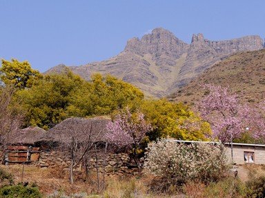
One of the highest countries in the world, Lesotho is made up of highland plateaus, hills and mountains. More than 80% of the country is over 1,800 m (5,900 ft) above sea level. A savanna is a grassland ecosystem with trees that are too widely separated to form a canopy. The Serengeti in Tanzania, with its abundant wildlife, is a typical savanna. Glaciated landscapes are found in Norway, amongst other places. A steppe is a grassland plain with few or no trees, such as is found is southwest Russia.

11. How does the Lesotho motto "Khotso, Pula, Nala" translate into English?

From Quiz The Kingdom of Lesotho

Answer: Peace, Rain, Prosperity

The name Lesotho roughly translates into "Those who speak Sesotho". The motto is in that language and translates to mean "Peace, Rain, Prosperity". The country's national anthem, "Lesotho Fatse La Bontata Rona", translates to "Lesotho, Land of My Fathers". "Love, Fatherland, Progress" is the motto of Madagascar.

12. How is the climate of Lesotho best described?

From Quiz The Landlocked Kingdom of Lesotho

Answer: Temperate

Temperate climates (in the Köppen-Geiger climate classification system) have an average temperature above 10 °C (50 °F) in their warmest months, and a coldest month average between -3 °C (26.6 °F) and 18 °C (64 °F). Lesotho's altitude means it is cooler than might be expected for its latitude, which places it just outside the tropics. Its capital, Maseru, and the surrounding lower parts of the country can reach temperatures as high as 30 °C (86 °F) in summer. Winters are cold, and snow is common in the highlands between May and September. Lesotho's climate is also sometimes referred to as continental.

13. Lesotho has 909 km of land boundaries. How long is the land boundary with South Africa?

From Quiz Lesotho

Answer: 909 km

Lesotho is an enclave in South Africa.

14. What are the district capitals called in Lesotho?

From Quiz The Kingdom of Lesotho

Answer: Camptowns

Lesotho is divided into ten districts: Berea, Butha-Buthe, Leribe, Mafeteng, Maseru, Mohale's Hoek, Mokhotlong, Qacha's Nek, Quthing and Thaba-Tseka. The capital of each district is called a camptown. The districts are subdivided further into eighty constituencies and 129 community councils.

15. The lowest point in Lesotho has an elevation of 1400 m (4600 ft) above sea level. At the junction of what two rivers is this point located?

From Quiz The Landlocked Kingdom of Lesotho

Answer: Orange and Makhaleng Rivers

The most notable geographic fact about Lesotho, apart from its status as an enclave, is that it is the only independent state in the world that lies entirely above 1,000 metres (3,200 ft) in elevation. Its lowest point, where the Makhaleng River joins the Orange River on the southwestern border, is the highest point of lowest elevation for any country. The Makhaleng River valley forms part of the approach to a number of important mountain passes, including the beautifully-named God Help Me Pass and the Gates of Paradise Pass.

16. What is the best way to describe the terrain in Lesotho?

From Quiz Lesotho

Answer: Mostly highland with plateaus, hills and mountains

17. What geographical record does Lesotho hold?

From Quiz The Kingdom of Lesotho

Answer: The world's highest low point

Lesotho is the only independent nation in the world that is entirely over 1,000 meters above sea level. Indeed, the lowest point in Lesotho is at 1,400 meters (4,593 feet), which is the highest low point of any country. Rwanda has the second-highest low point, at a mere 950 meters (3,117 feet). The country with the highest low point outside of Africa is Andorra, at 840 meters. Mongolia has the highest low point in Asia and Bolivia (at a mere 90 meters) the highest in the Americas.

18. Where is the highest point in the kingdom of Lesotho?

From Quiz The Landlocked Kingdom of Lesotho

Answer: Thabana Ntlenyana

The peak of Thabana Ntlenyana is the highest point in the country, at 3,482 m (11 424 ft) above sea level, as well as being the highest mountain in southern Africa. Thabana Ntlenyana, whose name means "Beautiful little mountain" in Sesotho, is situated on the ridge of the Drakensberg mountains near Sani Pass in Lesotho's east. The second highest point in Lesotho is nearby Njesuthi, at 3446 m (11 306 ft). Maseru is the capital city of Lesotho, located on the Caledon River, bordering South Africa, in the country's northwest. Mohale's Hoek is a town near the lowest point of Lesotho, in the southwest.

19. What is the main natural hazard in Lesotho?

From Quiz Lesotho

Answer: Periodic droughts

20. What is the main health problem in Lesotho?

From Quiz Lesotho

Answer: AIDS

21. What is Lesotho's main mineral resource?

From Quiz The Kingdom of Lesotho

Answer: Diamonds

The Letseng Diamond Mine in the Maloti Mountains in the far northeast of Lesotho is the world's highest diamond mine at 3,100 meters. Although it does not produce a great number of stones, it is famous for its quality, and particularly for producing relatively huge stones. Its average dollar/carat is higher than any other diamond mine in the world -- the world average is approximately $81/carat, but in just six months in 2007 the Letseng mine averaged $1,894/carat. It has produced numerous famous stones: the Lesotho Promise is a 603-carat white diamond (the largest find of the 21st Century at the time), the Lesotho Brown, a 601-carat stone found in 1967, the Letseng Legacy, a 493-carat stone found in 2007 that sold for more than $10 million.

22. What is the most important natural resource for the people of Lesotho?

From Quiz The Landlocked Kingdom of Lesotho

Answer: Water

Water is the most important resource for Lesotho, with the Lesotho Highlands Water Project producing the electricity needs for Lesotho, as well as allowing for the export of water to South Africa. When completed, this project is expected to produce approximately 20% of Lesotho's Gross Domestic Product. Diamonds from the Letseng diamond mine form the major mineral resource of Lesotho; it produces very few diamonds, but they are of excellent quality. Deposits of coal, galena, quartz, agate and uranium were not considered commercially viable at the start of the 21st century.

23. When does Lesotho celebrate Independence Day?

From Quiz Lesotho

Answer: 4 October

24. A creature of prehistoric Earth once roamed Lesotho, and its fossilized footprints are visible in many sites. What species of extinct animal have scientists named after Lesotho?

From Quiz Lesotho, Her Land and Her People

Answer: Dinosaur

Have you heard of the Lesothosaurus? Paleontologist Peter Galton named the herbivorous bipedal reptile in 1978 for the country in which it was discovered. Two specimens were found curled up together; perhaps they were hibernating underground to escape the heat. Like Tyrannosaurus, the hind limbs were much longer than the forelimbs. It was about 3 ft (1 m) long, and it had grooved teeth, a short, pointed snout, and possibly a beak. Lesotho has the highest concentration of dinosaur footprints in the world. You may view them at Morija, Leribe, and Quiteng. Other dinosaurs found in Lesotho include Massospondylus and Heterodontosaurus. Many fossils were discovered by missionaries exploring the area during the 19th century.

25. The Lesotho capital, Maseru, is located in the foothills of which mountain range?

From Quiz The Kingdom of Lesotho

Answer: Maloti

Located on the Lesotho/South Africa border in the extreme northwest of the country, Maseru is home to around a quarter of a million people. It was established as the capital when the region became the British Protectorate of Basutoland in 1869. The city sits in the foothills of the Maloti Mountains at an elevation of 1,600 meters (5,200 feet) above sea level. Of the alternatives, the Drakensberg mountains are in the northeast of Lesotho, Thabana Ntlenyana is the country's highest mountain peak at 3,482 meters, and the Makhaleng is is one of Lesotho's major rivers.

26. How many administrative divisions are there in Lesotho?

From Quiz Lesotho

Answer: 10

These ten are: Berea, Butha-Buthe, Leribe, Mafeteng, Maseru, Mohales Hoek, Mokhotlong, Qacha's Nek, Quthing and Thaba-Tseka.

This is category 20352
play trivia = Top 5% Rated Quiz, take trivia quiz Top 10% Rated Quiz, test trivia quiz Top 20% Rated Quiz, popular trivia A Well Rated Quiz
new quizzes = added recently, editor pick = Editor's Pick editor = FunTrivia Editor gold = Gold Member

Teachers / educators: FunTrivia welcomes the use of our website and quizzes in the classroom as a teaching aid or for preparing and testing students. See our education section. Our quizzes are printable and may be used as question sheets by k-12 teachers, parents, and home schoolers.

 ·  All questions, answers, and quiz content on this website is copyright FunTrivia, Inc and may not be reproduced without permission. Any images from TV shows and movies are copyright their studios, and are being used under "fair use" for commentary and education.