FREE! Click here to Join FunTrivia. Thousands of games, quizzes, and lots more!
South American Rivers and Oceans Quizzes, Trivia and Puzzles
South American Rivers and Oceans Quizzes, Trivia

South American Rivers and Oceans Trivia

South American Rivers and Oceans Trivia Quizzes

  1. Home
  2. »
  3. Quizzes
  4. »
  5. Geography Trivia
  6. »
  7. South America

Fun Trivia
12 quizzes and 120 trivia questions.
1.
Cruising the End of the World
  Cruising the End of the World   top quiz  
Photo Quiz
 10 Qns
Most of these pictures were taken at various ports of call on a cruise of the southern parts of South America. The cruise also entered Antarctica but that part of the cruise is covered in a different quiz!
Average, 10 Qns, skunkee, Jun 14 18
Average
skunkee editor
Jun 14 18
1882 plays
2.
Islands of South America
  Islands of South America   great trivia quiz  
Photo Quiz
 10 Qns
Come along on this visual tour of some of the huge variety of islands that South America has to offer. Good luck!
Easier, 10 Qns, pagea, May 27 18
Easier
pagea
May 27 18
294 plays
3.
Lakes of South America
  Lakes of South America   great trivia quiz  
Photo Quiz
 10 Qns
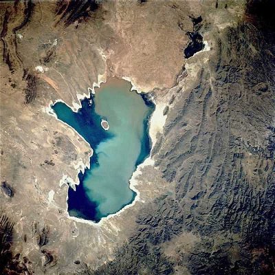
South America's rivers and mountains are relatively well-served by quizzes on this site, so for a change I offer ten questions about its lakes and lagoons. See what you know, and enjoy the pictures.
Average, 10 Qns, stedman, Oct 30 15
Average
stedman editor
712 plays
4.
  The Amazing Amazon   best quiz  
Multiple Choice
 10 Qns
Join me on a journey along one of the world's most iconic rivers - the mighty Amazon.
Average, 10 Qns, LadyNym, Aug 21 22
Average
LadyNym gold member
Aug 21 22
205 plays
5.
Coast Along South America
  Coast Along South America   great trivia quiz  
Photo Quiz
 10 Qns
Hop on aboard our cruise ship as we sail along the coast of South America stopping to take in the interesting sights on our way.
Average, 10 Qns, zorba_scank, Jan 19 15
Average
zorba_scank gold member
355 plays
6.
A Cruise Around South America
  A Cruise Around South America   popular trivia quiz  
Photo Quiz
 10 Qns
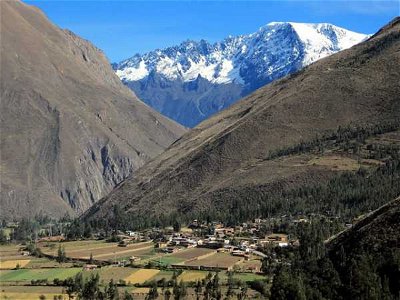
Let's take a visual tour around the continent of extremes, South America!
Easier, 10 Qns, PootyPootwell, Aug 19 17
Easier
PootyPootwell gold member
Aug 19 17
496 plays
7.
Lets Travel Down the Orinoco River
  Let's Travel Down the Orinoco River   top quiz  
Photo Quiz
 10 Qns
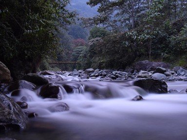
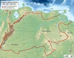
You find yourself about to head down a major river in South America. But it's not the Amazon! This time we will be exploring the Orinoco River and the countryside through which it flows.
Average, 10 Qns, stephgm67, Jun 02 17
Average
stephgm67 gold member
189 plays
8.
Amazon River Tributaries
  Amazon River Tributaries   popular trivia quiz  
Photo Quiz
 10 Qns
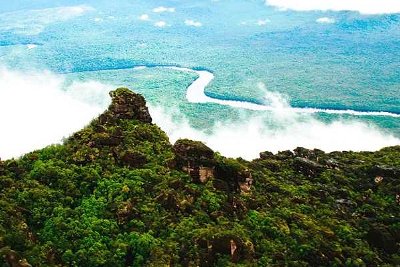
There are more than 1,100 tributaries of the Amazon River. How much do you know about some of the longest among them?
Average, 10 Qns, Shadowmyst2004, Nov 23 16
Recommended for grades: 10,11,12
Average
Shadowmyst2004
180 plays
9.
  Sailing on the Pacific and Atlantic Oceans    
Multiple Choice
 10 Qns
When my husband and I retired, we decided to gift ourselves a trip through South America. With this quiz I hope to share this fantastic experience with you.
Average, 10 Qns, masfon, Aug 11 20
Average
masfon gold member
Aug 11 20
390 plays
10.
  Rivers of South America    
Multiple Choice
 10 Qns
Here is a quiz on some of the major rivers of South America, with information about geographical features found within and along these rivers, and with a bit of info about the history of human habitation along their banks as well.
Average, 10 Qns, lola0177, Jul 20 19
Average
lola0177
Jul 20 19
482 plays
11.
  Amazon River    
Multiple Choice
 10 Qns
A quiz about the Amazon River, its animals, and its ecology.
Average, 10 Qns, bulls400, May 07 23
Average
bulls400
May 07 23
586 plays
12.
  The Rio de la Plata    
Multiple Choice
 10 Qns
The Rio de la Plata is an important waterway in South America. How much do you know about it?
Average, 10 Qns, CraniumMaximus, Mar 15 23
Average
CraniumMaximus
Mar 15 23
246 plays

South American Rivers and Oceans Trivia Questions

1. About how long is the Amazon River?

From Quiz
Amazon River

Answer: 4,000 miles

The Amazon River is about 4,000 miles long. In places, the river can be one to six miles wide. The average depth of the river is approximately forty feet.

2. In what western South American country would you find the headwaters of the Amazon River ?

From Quiz The Amazing Amazon

Answer: Peru

The source of the Amazon River has been the object of speculation for hundreds of years, although modern resources have allowed scientists to determine the origin of what is considered the world's second-longest river with a reasonable level of accuracy. Based on recent findings, the Amazon has a number of headstream areas rather than a single source: these are the headwaters of three rivers that rise in the Peruvian Andes - the Marañón, the Apurimac, and the Mantaro. The source of the Marañón at Lake Lauricocha, in central Peru, was considered the origin of the Amazon from the early 18th century to the mid-20th century, when the Apurimac was instead identified as the Amazon's main source. However, in 2014, the Mantaro - which is about 75 km longer than the Apurimac - was acknowledged as the most distant source of the mighty river, though its flow, unlike that of the other two rivers, is not continuous throughout the year. The Mantaro's headwaters are found at Lake Junin, in central Peru, while the Apurimac rises at Nevado Mismi, a 5,597-m (18,363-ft) peak of volcanic origin; a simple wooden cross on a mountain cliff marks the origin of the river. The Apurimac, the Mantaro and other rivers form the Ucayali, the main headstream of the Amazon, which joins the Marañón at Iquitos, the largest city in the Peruvian Amazon. The waterway created by the confluence of these rivers, known in Brazil as the Solimões, is the main stem of the Amazon.

3. About how much water does the Amazon River discharge every second on average?

From Quiz Amazon River

Answer: 200,000 cubic meters

The Amazon River discharges about 210,000 cubic meters of water per second. Twenty percent of all the freshwater entering the oceans comes from the Amazon River.

4. Obviously, the Rio de la Plata is a Spanish name. What does it mean?

From Quiz The Rio de la Plata

Answer: The River of Silver

Plata means 'silver' in Spanish, so the Rio de la Plata means "The River of Silver". Plates is platos (note the 'o'), plants is planta or plante, and plateau is meseta.

5. The name of which river, one of the Amazon's major tributaries, means "black river" in Spanish and Portuguese?

From Quiz Rivers of South America

Answer: Rio Negro

Rio Negro, the world's largest blackwater river, floods heavily during the rainy season, reaching a width of up to nineteen miles. Part of the Rio Negro forms part of the boundary between Colombia and Venezuela. The banks of Rio Negro, whose Native American population declined during the 17th century, support nonetheless a large fishing industry.

6. Leaving Valparaiso my husband and I went to Puerto Montt, a city colonized by Germans. How far, in a straight line, is Valparaiso from Puerto Montt?

From Quiz Sailing on the Pacific and Atlantic Oceans

Answer: 900 km

Puerto Montt is, in a straight line, 900 km south from Valparaiso. The city was founded in 1853 when a group of Germans came to colonize the region. It is located in a bay formed with waters of the Pacific Ocean and overlooking the Osorno volcano. It is the main port in the lower end of Chile's western continental land and is considered the gateway to the Andes mountains and the Patagonia fjords. From this point on, the trips are fantastic, with indescribable colors and scenery. In addition to tourism, its economy is based on agriculture, livestock, fishing and salmon aquaculture in the fjords and the nearby Pacific Ocean.

7. Which city, known as the "Heart of the Amazon" and "City of the Forest," is the capital of the Brazilian state of Amazonas?

From Quiz Rivers of South America

Answer: Manaus

Manaus, founded in 1669, owes its growth and development in the 19th century to the extraction of rubber from the Amazon forest. During the rubber boom, Manaus was one of the most corrupt and decadent cities in the New World. The profligacy featured an Opera House that cost the Brazilian public ten million dollars to build. During the boom, Manaus' rubber barons competed to outdo one another in extravagance. Today, timber, petroleum refining, and ecotourism are among the city's most important industries. Manaus is home to the Free Economic Zone of Manaus, which is politically and economically autonomous within Brazil.

8. The city of Punta Arenas, located next to the Strait of Magellan, was created in 1848 by the Chilean government to be what?

From Quiz Sailing on the Pacific and Atlantic Oceans

Answer: A penal colony

Punta Arenas is today the capital of Magallanes and Antarctica Chilena, the southernmost region of Chile. It is located on the Brunswick Peninsula, on top of hills overlooking the Strait of Magellan; it was originally created to be a penal colony and also to monitor and guarantee Chile's sovereignty over the Strait. The Punta Arenas harbor was a coaling station for the steamships that transited between the Atlantic and the Pacific. The city became the point of support for immigrants who came to the region to raise sheep. The port of Punta Arenas is today used by tourism cruises and scientific expeditions.

9. Is the Rio de la Plata considered a gulf or a river?

From Quiz The Rio de la Plata

Answer: Both

Some geographers consider it a river. To those who do it is one of the widest rivers in the world, at well over 200 km at its mouth in the Atlantic. Other geographers consider it an estuary, due to its brackish content.

10. Many of the Amazon's tributaries are blackwater rivers. What is responsible for the dark colour of their waters?

From Quiz The Amazing Amazon

Answer: decaying vegetation

Blackwater rivers typically flow through swampy, densely forested areas, where tannins from decaying vegetation leach into the slow-moving water, turning it the colour of strong black tea. Unlike black mud rivers, which owe their colour to black loam, blackwater rivers have transparent waters, though more acidic and lower in nutrients than those of whitewater rivers, which carry a lot of suspended sediment. This impacts the flora and fauna of the regions through which these rivers flow: for instance, animals that need calcium for their shells (such as snails and other molluscs) are less likely to be found in blackwater rivers. The majority of the world's blackwater rivers are found in the Amazon and Orinoco basins, as well as in the Southern US. The largest of them, the Rio Negro ("black river"), meets the Solimões, a pale, sandy-coloured whitewater river, at Manaus to form the Amazon. The two rivers run side by side for about 6 km (3.7 mi) almost without mixing - a popular tourist attraction called "Encontro das Aguas" ("Meeting of Waters"). This phenomenon is due to the differences between the two rivers in terms of speed, temperature, and sediment load - the Rio Negro, which flows south from eastern Colombia, being slower and warmer than the sediment-rich Solimões.

11. What title does the city of Ushuaia in Argentina claim?

From Quiz Sailing on the Pacific and Atlantic Oceans

Answer: The world's southernmost city

Ushuaia is a beautiful capital city of the Tierra del Fuego, Antarctica and Islas del Atlántico Sul Province in Argentina. Ushuaia is located at a large bay on the south coast of Isla Grande de Tierra del Fuego on the shores of the Beagle Channel. The city was founded in 1884 by Augusto Lasserre. It has a port and today is an administrative and tourist center. Almost all cruise ships in the region stop in Ushuaia and tourists there can make very interesting trips by browsing the canal, visiting one of the world's largest penguin colonies, taking a trip on the famous End of the World train, etc.

12. The Rio de la Plata was the site of one of the first battles of World War II. What is the name of the German capital ship that was hit by Royal Navy forces?

From Quiz The Rio de la Plata

Answer: Admiral Graf Spee

The Admiral Graf Spee was pursued into the Rio de la Plata by the other three, the HMS Exeter, Ajax, and Achilles. After being damaged, it put into port at Montevideo, but was forced to leave by local officials due to political pressures. Rather than let the ship be placed into enemy hands, the captain chose to scuttle the ship.

13. The Solimões, the main stem of the Amazon, joins the Rio Negro at Manaus. What natural resource made this large Brazilian city wealthy and famous during the 19th century?

From Quiz The Amazing Amazon

Answer: rubber

The capital of Amazonas, Brazil's largest state by area, Manaus is home to a population of over 2 million, spread over a land area of 11,401 km² (4,402 sq mi). Founded in 1669 by the Portuguese, the city was named after the indigenous Manaós people: its name means "Mother of the Gods". The rubber boom of the mid-19th century led to the growth of Manaus, which acquired imposing buildings such as its famed opera house, the Teatro Amazonas, as well as the nickname of "Paris of the Tropics". The city's moment of glory, however, did not last long: when the seeds of the rubber tree (Hevea brasiliensis) - endemic to the Amazon region - were smuggled out of South America to Southeast Asia, the rubber boom came to an abrupt end, causing loss of population and widespread poverty. This sorry state of affairs lasted until the late 1950s: then, the introduction of the Manaus free trade zone in 1960 led to robust demographic and economic growth. Though two highways connect Manaus with the capitals of the neighbouring states of Roraima and Rondônia, most of the transportation from the city occurs by plane or boat because of the lack of a true road link with other parts of the vast country of Brazil. The port of Manaus is an important hub for vessels sailing down the Amazon to the Atlantic Ocean, and a thriving commercial centre for the import and export of goods. The city's cultural heritage and its unique rainforest environment also attract many tourists from all over the world. Manaus was also one of the host cities of the 2014 FIFA World Cup and the 2016 Summer Olympics.

14. This point of the trip in southern Chile was just for observation. Charles Darwin wrote that its view alone is enough to make a man to have nightmares about the sea for one week. What place is so gloomy?

From Quiz Sailing on the Pacific and Atlantic Oceans

Answer: Cape Horn

Cape Horn is the southernmost headland of the Tierra del Fuego archipelago located in southern Chile. The cape marks the northern border of the Drake Passage and it is the meeting point between the Atlantic and Pacific oceans. At this location between the two oceans (55°56 'South and 67°19' West), the violence of the winds, waves, currents, make one's crossing an indescribable experience. The most famous person to describe the crossing of the Cape Horn was Charles Darwin who went through there in 1832. In the "Voyage of the Beagle", the diary of the five-years expedition, Darwin detailed his experience very well when he rounded this mythical place.

15. What sort of creatures normally found in marine waters rather than fresh water can be found in the Amazon River?

From Quiz Amazon River

Answer: Stingrays

It is true that stingrays live in the Amazon River. When the Andes Mountains rose they were trapped in the river and adapted to their new environment.

16. Does the Rio de La Plata have its own type of dolphin?

From Quiz The Rio de la Plata

Answer: Yes

The Rio de la Plata is home to the La Plata Dolphin. These dolphins are very rare. The Rio de la Plata is also home to many species of fish, turtles and other marine life forms.

17. Which lake on the border between Bolivia and Peru, which by volume of water is the largest lake in South America, is fed by five river systems?

From Quiz Rivers of South America

Answer: Lake Titicaca

The river systems that feed into Lake Titicaca are the Ramis, Coata, Llave, Huancane, and Suchez. Additionally, the lake has 41 islands, including the Islas del Sol and de la Luna featured in Inca mythology.

18. The Portuguese word "várzea" describes what kind of ecosystem, very common in the Amazon basin?

From Quiz The Amazing Amazon

Answer: flooded forest

In Brazil, "várzea" refers to a freshwater swamp forest seasonally flooded by whitewater, pale-coloured and rich in sediments; the term used to describe a forest flooded by blackwater is "igapó" (Tupi for "root forest"). The inundation is caused by the abundant rains that fall in the region, especially from March to July. Though the term várzea covers a variety of habitats, about 75% of a várzea area consists of the dense canopy forest that characterizes much (about 180,000 km²/69,000 sq mi) of the Amazon basin. Annual flooding by nutrient-rich whitewater encourages the growth of plant and animal species, and provides important breeding grounds for the Amazon basin's rich wildlife, which has adapted to this unique environment in a variety of ways. Várzea areas are also favourable to human occupation, as the fertile soil of the floodplains is conducive to agriculture, and offers plenty of natural pasture to livestock. Savanna, a mixed woodland-grassland ecosystem, is found in large parts of South America, though very rarely in the Amazon Basin. The xeric shrubland is a kind of desert, which in South America is mainly present on the Pacific coast (Peru and Chile), while the taiga, or boreal forest, is only found in the Northern Hemisphere.

19. About how many tributaries does the Amazon River have?

From Quiz Amazon River

Answer: Over 1,000

The Amazon River has over 1,000 tributaries such as Branco, Xingu, and Ucayali Rivers. Some of these rivers are more than 900 miles long and form part of the world's largest drainage basin.

20. Arriving in Punta del Este in Uruguay, we went to visit the most original tourist spot in the city. What is it?

From Quiz Sailing on the Pacific and Atlantic Oceans

Answer: The Hand

Punta del Este is a city located on the Atlantic Coast, in southeastern Uruguay. It is very popular for its beaches and casinos. Among its main landmarks is La Mano (The Hand), a giant sculpture made by the Chilean artist Mario Irarrazabel in 1982. The sculpture shows part of five human fingers coming out from the sand and the idea of ​​the sculptor was to warn swimmers about the danger of the waters of La Barra beach, where the sculpture is.

21. Located at the mouth of the Amazon, Marajó Island is the second-largest island in South America. With a land area of 40,100 km² (15,500 sq mi), it is approximately the size of which affluent European country?

From Quiz The Amazing Amazon

Answer: Switzerland

Comparable in size to Switzerland, whose total surface area is 41,285 km² (15,940 sq mi), Marajó Island lies almost directly on the Equator. It is separated from the mainland of the Brazilian state of Pará by Marajó Bay, which receives the waters of the huge distributary channel known as Pará River, as well as a number of smaller rivers; all of these bodies of water are part of the Amazon delta. Most of this almost completely flat island, with its 20 large rivers, is flooded during the rainy season: because of that, many settlements are built on stilts, called "palafitas" in Portuguese. Comprising both savanna and flooded forest ecosystems, Marajó is home to a number of large "fazendas" (ranches) where domestic animals are raised - notably water buffaloes, introduced into the Amazon basin from Asia at the end of the 19th century, which now outnumber humans on the island. For over 2000 years (approximately from 400 BC to 1600 AD), Marajó was the site of a pre-Columbian society known as Marajoara culture, which collapsed for reasons that are still unclear. Extensive archaeological research on the island has revealed artifacts (especially pottery) of a high level of sophistication. Though all the countries listed as wrong answers could be labeled as affluent, they are either much larger (as in the case of France and Finland) or smaller (Andorra) than Switzerland.

22. Then we visited the capital of Uruguay, which is in an estuary, where the Rio da Prata meets the Atlantic Ocean. What city is the capital of Uruguay?

From Quiz Sailing on the Pacific and Atlantic Oceans

Answer: Montevideo

Montevideo is the capital and largest city in Uruguay. It is the southernmost capital city in the Americas and is located on the northeastern shore of the Rio de la Plata estuary which at this point is about 250 km wide. Montevideo was founded in 1724 by the Spaniards who disputed the region with the Portuguese. Uruguay was the host country of the first FIFA World Cup in 1930. The Estadio Centenario, which was built for the tournament, is still one of Montevideo tourist landmarks.

23. The Paraguay river flows through a major wetland area. What is this wetland area?

From Quiz The Rio de la Plata

Answer: Pantanal

The Pantanal is one of the world's largest and most important wetland areas. The Paranaiba is a tributary of the Parana. Paraguay is a landlocked South American country, and Paramaribo is the capital of Suriname, another South American country.

24. Which river, located in eastern Brazil, was "discovered" by Amerigo Vespucci on Oct 4, 1501, who named it after a saint whose feast day falls on October 4?

From Quiz Rivers of South America

Answer: Sao Francisco River

The Sao Francisco River, the fourth longest in South America and the longest to lie completely in Brazil, is particularly important in Brazilian folklore. Stories of monsters and demons residing in the river circulate in eastern Brazil until today.

25. What kind of aquatic animal of the Amazon basin is the boto, or Inia geoffrensis, known for its distinctive pink coloration?

From Quiz The Amazing Amazon

Answer: dolphin

"Boto" is the name given in Portuguese to various species of dolphin native to the Amazon and Orinoco rivers and their tributaries. The Amazon river dolphin (Inia geoffrensis geoffrensis) is the largest species of river dolphin: males (which are considerably larger than females, a unique case among river dolphins) can reach a length of 2.5 m (8.2 ft), and weigh as much as 185 kg (408 lb). Like all toothed whales (dolphins, porpoises, and larger cetaceans such as sperm whales), they possess an organ located in the forehead, known as melon, used for communication and echolocation. The adults of the species - particularly the males - acquire a distinctive pink or mottled pink colour - hence their Portuguese nickname of "boto cor-de-rosa", or "pink river dolphin". Amazon river dolphins feed primarily on fish, crustaceans, and other water-dwelling animals, which they grab with their distinctive long, thin snout. Found in most aquatic habitats of the Amazon basin, they often compete with local fishermen for the same fish species - a conflict that is often fatal to the dolphins. Because of this, as well as threats to its habitat, the species is listed by IUCN as Endangered (2018). In the folklore of the peoples of the Amazon basin, river dolphins are believed to be shapeshifters who can turn into beautiful young men and women in order to seduce humans. The Amazon River and its tributaries are home to all the animals listed as wrong answers - though none of them are pink.

26. During the wet season, about how wide can the Amazon River get?

From Quiz Amazon River

Answer: 30 miles

During the wet season, the Amazon River can be as wide as thirty miles, but this then drains into the Atlantic Ocean.

27. Which river in Chile shares its name with the tallest mountain in South America?

From Quiz Rivers of South America

Answer: Aconcagua River

Despite the river's and mountain's shared name, the slopes of Mount Aconcagua and the source of the Aconcagua River are geographically separated. Mount Aconcagua is in Argentina while the Aconcagua River is created by two joining tributaries, the Juncal and the Blanco, in the Chilean Andes. The river feeds into the Pacific Ocean north of Valparaiso, Chile.

28. What human activity (widespread in Argentina and Uruguay) has been the main driver of deforestation in the Amazon basin?

From Quiz The Amazing Amazon

Answer: cattle ranching

In the 21st century, cattle ranching is by far the human activity that poses the most danger to the Amazon rainforest. Of course, other activities (such as road construction, mining, logging, and agriculture) have also been the cause of extensive deforestation, but none of them has reached the extent of the damage done by cattle ranching, which amounts to about 80% of the deforestation in the region. Unfortunately, the activities that have led to the destruction of vast swathes of the rainforest - often referred to as the "lungs of the Earth" because of its function as an absorber of carbon dioxide - are frequently subsidized by local governments. In recent years, the cattle sector has taken the lion's share of these subsidies - especially in Brazil, where recent decisions that encourage deforestation to promote economic activity have caused friction between the government and indigenous peoples. The practice of slash-and-burn agriculture, the production of charcoal for industrial use, and soybean cultivation have also been major causes of deforestation in the Amazon basin, though on a much smaller scale if compared to cattle ranching. The extensive deforestation in the Amazon basin and other rainforest areas (such as Indonesia and Central Africa) has caused the disappearance of many animal and plant species, altering the delicate balance of this complex environment, and affecting in particular the quality of the soil. The rate of forest loss, which peaked in the early 2000s, slowed down considerably in the 2010s, but has more recently been on the increase.

This is category 24416
Last Updated Apr 22 2024 11:06 AM
play trivia = Top 5% Rated Quiz, take trivia quiz Top 10% Rated Quiz, test trivia quiz Top 20% Rated Quiz, popular trivia A Well Rated Quiz
new quizzes = added recently, editor pick = Editor's Pick editor = FunTrivia Editor gold = Gold Member

Teachers / educators: FunTrivia welcomes the use of our website and quizzes in the classroom as a teaching aid or for preparing and testing students. See our education section. Our quizzes are printable and may be used as question sheets by k-12 teachers, parents, and home schoolers.

 ·  All questions, answers, and quiz content on this website is copyright FunTrivia, Inc and may not be reproduced without permission. Any images from TV shows and movies are copyright their studios, and are being used under "fair use" for commentary and education.