FREE! Click here to Join FunTrivia. Thousands of games, quizzes, and lots more!
Quiz about But Whats the Point

But What's the Point? Trivia Quiz


Take a whimsically serious tour of various geographical points, heads, capes, bluffs, and necks around the world. An Adventures in Authoring quiz, with thanks to shuehorn for the title and Author Challenge!

A multiple-choice quiz by shorthumbz. Estimated time: 5 mins.
  1. Home
  2. »
  3. Quizzes
  4. »
  5. Geography Trivia
  6. »
  7. Physical Geography
  8. »
  9. Peninsulas and Capes

Author
shorthumbz
Time
5 mins
Type
Multiple Choice
Quiz #
360,099
Updated
Jul 28 22
# Qns
10
Difficulty
Tough
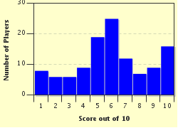
Avg Score
6 / 10
Plays
388
Awards
Top 35% Quiz
- -
Question 1 of 10
1. There is actually a point called simply "Point," specifically a peninsula connected by an isthmus to the Isle of Lewis. If that doesn't pinpoint Point for you, it might help to know that Point is very near the regional capital of Stornoway. Still lost? The whole area comprises the most populous region of the Western Isles or Outer Hebrides, which is an archipelago of what considerably-more-famous country? Hint


Question 2 of 10
2. Although not the southernmost location in South America, Punta Arenas (Sandy Point), Chile, is a busy port and the most populous city south of the 46th south parallel. It began as a penal colony in 1848, but quickly grew in size and prominence due to its location on what body of water? Hint


Question 3 of 10
3. Gay Head is a place that has special meaning to the Wampanoag Tribe of North America. In their lore the place was formed by Moshup, a giant who was one of their forebears. Where is Gay Head located? Hint


Question 4 of 10
4. A dauntingly remote location, Zenith Point is the northernmost spot on the North American mainland. Located on the Murchison Promontory, which itself is a northern extension of the Boothia Peninsula in the Canadian Arctic, Zenith Point sits on the south shore of the Bellot Strait, a key transit route of the Canadian Northwest Passage. These places are all part of which largest and newest Canadian territory? Hint


Question 5 of 10
5. Located in an island group, The Bluff's notable features may give a clue to its location (that's its full name - The Bluff): 1) while the terrain in these islands is almost entirely flat, The Bluff's altitude of over 140 ft. makes it easily their highest point; 2) it may not be surprising that the islands are known for excellent SCUBA diving; however, The Bluff has also made rock climbing an increasingly-important tourist attraction there; and 3) the Gaelic word for "bluff" is "brac." Based on these facts about The Bluff, can you identify the islands that are its home? Hint


Question 6 of 10
6. Punta de Tarifa, Spain, is the southernmost point of the Iberian Peninsula and thus of continental Europe. It is situated on the Atlantic side of which famous waterway? Hint


Question 7 of 10
7. Eaglehawk Neck is an isthmus that connects the northern Tasman Peninsula to the island of Tasmania, a state in the Commonwealth of Australia. Very small, The Neck, as it is locally known, is barely 1200 feet long in total and less than 100 feet wide at its most narrow point. Today it's a popular vacation spot featuring surfing, SCUBA diving, fishing, and hiking among picturesque geological formations. However, in the 19th century The Neck played a very different and important role in the history of what Australian World Heritage location? Hint


Question 8 of 10
8. Which of these capes actually exists in nature? Hint


Question 9 of 10
9. What area is called the "land nearest nowhere" because it is the nearest land to a place in the ocean that lies at 0 degrees latitude, 0 degrees longitude, and 0 degrees altitude? Hint


Question 10 of 10
10. What does Merriam-Webster define as "a bend in a coast forming an open bay; a bay formed by such a bend"? This feature may be considered the opposite of "point," and therefore, beside the point. Hint


(Optional) Create a Free FunTrivia ID to save the points you are about to earn:

arrow Select a User ID:
arrow Choose a Password:
arrow Your Email:


Quiz Answer Key and Fun Facts
1. There is actually a point called simply "Point," specifically a peninsula connected by an isthmus to the Isle of Lewis. If that doesn't pinpoint Point for you, it might help to know that Point is very near the regional capital of Stornoway. Still lost? The whole area comprises the most populous region of the Western Isles or Outer Hebrides, which is an archipelago of what considerably-more-famous country?

Answer: Scotland

The Isle of Lewis is more commonly known as the northern part of the Isle of Lewis and Harris, the largest island in the Outer Hebrides. Local industries are historical ones: peat cutting, crofting, fishing, and weaving; but all exist in greatly-reduced form today.

However, the legendary Harris Tweed cloth is still produced here, although primarily in Lewis, not Harris. Point itself has a growing population of over 2500 people and contains six major villages. This region is full of geographic detail, history, and, seeing as it's Scotland, massive charm. One could do an entire quiz on just the points, heads, bluffs, capes, and necks on the Hebrides - both Inner-and-Outer. Maybe later ...
2. Although not the southernmost location in South America, Punta Arenas (Sandy Point), Chile, is a busy port and the most populous city south of the 46th south parallel. It began as a penal colony in 1848, but quickly grew in size and prominence due to its location on what body of water?

Answer: Strait of Magellan

Punta Arenas prospered as a result of increased sea traffic bound for the west coasts of North and South America during the 19th and early 20th centuries, spurred on by westward population expansion on those continents and the Gold Rushes in California and Canada.

The city was known for a time as Magallanes because of its location on the north shore of the Strait. In modern times the city has become a key access point to Antarctica for scientific exploration and tourism. Surprisingly, one of the contributing factors to the city's prosperity was the influx of Croatian immigrants to the region.

Their descendants make up a significant portion of the population; and their influence can be seen in names of streets, buildings, and businesses. The city of Split, Croatia, is a sister city to Punta Arenas.
3. Gay Head is a place that has special meaning to the Wampanoag Tribe of North America. In their lore the place was formed by Moshup, a giant who was one of their forebears. Where is Gay Head located?

Answer: Martha's Vineyard, Massachusetts, USA

If you think you know how Gay Head might have gotten its name, think again. The area at the western end of Martha's Vineyard was first named by 17th century British explorers who, as they approached from the sea, were most taken by the varied bright colors visible in its cliffs.

These colors, which included reds, golds, greens, and browns, were caused in the clay substrata by geological activity over the ages. Thus, the gaily colored cliffs became Gay Head, and were declared a National Natural Landmark in 1966.

The area boasts a famous lighthouse and has become a center of Wampanoag culture and government in the present day. Its name was changed in 1997 from Gay Head to Aquinnah, which is Wampanoag for "land under the hill." The official name of the tribe remains the Wampanoag Tribe of Gay Head.
4. A dauntingly remote location, Zenith Point is the northernmost spot on the North American mainland. Located on the Murchison Promontory, which itself is a northern extension of the Boothia Peninsula in the Canadian Arctic, Zenith Point sits on the south shore of the Bellot Strait, a key transit route of the Canadian Northwest Passage. These places are all part of which largest and newest Canadian territory?

Answer: Nunavut

Established in 1999 when it was created from the Northwest Territories, Nunavut encompasses a large portion of Northern Canada and the Canadian Arctic Archipelego. The entire territory is so remote that it cannot be reached by a highway from anywhere else in North America. Zenith Point is doubly inaccessible: unapproachable by land and located on a waterway that is known for its unpredictable currents and which is blocked by ice a good part of the year, it has never been inhabited.

The nearest settlement is the small community of Taloyoak, about 160 miles south on the Boothia Peninsula, which relies on a small airport for outside contact and a yearly delivery of supplies by ship.

The exploration history of Point Zenith and the Murchison Promontory mirrors that of Arctic Canada.

The area was first visited by an expedition mounted to find one that had been lost. Other similar searches in the area resulted in further discoveries. And so on ... Ships of Hudson's Bay Company made some of the first crossings through this region, the first not until 1937.
5. Located in an island group, The Bluff's notable features may give a clue to its location (that's its full name - The Bluff): 1) while the terrain in these islands is almost entirely flat, The Bluff's altitude of over 140 ft. makes it easily their highest point; 2) it may not be surprising that the islands are known for excellent SCUBA diving; however, The Bluff has also made rock climbing an increasingly-important tourist attraction there; and 3) the Gaelic word for "bluff" is "brac." Based on these facts about The Bluff, can you identify the islands that are its home?

Answer: Caymans

There are three Cayman Islands - a British dependency located in the Caribbean Sea - Grand Cayman, Cayman Brac, and Little Cayman. They were first sighted by Christopher Columbus in 1503 and first visited by Sir Francis Drake in 1586. Cayman Brac was named for The Bluff, a limestone formation that runs the length of the island (12 miles) gradually rising to its full height at the eastern end. Rock climbers have increasingly flocked to Cayman Brac since the early 1990s, attracted by the challenging terrain of The Bluff; and the island has been listed in the Top Ten Exotic Climbing Sites in the World.

The Bluff also produces Caymanite, a semi-precious exotic form of dolostone, which is used by island artisans to craft jewelry and small sculptures.

A beautiful variegated mineral that ranges from white to red and black, Caymanite is a very hard stone that can only be cut with a diamond tool.
6. Punta de Tarifa, Spain, is the southernmost point of the Iberian Peninsula and thus of continental Europe. It is situated on the Atlantic side of which famous waterway?

Answer: Strait of Gibraltar

Punta de Tarifa provides an excellent view of Morocco in North Africa across the Strait, which is less than nine miles wide at this point. Those who research the name "Punta de Tarifa" may expect it to refer to something about the Strait: the Spanish "tarifa" can mean "rate," "tariff," or "fare;" so it's easy to surmise that the name has something to do navigation charges on that key waterway.

However, the name refers to Tariq ibn Ziyad, a Moorish general who led the Muslim conquest of what is now Spain in the eighth century and whose troops came through Punta de Tarifa.

The influence of this conquest can still be seen throughout Spain today. Because of its history and key location, the area around Punta de Tarifa has served as some form of military installation throughout history.
7. Eaglehawk Neck is an isthmus that connects the northern Tasman Peninsula to the island of Tasmania, a state in the Commonwealth of Australia. Very small, The Neck, as it is locally known, is barely 1200 feet long in total and less than 100 feet wide at its most narrow point. Today it's a popular vacation spot featuring surfing, SCUBA diving, fishing, and hiking among picturesque geological formations. However, in the 19th century The Neck played a very different and important role in the history of what Australian World Heritage location?

Answer: Port Arthur

Port Arthur was the location of a prison, called a "convict settlement," one of a group of such sites constructed by the British Empire in Australia in the 18th and 19th centuries, to which convicts were shipped from around the Empire. Situated on the Tasman Peninsula, Port Arthur was the prison used for the worst-of-the-worst British and Irish criminals, usually those who had committed additional crimes after being sent to Australia. Because it was located at the southern end of a peninsula connected to the mainland in the north only by the tiny Eaglehawk Neck, Port Arthur was considered to be all but escape-proof in its day. For additional insurance against escapes, the Neck was fortified with soldier-guards, traps, and vicious deliberately-starved dogs. Anyone who managed to escape the prison would have to risk these hazards or attempt to swim or sail around them to get to the mainland. Even so, there were a few escape attempts, and one was successful, led by the legendary Martin Cash, who actually escaped from Port Arthur TWICE.
8. Which of these capes actually exists in nature?

Answer: Cape Flattery

Cape Flattery is the northwesternmost point of the 48 contiguous United States. It is located in the state of Washington on the Olympic Peninsula where the Strait of Juan de Fuca meets the Pacific Ocean. Cape Flattery was named by Captain James Cook in 1778 and described in his journal as flattering his expedition with the prospect of a safe harbor. It is thus the oldest permanently-named feature in Washington State. Maintained today by the Makah Indian Nation, Cape Flattery's hiking trails provide spectacular views of the rocky cliffs, roiling ocean, and of the abundant wildlife which make their homes in the area.

None the other options exists in reality, although Cape Regret is the name of a town mentioned in "Star Wars Gamer 7" magazine (2001).
9. What area is called the "land nearest nowhere" because it is the nearest land to a place in the ocean that lies at 0 degrees latitude, 0 degrees longitude, and 0 degrees altitude?

Answer: Cape Three Points, Ghana, Africa

What bliss: a cape with not one, but three points! Such a find on our geographic expedition ... Cape Three Points, Ghana, is a small peninisula that marks the southernmost location of West Africa. It was named for the three small land forms which can be observed projecting into the sea from its tip.

The Cape is known for its historic lighthouses: the original, built in 1875, is all but gone, although its remains can be visited; but the more modern one (1925) is solar-powered, very much in use today, and open for tours conducted by its personable keeper.

The Cape has some beautiful beaches and access to a nearby coastal raiforest reserve, Ankasa National Park. The 0-0-0 point mentioned in the "nearest nowhere" nickname can be found in the Gulf of Guinea about 350 miles slightly to the southeast of the Cape.
10. What does Merriam-Webster define as "a bend in a coast forming an open bay; a bay formed by such a bend"? This feature may be considered the opposite of "point," and therefore, beside the point.

Answer: bight

As geographical phenomena, bights can be relatively small, such as the Bights of Benin and Bonny on the west coast of Africa or the North and South Taranaki Bights on New Zealand's North Island. On the other hand, bights can be quite extensive, such as the Great Australian Bight, which encompasses 720 miles of the southern coast of Australia; or the Mid-Atlantic Bight, which runs along the east coast of the United States from Massachusetts to North Carolina.
Source: Author shorthumbz

This quiz was reviewed by FunTrivia editor spanishliz before going online.
Any errors found in FunTrivia content are routinely corrected through our feedback system.
4/28/2024, Copyright 2024 FunTrivia, Inc. - Report an Error / Contact Us