FREE! Click here to Join FunTrivia. Thousands of games, quizzes, and lots more!
Quiz about Deserted Ends of the Earth

Deserted Ends of the Earth? Trivia Quiz


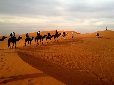
'The Ends of the Earth' are not officially designated locations, but any of the world's deserts might fit the bill - especially if they are rocky, barren and apparently empty. However, are all deserts really deserted? Take this quiz to find out!

A photo quiz by Fifiona81. Estimated time: 4 mins.
  1. Home
  2. »
  3. Quizzes
  4. »
  5. Geography Trivia
  6. »
  7. Physical Geography
  8. »
  9. Deserts

Author
Fifiona81
Time
4 mins
Type
Photo Quiz
Quiz #
372,981
Updated
Dec 03 21
# Qns
10
Difficulty
Average
Avg Score
8 / 10
Plays
640
Awards
Top 5% quiz!
Last 3 plays: Guest 68 (4/10), Guest 38 (8/10), Guest 99 (6/10).
-
Question 1 of 10
1. A desert located on the US-Mexican border is definitely not deserted because it is home to several major cities including Cuidad Juárez on the Mexican side and El Paso, Texas on the American side. What is this desert called? Hint


Question 2 of 10
2. The Nebraska Sandhills is an example of a paleodesert - an area where climate change over a long period of time has allowed the sand dunes to become stabilised by vegetation. What major industry is the economy of this area dependent on? Hint


Question 3 of 10
3. The western end of the Sahara Desert is marked by the Atlantic coastline and includes the city of Nouakchott. In which northern African nation would you find Nouakchott? Hint


Question 4 of 10
4. The Three-North Shelterbelt Forest Programme was introduced by the Chinese government in 1978 in an attempt to prevent one of the world's deserts encroaching into populated areas of the country. The apparent expansion of which desert prompted this action? Hint


Question 5 of 10
5. The cold, inhospitable land of the Patagonian Desert of South America holds some clues to the fact that the area has been inhabited by the Tehuelche people for around 15,000 years. Which of these features might you see if you took a trip to this end of the Earth? Hint


Question 6 of 10
6. Located in the states of Western Australia and South Australia, the Great Victoria Desert is the largest in the country and, like most deserts, is sparsely populated. This made it an apparently ideal location for what type of activity? Hint


Question 7 of 10
7. The state tree of Rajasthan, Prosopis cineraria, is a key species for the economy of which of the world's deserts? Hint


Question 8 of 10
8. The 'Flowering Desert' phenomenon can be seen in which desert of South America, located along the coast of Chile? Hint


Question 9 of 10
9. The Mojave Desert can't really be described as an 'end of the Earth' as it is located in the United States of America and is home to one of the most vibrant and populous cities in the country. What is the official name of the city in the Mojave Desert that, amongst other things, is also known as 'Sin City' and 'The Entertainment Capital of the World'?

Answer: (Two Words)
Question 10 of 10
10. The Namib and Kalahari Deserts of south-west Africa are home to a variety of animal species, including Suricata suricatta. What is the common name of this desert-dwelling species? Hint


(Optional) Create a Free FunTrivia ID to save the points you are about to earn:

arrow Select a User ID:
arrow Choose a Password:
arrow Your Email:


View Image Attributions for This Quiz

Most Recent Scores
Apr 15 2024 : Guest 68: 4/10
Apr 15 2024 : Guest 38: 8/10
Apr 12 2024 : Guest 99: 6/10
Apr 11 2024 : Amitchell915: 6/10
Apr 06 2024 : Guest 24: 7/10
Mar 26 2024 : Guest 107: 6/10
Mar 21 2024 : Guest 67: 6/10
Mar 18 2024 : Indonesia129: 8/10
Mar 02 2024 : Guest 50: 7/10

Score Distribution

quiz
Quiz Answer Key and Fun Facts
1. A desert located on the US-Mexican border is definitely not deserted because it is home to several major cities including Cuidad Juárez on the Mexican side and El Paso, Texas on the American side. What is this desert called?

Answer: Chihuahuan Desert

The Chihuahuan Desert is a rain shadow desert located between two mountain ranges - the Sierra Madre Occidental to the west and the Sierra Madre Oriental to the east. These two areas of high ground generally prevent moisture from the Pacific Ocean or the Gulf of Mexico reaching the area. However, the Chihuahuan Desert is not one of the driest or hottest deserts in the world as it actually has mean annual rainfall of about 235 mm (or 9 inches) and northern areas often receive snowfall in the winter. The area covered by the desert includes parts of the Mexican states of Chihuahua (from which it takes its name), Coahuila and Durango along with parts of the US states of Texas, Arizona and New Mexico.

Cuidad Juárez and El Paso are located on opposite banks of the Rio Grande. The 2010 Mexican and US Censuses put the population of the two cities at 1.3 million and 650,000 respectively. The city of Chihuahua also falls within the area covered by the Chihuahuan Desert.

The picture clue shows a Chihuahua - the smallest breed of dog - which is also named after the Mexican state. The incorrect options all relate to other small canines.
2. The Nebraska Sandhills is an example of a paleodesert - an area where climate change over a long period of time has allowed the sand dunes to become stabilised by vegetation. What major industry is the economy of this area dependent on?

Answer: Cattle ranching

The picture clue shows Angus cattle, one of the breeds commonly found on cattle ranches in the Nebraska Sandhills area. The extent of the cattle ranching industry means that you are much more likely to encounter cattle than humans in the Nebraska Sandhills, as the area is sparsely populated but home to over 500,000 cattle. The sparse population is a legacy of the fact that the sandy soil is not conducive to successful arable farming. Despite many people rushing to claim land in the Sandhills area after the passing of the 1904 Kinkaid Act (which allowed families to claim up to 640 acres of previously government owned land), many of the resulting small farms, particularly those attempting to raise crops, quickly failed.

Although the grass-covered sand dunes provide good grazing land for cattle, it is important that the grazing is carefully managed as overgrazing and the subsequent removal of the vegetation could lead to the sand dunes becoming unstable. However, grazing of this ecosystem is nothing new as prior to the arrival of people and their cattle, the area was home to significant numbers of bison and elk. The ecological importance of the Nebraska Sandhills was recognised in 1984 when the area was designated a National Natural Landmark.
3. The western end of the Sahara Desert is marked by the Atlantic coastline and includes the city of Nouakchott. In which northern African nation would you find Nouakchott?

Answer: Mauritania

Nouakchott is the capital of Mauritania (a map of which is shown in the picture clue), which has a 750 km (470 mile) coastline on the Atlantic Ocean, although most of its territory is sandwiched between Mali and the area known as Western Sahara. Most of Mauritania's land is part of the Sahara Desert and although the country's major cities and population are generally located in the coastal region and the area to the south along the Senegal River, many (including Nouakchott) still fall within the boundaries of what is probably the most famous desert in the world.

Nouakchott was chosen as Mauritania's capital city in 1958 shortly before Mauritania gained independence from France. Over fifty years later rapid development and population growth have transformed it from a small fishing village to a major port city and the country's economic hub.

Morocco is also in northern Africa and has coastlines on both the Atlantic Ocean and Mediterranean Sea. Malawi is located in south-east Africa, next to Mozambique.
4. The Three-North Shelterbelt Forest Programme was introduced by the Chinese government in 1978 in an attempt to prevent one of the world's deserts encroaching into populated areas of the country. The apparent expansion of which desert prompted this action?

Answer: Gobi Desert

The Gobi Desert covers around 1.3 million square kilometres (500,000 square miles) of northern China and southern Mongolia. The Karakum Desert (in Turkmenistan), Kyzyl Kum (in Turkmenistan, Kazakhstan and Uzbekistan) and Great Basin Desert (in the USA) all have, like the Gobi Desert, a cold winter desert climate.

The Three-North Shelterbelt Forest Programme is also known by a variety of other names including the 'Great Green Wall of China' (hence the picture clue showing the standard Great Wall of China). In essence it is a long-term plan to plant massive numbers of trees in order to prevent the ongoing desertification of land around the Gobi Desert. Other intended benefits include a reduction in air pollution caused by dust storms that originate in the Gobi Desert but find their way to major Chinese cities - including the capital Beijing. The first 30 years or so of the project have resulted in the planting of over 25 million hectares of forest - if the plan for the next 40 years goes ahead then over 10% of China's land area will have been seeded with trees.
5. The cold, inhospitable land of the Patagonian Desert of South America holds some clues to the fact that the area has been inhabited by the Tehuelche people for around 15,000 years. Which of these features might you see if you took a trip to this end of the Earth?

Answer: Tehuelche cave paintings

The Tehuelche people were nomadic hunter-gatherers so had little requirement for cities, communication tunnels or mines of any sort. They did however create many rock-based tools that they used to hunt a variety of prey - from small rodents to large whales - and produced many impressive cave paintings.

One famous site where Tehuelche cave paintings can be seen is the Cueva de los Manos in Argentina's Santa Cruz province. 'Cueva de los Manos' means 'Cave of the Hands' in English and contains a dazzling array of handprints produced by blowing pigments onto the cave walls using bone tubes. In addition to the fun-looking handprints, there are rhea footprints and the caves also contain painted depictions of guanacos (a key Tehuelche prey animal), humans, hunting scenes and geometric designs.

The picture clue simply depicts a standard cave - one which the Tehuelche people clearly never got their hands on (literally)...
6. Located in the states of Western Australia and South Australia, the Great Victoria Desert is the largest in the country and, like most deserts, is sparsely populated. This made it an apparently ideal location for what type of activity?

Answer: Testing nuclear weapons

The UK carried out nuclear weapons testing in the area around Emu Field in the Great Victoria Desert in 1953 and in neighbouring Maralinga between 1956 and 1963. The sites were left contaminated with nuclear waste from nine major tests and hundreds of minor ones. However, a more painful legacy of the testing was the illnesses (including cancers) suffered by both servicemen who worked at the test sites and the local Aboriginal population.

Despite the contamination in some areas, the Great Victoria Desert has been designated as a World Wildlife Fund ecoregion and is a good example of an undisturbed habitat. It is also home to many different species of lizard.

The picture clue includes a radioactive hazard warning sign. The incorrect options are all human activities that have been detrimental to the environment around the world, but have not taken place in this particular location.
7. The state tree of Rajasthan, Prosopis cineraria, is a key species for the economy of which of the world's deserts?

Answer: Thar Desert

The Thar Desert (also called the Great Indian Desert or Marusthali) is one of the world's most densely populated deserts and covers a large chunk of north-western India (including the state of Rajasthan) and parts of neighbouring Pakistan. The people of this region are heavily dependent on agriculture and livestock, including cultivating Prosopis cineraria for animal fodder, fire wood and house-building. The tree is a member of the pea family and is generally found growing in extremely arid conditions - making the Thar Desert an ideal home for it.

The Thar Desert is classified as a monsoon (or sub-tropical) desert, an arid inland area caused by any precipitation falling almost exclusively on neighbouring coastal regions. The incorrect options can also all be described as monsoon deserts; the Gibson and Simpson deserts are located in Australia and the Dasht-e Kavir can be found in Iran.

The picture clue shows a particular example of Prosopis cineraria called the 'Tree of Life', which can actually be found in Bahrain.
8. The 'Flowering Desert' phenomenon can be seen in which desert of South America, located along the coast of Chile?

Answer: Atacama Desert

The Atacama Desert in northern Chile (as seen on the map shown in the picture clue), usually one of the driest places on Earth, certainly doesn't look like a barren 'end of the earth' when the 'Flowering Desert' phenomenon is in full swing. The phenomenon transforms the landscape from its normal dry, rocky appearance to one which appears carpeted by various small endemic flowers. The phenomenon is directly associated with higher than usual levels of rainfall, which result in dormant seeds and bulbs germinating to create the colourful display. It occurs in spring (between September and November) but certainly not every year, so tourists need to be either very lucky or book their trip very quickly after the flowers first appear!

The less arid parts of the Atacama Desert are home to a variety of animal and bird species including various reptiles, Humboldt penguins, Andean flamingos and South American gray foxes. The human population of the area is much sparser with various towns located along the coast and at a small number of oases in the interior.

The Sonoran Desert is located in the USA and Mexico; the Tanami Desert is in northern Australia; and the Tabernas Desert is in Spain.
9. The Mojave Desert can't really be described as an 'end of the Earth' as it is located in the United States of America and is home to one of the most vibrant and populous cities in the country. What is the official name of the city in the Mojave Desert that, amongst other things, is also known as 'Sin City' and 'The Entertainment Capital of the World'?

Answer: Las Vegas

Las Vegas has a variety of nicknames - in addition to the two mentioned in the question, it is also known as 'The Gambling Capital of the World', 'The Marriage Capital of the World', the 'Capital of Second Chances', or simply 'Vegas'. Despite being the 'capital' of so many things, it is not actually the state capital of Nevada - that honour belongs to Carson City. The 2010 US Census recorded Las Vegas as the most populous city in Nevada, and the 30th most populous in the US as a whole, with over 580,000 inhabitants.

The Mojave Desert is a rain shadow desert which covers about 125,000 square kilometres (50,000 square miles) of California, Nevada, Utah and Arizona. Its topography consists of numerous mountain ranges accompanied by deep valleys. One of its best known geographic features is probably Death Valley, the home of Badwater Basin - the lowest point on the continent of North America, at about 85m (280 feet) below sea level.

The picture clue shows the Las Vegas skyline at night.
10. The Namib and Kalahari Deserts of south-west Africa are home to a variety of animal species, including Suricata suricatta. What is the common name of this desert-dwelling species?

Answer: Meerkat

As shown in the picture clue, meerkats are perky little creatures that live in extended family 'clans' or 'mobs' and are famed for the 'sentry duty' pose that one or more of the group adopts while acting as lookout for the others. They are well adapted for desert life, living in large underground burrows - which they retreat to in order to avoid the hottest periods of the day - and foraging for food (mainly insects) in the sandy desert soil.

The Namib Desert runs along the coast of south-west Africa, from Angola in the north to northern South Africa, but lies mainly within the country of Namibia which takes its name from the desert. The desert also contains the Namib-Naukluft National Park, which is the largest African game reserve and home to many of Africa's iconic animal species such as elephants, hyenas, antelopes and ostriches. The Kalahari Desert is located inland from the Namib Desert, covering major parts of Namibia and Botswana; as a semi-desert, it has a wider range of climates, flora and fauna.

The incorrect options are all creatures that shouldn't be confused with or compared to meerkats. Muskrats are aquatic rodents native to North America (so really wouldn't be happy with a desert lifestyle); mandrills are a species of monkey native to forested areas of sub-Saharan Africa; and although meerkats belong to the mongoose family they are unrelated to the mongoose lemurs of Madagascar and the Comoros, who are (unsurprisingly perhaps) lemurs.
Source: Author Fifiona81

This quiz was reviewed by FunTrivia editor Tizzabelle before going online.
Any errors found in FunTrivia content are routinely corrected through our feedback system.
4/19/2024, Copyright 2024 FunTrivia, Inc. - Report an Error / Contact Us