FREE! Click here to Join FunTrivia. Thousands of games, quizzes, and lots more!
Quiz about Round the World with Team Red Stage 3

Round the World with Team Red. Stage 3 Quiz


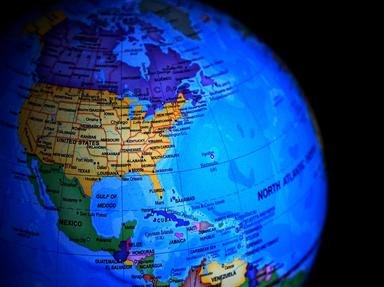
In the Team Task Challenge, Team Red is circling the globe making a massive 100 stops in ten stages. So grab your passport and hang on! This is stage number three where we visit south-western USA and Central America.

A multiple-choice quiz by 1nn1. Estimated time: 5 mins.
  1. Home
  2. »
  3. Quizzes
  4. »
  5. Geography Trivia
  6. »
  7. North America

Author
1nn1
Time
5 mins
Type
Multiple Choice
Quiz #
397,073
Updated
Dec 03 21
# Qns
10
Difficulty
Average
Avg Score
7 / 10
Plays
613
Awards
Top 10% Quiz
Last 3 plays: TurkishLizzy (9/10), Nala2 (7/10), BarbaraMcI (7/10).
- -
Question 1 of 10
1. From our stopover in Stage 2 in San Diego we scoot east 500 miles into Arizona to travel to the Grand Canyon, where we visit the village home of the Havasupai tribe. The village is so remote it is inaccessible by road. How is the mail stubbornly delivered? Hint


Question 2 of 10
2. Just before we cross over into Mexico, it's time to take a brief sojourn from our road trip at the Plaza Hotel in Sun City, formerly known as the Six-Shooter Capital. Which Texas city in the Mountain Standard Time zone are we stopping by? Hint


Question 3 of 10
3. As we cross the Rio Grande River and move into the twin city of Ciudud Juarez in Mexico we are headed 1800 kilometres south to the Mexican capital. However we stop after only 380km at the city of Chihuahua, refuel and head 250km west to see what "Grand" sight? Hint


Question 4 of 10
4. Back to the city of Chihuahua, we are back on our trek down the Pan-American Highway. We stop off in Mexico City to visit one of the largest city parks in the Western hemisphere. Which of Mexico City's parks is home to a variety of attractions, including a castle, a zoo, and multiple museums, like the Museo del Caracol and the Museo Nacional de Antropología, but definitely no canals? Hint


Question 5 of 10
5. After leaving Mexico City we hit the Pan-American Highway, heading south. But before we leave Mexico, we decide to take a detour to see the Chicxulub crater. Where will we need to go to find this phenomenon? Hint


Question 6 of 10
6. As we cross the southern Mexican border we enter the first of the seven smaller Central American countries. Team Red members are asked if they could remember the mnemonic that lists all the seven countries north to south. There four replies. Which is correct? Hint


Question 7 of 10
7. As not many of Team Red have made it to Australia to see the Great Barrier Reef, they are keen to see a large reef system just off the coast of Belize. What is the obvious name of this reef? Hint


Question 8 of 10
8. While passing through Honduras, we decide to take a detour off the highway to visit Copán, a site of Mayan ruins close to the Guatemalan border. A hieroglyphic account, (on the way to heaven, perhaps) of the city's rulers can be found on which type of structure at the site? Hint


Question 9 of 10
9. While travelling down the Pan-American Highway through Costa Rica, we see the Guanacaste Range which has several volcanoes. Of course a detour is in order so we can visit the Rio Celeste. Which musically sounding volcano's surrounding national park features this lovely river? Hint


Question 10 of 10
10. It's been a long stage so we are in the narrow isthmus country of Panama in the capital city of the same name now resting in our hotel rooms overlooking Panama Bay. We are told to rise early to observe the sunrise. What geographical oddity causes an unusual circumstance? Hint


(Optional) Create a Free FunTrivia ID to save the points you are about to earn:

arrow Select a User ID:
arrow Choose a Password:
arrow Your Email:


Most Recent Scores
Apr 18 2024 : TurkishLizzy: 9/10
Apr 13 2024 : Nala2: 7/10
Mar 27 2024 : BarbaraMcI: 7/10
Mar 19 2024 : adam36: 4/10
Mar 18 2024 : Guest 73: 6/10
Mar 09 2024 : nikkitem: 9/10
Mar 08 2024 : Guest 172: 7/10
Mar 05 2024 : Guest 99: 8/10
Mar 03 2024 : macatak: 8/10

Quiz Answer Key and Fun Facts
1. From our stopover in Stage 2 in San Diego we scoot east 500 miles into Arizona to travel to the Grand Canyon, where we visit the village home of the Havasupai tribe. The village is so remote it is inaccessible by road. How is the mail stubbornly delivered?

Answer: Mules

Supai Village is located in Havasu Canyon (a side branch of the Grand Canyon) within the Havasupai Indian Reservation. With a population of about 210 it is the most remote community within the contiguous United States. Since it is about 13 ½ miles from the nearest road, cars can't reach it. Helicopter, hiking or mule riding along the Havasupai Trail are the options. It is the only place in the US where mail is still carried by mule.

Question contributed by Sally0Malley
2. Just before we cross over into Mexico, it's time to take a brief sojourn from our road trip at the Plaza Hotel in Sun City, formerly known as the Six-Shooter Capital. Which Texas city in the Mountain Standard Time zone are we stopping by?

Answer: El Paso

El Paso used to be known as the Six-Shooter Capital due to its association with lawlessness and the Wild West, but became known as Sun City due to it having an average of 302 days of sun every year. The Plaza Hotel used to be a Hilton Hotel and, in an incredible stroke of poor fortune, construction started just nineteen days before the Great Depression in 1929. However, the hotel was completed in 1930 and then sold on in 1963 when it became known as the Plaza Hotel. El Paso's use of Mountain Standard Time goes back to 1921, and differs from most Texas cities which use Central Standard Time. El Paso have been resistant to legislation and other attempts to force conformity, citing potential economic disruption and its more western location as being reasons to remain in Mountain Standard Time.

Question created by Malik24
3. As we cross the Rio Grande River and move into the twin city of Ciudud Juarez in Mexico we are headed 1800 kilometres south to the Mexican capital. However we stop after only 380km at the city of Chihuahua, refuel and head 250km west to see what "Grand" sight?

Answer: Barranca del Cobre (The Copper Canyon)

While all these options are must see locations on a trip to Mexico, only the Copper Canyon is in the state of Chihuahua, Mexico's largest state (which is largely associated with the Chihuahua desert).
The best way to see this breathtaking marvel is by train called "El Chepe" particularly the section between Creel and El Fuerte. If you buy a first class ticket you can hop off and explore before catching the next train. The canyon is actually a series of canyons that are larger and deeper than the Grand Canyon although the Grand Canyon is larger overall.

Question contributed by 1nn1
4. Back to the city of Chihuahua, we are back on our trek down the Pan-American Highway. We stop off in Mexico City to visit one of the largest city parks in the Western hemisphere. Which of Mexico City's parks is home to a variety of attractions, including a castle, a zoo, and multiple museums, like the Museo del Caracol and the Museo Nacional de Antropología, but definitely no canals?

Answer: Chapultepec

The 'Bosque de Chapultepec' (Chapultepec Forest) gets its name from a Náhuatl word meaning "grasshopper hill", which refers to a rock formation located in the center of the park. The park has been a site of interest since pre-Colombian times, and is one of the most visited urban parks in the world, with about 15 million visitors a year. During the colonial period, the Spanish built the Chapultepec Castle, originally used as a summer retreat for the viceroy of New Spain. While the park is home to multiple museums, the most important one is the Museo Nacional de Antropología (National Museum of Anthropology), which houses a large collection of pre-Columbian art, including the Aztec Sun Stone.
The famous canals of Xochimilco are the final reminders of an extensive water transport system built by the Aztecs. This area is 30km south of Chapultepec.

Question created by Tiffanyram
5. After leaving Mexico City we hit the Pan-American Highway, heading south. But before we leave Mexico, we decide to take a detour to see the Chicxulub crater. Where will we need to go to find this phenomenon?

Answer: Yucatán Peninsula

The Chicxulub crater was formed when a large bolide impacted just off the coast of the Yucatan Peninsula. The crater measures over 150 km in diameter and is 20 km deep. The crater forms an almost perfect circle, half of it in the Gulf of Mexico and the rest on the peninsula itself. Scientific evidence has proven that the meteor was large enough to cause an Extinction Level Event, the event that killed the dinosaurs almost 66 million years ago.

Question created by Leith90
6. As we cross the southern Mexican border we enter the first of the seven smaller Central American countries. Team Red members are asked if they could remember the mnemonic that lists all the seven countries north to south. There four replies. Which is correct?

Answer: Big Gorillas Eat Hotdogs Not Cold Pizza

Most of the land in Central America including what is now Central America, Mexico and some parts of south western USA and Florida was under Spanish control as the Captaincy General of Guatemala from 1609 to 1821. In 1821 an independent New Spain became a sovereign state. At this time some of its provinces were annexed to the First Mexican Empire. However a year later these provinces seceded from Mexico to form the Federal Republic of Central America, which lasted 15 years from 1823 to 1838. Then four independent states proclaimed independence in 1838: Nicaragua, Honduras, Costa Rica, and Guatemala. El Salvador joined them in 1841. Panama gained independence from Colombia in 1903 and Belize gained independence from the British in 1981 (Before that Belize was known as British Honduras). The Central American countries from north to south are Mexico, Belize, Guatemala, El Salvador, Honduras, Nicaragua, Costa Rica, and Panama.
As we roll into Guatemala (Belize is not on the Pan American Highway), at least I do not need to remember the name of the capital as it is the same as the country!

Question contributed by 1nn1
7. As not many of Team Red have made it to Australia to see the Great Barrier Reef, they are keen to see a large reef system just off the coast of Belize. What is the obvious name of this reef?

Answer: Belize Barrier Reef

The Belize Barrier Reef is a 300-kilometer long section of the 900 kilometer Mesoamerican Barrier Reef System, which continues north to the tip of the Yucatan Peninsula. It can be as close as 300m off the Belize coast but varies up to 25km offshore. The reef is UNESCO World Heritage listed and is home to 70 hard and 36 soft coral species as well as over 500 species of fish. A feature is the Great Blue Hole which is a large marine sinkhole, circular in shape, 318 m across and 124 m deep.
Incidentally the reason the Pan-American Highway does not go through Belize (the only one of the seven countries it does not) is because being a former British possession, they drove on the left. They changed to conform (despite being British until 1981) in 1961 but by then it was too late, the highway had gone past without them.

Question created by 1nn1
8. While passing through Honduras, we decide to take a detour off the highway to visit Copán, a site of Mayan ruins close to the Guatemalan border. A hieroglyphic account, (on the way to heaven, perhaps) of the city's rulers can be found on which type of structure at the site?

Answer: Stairway

The Hieroglyphic Stairway at Copán is an amazing structure which is made of stones with glyphs recounting the history of the city's rulers. It was originally constructed during the reign of ruler K'ak' Yipyaj Chan K'awiil (742-763 CE). The stairway was originally a part of a ceremonial temple, but the original positioning of the glyph blocks was destroyed when the temple façade collapsed. Efforts have been taken to reconstruct the stairway's hieroglyphs, and the Honduran government first covered the stairway with a tarp in 1985 to help prevent erosion. The stairway contains a total of about 2200 glyphs, which makes it the longest Mayan text known to exist.

Question created by Tiffanyram
9. While travelling down the Pan-American Highway through Costa Rica, we see the Guanacaste Range which has several volcanoes. Of course a detour is in order so we can visit the Rio Celeste. Which musically sounding volcano's surrounding national park features this lovely river?

Answer: Tenorio Volcano

The Tenorio Volcano has four peaks and two craters, and the surrounding area was made a National Park in 1995. The Rio Celeste is famous for its brilliant turquoise colour. The colour is due to the sediment found in the Buenavista River and Sour Creek, both of which merge to form the Celeste. The mixing of the sediments gives rise to the colour. In the area around the Rio are geysers and thermal springs which are fed by sulphur emissions from the volcano.

Question created by Leith90
10. It's been a long stage so we are in the narrow isthmus country of Panama in the capital city of the same name now resting in our hotel rooms overlooking Panama Bay. We are told to rise early to observe the sunrise. What geographical oddity causes an unusual circumstance?

Answer: Sun rises over the Pacific Ocean and sets over the Atlantic

Panama is an S-shaped isthmus connecting Central America with South America. While Central America generally runs north-west to south-east, a portion of Panama's isthmus actually runs south-west to north-east including the region where the capital is located and indeed the Panama Canal itself. As such when the sun rises in the east in Panama City is comes up over the Pacific and sets in the Caribbean Sea (Atlantic Ocean) in the west. This is the only place in the world this event occurs. The city's most recognised landmark is a steel arch bridge that crosses the Pacific end of the canal and connects the North and South American land masses. Until the Centennial Bridge was built upstream, the older bridge was also part of the Pan-American Highway.

Question created by 1nn1
Source: Author 1nn1

This quiz was reviewed by FunTrivia editor agony before going online.
Any errors found in FunTrivia content are routinely corrected through our feedback system.
Related Quizzes
This quiz is part of series Round The World With Team Red:

Team Red have written a monster Round the World quiz divided into ten stages .created for week one of the Team Task Challenge. This is the first 100 question Geography quiz on Fun Trivia. This was a true interactive quiz where each stage usually had multiple authors. Team Red are Malik24, Sally0Malley, Tiffanyram, Leith90, VegemiteKid,Pollucci19, 480154st, Rossian, Triviaballer and 1nn1. This collective quiz is a triumph for authors working as a team.

  1. Round the World With Team Red: Stage 1 Average
  2. Round the World With Team Red. Stage 2 Average
  3. Round the World with Team Red. Stage 3 Average
  4. Round the World with Team Red. Stage 4 Average
  5. Round the World with Team Red. Stage 5 Average
  6. Round the World with Team Red. Stage 6 Average
  7. Round the World with Team Red: Stage 7 Average
  8. Round the World with Team Red: Stage 8 Average
  9. Round the World with Team Red: Stage 9 Average
  10. Round the World with Team Red: Stage 10 Average

4/23/2024, Copyright 2024 FunTrivia, Inc. - Report an Error / Contact Us