FREE! Click here to Join FunTrivia. Thousands of games, quizzes, and lots more!
Quiz about Alabamas Amazing Geography

Alabama's Amazing Geography Trivia Quiz


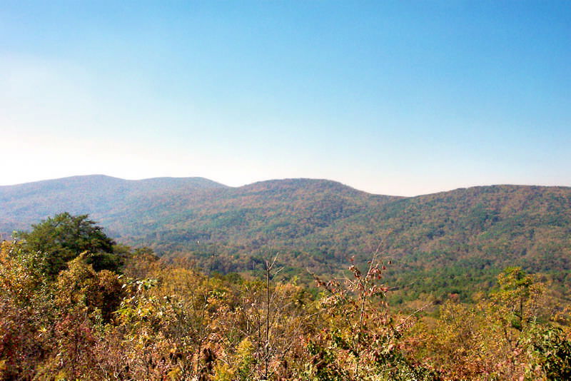
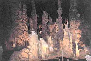
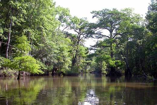
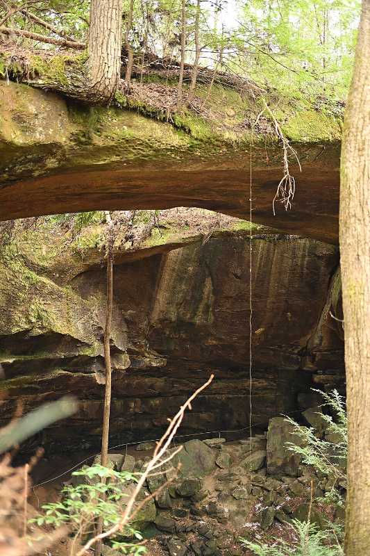
I have lived in Alabama for almost thirty years now and am still amazed at the diverse geographical areas that abound here. Simply match up the geographic type with its photo. I have also added where in the state it can be found.

by stephgm67. Estimated time: 3 mins.
  1. Home
  2. »
  3. Quizzes
  4. »
  5. Geography Trivia
  6. »
  7. States A-D
  8. »
  9. Alabama

Author
stephgm67
Time
3 mins
Type
Quiz #
421,879
Updated
Nov 15 25
# Qns
10
Difficulty
Easy
Avg Score
9 / 10
Plays
34
Last 3 plays: Guest 98 (10/10), violet71 (10/10), miner8265 (10/10).
Drag-Drop or Click from Right
Options
Natural bridge (Winston County) River with endemic flora (Cahaba) Metamorphic plateau (Mt Cheaha) Strand (Gulf Shores) Forest ecosystem (Talladega) Black belt prairie (Orrville) Dissected plateau canyon (Fort Payne) Karst cave (Marshall County) Single-drop falls (Noccalula) Delta (Mobile)


 View Image Attributions for This Quiz

Most Recent Scores
Today : Guest 98: 10/10
Today : violet71: 10/10
Today : miner8265: 10/10
Today : Guest 67: 4/10
Today : Guest 50: 10/10
Today : Guest 69: 8/10
Today : Guest 107: 8/10
Today : Guest 40: 8/10
Today : GoodVibe: 5/10

Quiz Answer Key and Fun Facts
1. Metamorphic plateau (Mt Cheaha)

Mount Cheaha is a metamorphic plateau. It is part of the Talladega Mountains, which are a section of the ancient Ridge-and-Valley Appalachians in north-central Alabama.

This plateau was formed hundreds of millions of years ago when tectonic plates crashed together and formed a mountain range. Over time, wind and water have eroded the softer surrounding rock, leaving the more resistant metamorphic rocks of Mount Cheaha as a high point. The mountain is composed of strong, erosion-resistant rocks like Cheaha quartzite.

It is the highest point in Alabama with an elevation of approximately 2,413 feet (735 meters). Visitors can go to the park, located near Oxford, Alabama, and drive to the summit and access an observation tower.
2. Karst cave (Marshall County)

A karst cave is a natural underground space formed by the slow dissolution of soluble bedrock, such as limestone, by water that is slightly acidic.

Cathedral Caverns, in Marshall County, Alabama, is a karst cave system that is approximately 350 million years old. The cave's name comes from the cathedral-like appearance of its large chambers and formations, such as Goliath, one of the world's largest stalagmites. The cavern boasts one of the largest commercial cave entrances in the world, measuring 128 feet (39 m) wide and 25 feet (7.6 m) high.

Other notable features include a "frozen" waterfall (a large flowstone wall), a vast stalagmite forest, and an underground river that flows through the cave passages.
3. Delta (Mobile)

A geographic delta is a landform at the mouth of a river where it empties into a slower-moving or standing body of water like an ocean, sea, or lake. As the river approaches the sea, its flow slows down dramatically. This reduction in speed causes the river to drop the sediment it has been carrying, such as silt, sand, and clay. Over time, this sediment builds up, creating a delta.

The Mobile-Tensaw Delta is the largest river delta and wetland in Alabama, and one of the largest in the contiguous United States. It covers about 260,000 acres of swamps, marshes, and bottomland forests. It is formed by the confluence of the Alabama and Tombigbee Rivers, which then fan out into a complex network of tidally influenced rivers, creeks, and bays before draining into the head of Mobile Bay.

The biologically diverse ecosystem is a popular destination for outdoor activities such as boating, fishing, hunting, and bird watching.
4. Natural bridge (Winston County)

A natural bridge is a rock formation that forms a natural arch, with a current of water, such as a stream or river, being a major factor in its creation.

The Natural Bridge of Alabama is in Winston County and was formed by water from the New River eroding softer rock over millions of years. The erosion carved the weaker sandstone, leaving the more durable bridge structure, which is held together by iron ore veins. It is estimated to be over 200 million years old and is 148 feet (45 m) long and 60 feet (18 m) high.

It is believed that Muscogee Creek Indians likely used the sheltered space under the bridge for centuries.
5. Strand (Gulf Shores)

A "strand" is a general term for the land along a sea, lake, or river, essentially another word for beach or shore.

Alabama's Gulf Coast covers 32 miles (51 km) of shoreline and is known for its fine, quartz crystal, white sand and warm green-blue water. The white sand in this area is made of pure quartz crystals, which were transported from the Appalachian Mountains over thousands of years by rivers like the Apalachicola River. The high-purity quartz is the reason for the sand's bright white color, fine-grained, and soft, "sugar-like" texture. The sand even squeaks when it is walked upon.

There are multiple public beach areas along the stretch.
6. Forest ecosystem (Talladega)

A forest ecosystem is a complex community of living organisms like plants, animals, and fungi that interact with each other. Plants, including the dominant trees, are the producers that create food from sunlight, water, and carbon dioxide. Animals, from large mammals to small insects, eat that food, plus other organisms. for energy.

The Talladega National Forest is located in the eastern part of Alabama and covers 392,567 acres (613.39 sq mi, or 1,588.66 km2) at the southern edge of the Appalachian Mountains. The forest is predominantly a mix of oak and pine trees, with common species including shortleaf pine, southern red oak, white oak, and chestnut oak. It is home to numerous large mammals, like black bears and white-tailed deer, and smaller mammals such as foxes and raccoons, as well as a large variety of birds.

There are over sixty hiking trails, of varying degrees of difficulty, throughout the forest.
7. Dissected plateau canyon (Fort Payne)

A dissected plateau canyon is a deep, narrow channel with steep sides and was formed by severe erosion on a large, flat-topped area of land. Gorges like this, and the surrounding rugged terrain, are created over millions of years by processes like water erosion, which carves through the rock, often exposing layers of sedimentary rock.

Little River Canyon is a 600-foot (182 m) deep canyon in northern Alabama, near Fort Payne. It was carved by the Little River, which is unique as it is the only river in the U.S. that forms and flows for almost its entire length along the top of a mountain. It is one of the most extensive canyon systems in the eastern United States and contains several different waterfalls and overlooks. Its unique ecosystem supports three globally rare and unique plant communities.
8. Single-drop falls (Noccalula)

A single-drop fall refers to a waterfall with a single, continuous, vertical fall of water. It is usually formed when a river flows over a top layer of resistant bedrock before falling onto softer rock, which erodes faster, leading to an increasingly high drop.

Noccalula Falls is a 90-foot (27 m) waterfall in Gadsden, Alabama. The name Noccalula comes from a Cherokee legend about a princess who, according to the story, jumped to her death from the falls to escape an unwanted marriage. During winter and spring, after heavy rain, the falls can be strong with a high volume of water. Sometimes, when the Black Creek watershed that feeds the falls is suffering from drought, the falls can be just a trickle.
9. Black belt prairie (Orrville)

A Black Belt prairie is a specific type of highly fertile grassland ecosystem located in a crescent-shaped geological region that stretches across parts of Mississippi and Alabama. The name "Black Belt" refers to the region's rich, dark soil which formed from marine chalk deposits during the Cretaceous period. The original prairie was dominated by native grasses like big bluestem and switchgrass, along with a diverse array of wildflowers.

Old Cahawba Archaeological Park is the site of Alabama's first state capital (1820-1826) and a former antebellum river town located near Selma. It is also a a protected prairie preserve. A 3,000-acre tract adjacent to the park is a designated area for conserving a remnant of this prairie habitat and its unique plants.
10. River with endemic flora (Cahaba)

A river is a large, natural flow of freshwater that moves downhill in a channel toward another body of water like an ocean, lake, or another river. Rivers usually begin as smaller streams and can become much larger as they collect water from other tributaries and gain momentum. They also often have endemic plants, meaning they are specific to that area.

The Cahaba River is the longest remaining free-flowing river in Alabama. It starts north of Birmingham and flows south and east to join the Alabama River at Old Cahawba and is 194 miles long (312 km). It is extremely biologically diverse and boasts the Cahaba lily. It is a rare, threatened flower, which blooms on rocky shoals from mid-May to mid-June.
Source: Author stephgm67

This quiz was reviewed by FunTrivia editor agony before going online.
Any errors found in FunTrivia content are routinely corrected through our feedback system.
11/15/2025, Copyright 2025 FunTrivia, Inc. - Report an Error / Contact Us