FREE! Click here to Join FunTrivia. Thousands of games, quizzes, and lots more!
Quiz about Living the High Life

Living the High Life Trivia Quiz

A Journey Through High-Mountain Asia

Home to the world's loftiest mountain peaks, high-mountain Asia is a vast geographical region that occupies much of the central and southern part of the continent. This quiz will explore some of the significant features of this unique part of the world.

A photo quiz by LadyNym. Estimated time: 3 mins.
  1. Home
  2. »
  3. Quizzes
  4. »
  5. Geography Trivia
  6. »
  7. Asia
  8. »
  9. Asia - Regions

Author
LadyNym
Time
3 mins
Type
Photo Quiz
Quiz #
425,165
Updated
Aug 11 26
# Qns
10
Difficulty
New Game
Avg Score
9 / 10
Plays
12
Last 3 plays: Yahma (10/10), Dizart (10/10), jonathanw55 (4/10).
-
Question 1 of 10
1. All the world's mountains with an elevation of over 7,000 m (23,000 ft) are found in high-mountain Asia. True or false?


Question 2 of 10
2. What country, ruled by a military dictatorship and known for human rights abuses, is the only Southeast Asian country to be part of high-mountain Asia? Hint


Question 3 of 10
3. High-mountain Asia, particularly the Tibetan Plateau, is often referred to as the Third Pole. What is the reason for this?


Question 4 of 10
4. Which of these four major mountain ranges is NOT part of high-mountain Asia, being located in a different part of the continent? Hint


Question 5 of 10
5. Covering an area larger than Algeria, the Tibetan Plateau is known for its many high-altitude lakes. What is the name of the largest of them, also the name of China's largest province? Hint


Question 6 of 10
6. What former member of the Soviet Union, covered by mountains for about 90% of its area, boasts the third-highest average elevation in Asia? Hint


Question 7 of 10
7. Located in southeastern Tibet, the world's deepest canyon is carved by the Yarlung Tsangpo, one of Asia's major rivers, known by what other name when it flows south through India and Bangladesh? Hint


Question 8 of 10
8. The union territory of Ladakh in northern India is a high desert plateau known for its Tibetan-influenced culture and strategic location. It is part of what larger region, disputed by India, Pakistan and China and familiar to Led Zeppelin fans? Hint


Question 9 of 10
9. The Tarim Basin is a large depression situated between the Kunlun and the Tian Shan mountain ranges, in the Chinese Autonomous Region of Xinjiang. It is dominated by what desert, whose name is believed to mean "place of no return"? Hint


Question 10 of 10
10. The capital of the Autonomous Region of Tibet is the second-largest city in high-mountain Asia and would be the world's highest national capital if Tibet was still independent. What is the name of this city? Hint


(Optional) Create a Free FunTrivia ID to save the points you are about to earn:

arrow Select a User ID:
arrow Choose a Password:
arrow Your Email:


View Image Attributions for This Quiz

Most Recent Scores
Today : Yahma: 10/10
Today : Dizart: 10/10
Today : jonathanw55: 4/10
Today : MalStone: 8/10
Today : Baldfroggie: 7/10
Today : 4wally: 10/10
Today : Kota06: 7/10
Today : bernie73: 6/10
Today : xchasbox: 10/10

Quiz Answer Key and Fun Facts
1. All the world's mountains with an elevation of over 7,000 m (23,000 ft) are found in high-mountain Asia. True or false?

Answer: True

Although Europe, Africa and the Americas boast their share of high peaks, none of the mountains in those continents reach the heights of those found at the heart of Asia. Not only do those mountain ranges contain all peaks above 8,000 m (26,000 ft) - 14 of them, colloquially known as "eight-thousanders" - but also all of those between 8,000 and 7,200 m (23,600 ft), for a total of 108. Most of these mountains are part of two ranges - the Himalayas and the Karakorum, formed by the collision of the Indian and Eurasian Plates. Indeed, high-mountain Asia fully deserves its nickname of "Roof of the World".

Aconcagua, the highest peak outside Asia, located in the Andes of central Argentina, falls a few metres short of 7,000 m (23,000 ft). The stunning, pyramid-shaped peak in the photo belongs to K2, the world's second-highest mountain, found in the Karakorum.
2. What country, ruled by a military dictatorship and known for human rights abuses, is the only Southeast Asian country to be part of high-mountain Asia?

Answer: Myanmar

High-mountain Asia covers about 5 million km² (1.9 million sq mi), extending from Afghanistan in the west to China in the east. All the countries that lie, partly or wholly, within this region are part of Central, South or East Asia - with one notable exception, the Southeast Asian country of Myanmar.

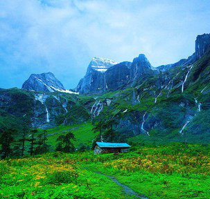
The largest country in Mainland Southeast Asia, Myanmar has got a distinctive, kite-like shape; it is about 2,050 km (1,275 mi) long from north to south. While its southern "tail" occupies part of the Malay Peninsula, its northernmost tip borders southeastern Tibet. Myanmar's Northern Mountains include several subranges of the Himalayas. The country's highest peak - also the highest in all Southeast Asia, with an elevation of 5,881 m (19,295 ft) - is called Hkakabo Razi (in the photo) and is found in Kachin State, on the border with Tibet. The peak lies at the centre of a national park famed for its extraordinarily rich and varied biodiversity. However, another nearby mountain, Gamlang Razi, has challenged Hkakabo Razi's status, as its height has been measured exactly by GPS while Hkakabo Razi's has not.

A poor, underdeveloped country, Myanmar has been torn apart by civil war for decades. Human rights abuses against some minority groups (such as the Muslim Rohingya) are rife.
3. High-mountain Asia, particularly the Tibetan Plateau, is often referred to as the Third Pole. What is the reason for this?

Answer: the extent of its glaciers and snowfields

The immense expanse of perennial snow and ice that covers the peaks of high-mountain Asia forms the world's largest reservoir of fresh water outside the polar ice sheets - this according to NASA, which has made the region an object of in-depth study. The region acts as a veritable natural "water tower" for nearly three billion people, the meltwater from tens of thousands of glaciers forming the headwaters of the major river systems of Central, South, Southeast and East Asia.

The impact of climate change on high-mountain Asia may prove to be devastating - especially as the Tibetan Plateau at its centre is warming at a much higher rate than the rest of China and Asia. Nearly half of the permafrost on the Plateau has warmed so much as to threaten the infrastructure of those areas.

The photo shows a view of the Khumbu Glacier, the world's highest, which lies between Mount Everest and Lhotse. The glacier has a large icefall that is particularly dangerous for those who attempt to climb the world's highest mountain. The largest glacier in Asia, Siachen Glacier, is in the Karakoram range.
4. Which of these four major mountain ranges is NOT part of high-mountain Asia, being located in a different part of the continent?

Answer: Urals

Seen from above, high-mountain Asia appears as a huge mass of white-capped mountains clustered around the Tibetan Plateau and extending from there in every direction. The great arc of the Himalayas runs from northwest to southeast for 2,400 km (1,500 mi). The Karakoram (500 km/311 mi) and the Hindu Kush (800 km/500 mi) lie west of the Himalayas, while the Tian Shan is the northernmost of the ranges that form high-mountain Asia, and one of the longest at 2,900 km (1,801 mi). Though not the longest of the Asian mountain ranges, the Himalayas contain ten out of the world's fourteen mountains over 8,000 m (26,247 ft) in height. The distinction of longest mountain range in Asia (over 3,000 km/19,000 mi) is held by the Kunlun Mountains, which form the northern edge of the Tibetan Plateau.

The Urals are located much further west than high-mountain Asia, mostly in Russian territory, forming the conventional boundary between Europe and Asia. While they are longer than the Himalayas - stretching from the Arctic Ocean to the Caspian Sea for about 2,500 km (1,550 mi) - they are nowhere as high, their highest point, Mount Narodnaya, being below 2,000 m (6,562 ft) in height.

This beautiful photo depicts the Tien Shan range in Karakol Valley, Kyrgyzstan.
5. Covering an area larger than Algeria, the Tibetan Plateau is known for its many high-altitude lakes. What is the name of the largest of them, also the name of China's largest province?

Answer: Qinghai

The world's highest plateau with its average elevation of over 4,500 m (14,8000 ft) above sea level, the Tibetan Plateau covers an area of 2.5 million km² (970,000 sq mi). Though named for the Tibet Autonomous Region of China (Xizang), the plateau also covers large parts of other Chinese provinces, as well as other countries and regions of Central and South Asia. The huge but sparsely populated Qinghai Province - with an area of 722,300 km² (278,900 sq mi) - also lies for the most part on the Tibetan Plateau. Its capital, Xining, is the most populous city in high-mountain Asia, home to over 2.5 million people. The province is also remarkable for its ethnic diversity, with ethnic minorities making up nearly half of its population.

Qinghai is named after Qinghai Lake, China's largest, known as Koko Nor in Classical Mongolian: both names mean "blue-green (grue) sea". With a surface area of 4,543 km² (1,754 sq mi) (2020), it is the world's 33rd-largest lake and one of the highest, with an elevation of 3,205 m (10,515 ft) above sea level. A saline lake like many other lakes in the Tibetan Plateau, Qinghai Lake shrunk in size during most of the 20th century but has been increasing since 2004. The lake is also an important pilgrimage site for Tibetan Buddhists.

Qinghai is the largest Chinese province, but not the largest of the country's administrative divisions, as the three Autonomous Regions of Xinjiang, Tibet and Inner Mongolia are all considerably larger. The three lakes listed as wrong answers are among Asia's largest: Lake Balkash lies in Kazakhstan, Lake Issyk-Kul in Kyrgyzstan, and Tonlé Sap in Cambodia.
6. What former member of the Soviet Union, covered by mountains for about 90% of its area, boasts the third-highest average elevation in Asia?

Answer: Tajikistan

Tajikistan is the only one of the five former USSR constituent countries of Central Asia to have an Indo-European language (Tajik, a variety of Persian) as its state language rather than a Turkic one. The smallest country in Central Asia, it covers an area of 143,100 km² (55,300 sq mi) and borders Kyrgyzstan, Afghanistan, Uzbekistan and China. Annexed by the Soviet Union in 1929, Tajikistan became officially independent on 26 December 1991.

Like its northern neighbour Kyrgyzstan (nicknamed "the Switzerland of Central Asia"), Tajikistan is a very mountainous country, with an average elevation of 3,186 m (10,453 ft) above sea level: in Asia, only Nepal and Bhutan are higher. The mountains that cover most of Tajikistan's territory are the Pamirs, which were originally known as "Roof of the World" before the definition became more commonly associated with the whole of high-mountain Asia. The country's highest mountain, Ismail Somoni Peak (7,4950 m/24,590 ft), is the world's 50th-highest peak. It is found in the autonomous region of Gorno-Badakshan, which borders China to the east. The photo shows a detail of the region's rugged landscape.

The three countries listed as wrong options are all landlocked and have average elevations of over 1,500 m (4,921 ft) above sea level. However, only one of them - Armenia - was also part of the USSR.
7. Located in southeastern Tibet, the world's deepest canyon is carved by the Yarlung Tsangpo, one of Asia's major rivers, known by what other name when it flows south through India and Bangladesh?

Answer: Brahmaputra

The world's 15th-longest river and the 9th-largest by discharge, the Brahmaputra ("son of Brahma" in Sanskrit) rises in southwestern Tibet, near Mount Kailash, a mountain sacred to Hinduism, Buddhism, Jainism and Bön (the indigenous religion of Tibet). Known in Tibet as Yarlung Tsangpo, the river flows east for about 1,100 km (680 mi), receiving many tributaries. Then, near the remote town of Pei, it turns sharply to the north and northeast, cutting through a series of narrow gorges between the massifs of Namcha Barwa and Gyala Peri, the easternmost mountains of the Himalaya range. From there it flows south through the deep gorge known as the Yarlung Tsang Grand Canyon. The aerial photo by NASA clearly shows the Great Bend where the river enters the gorge.

The Yarlung Tsangpo Grand Canyon is the world's deepest canyon on land, with an average depth of 2,268 m (7,440 ft) and a maximum depth of 6,009 m (19,714 ft). With a length of 504.6 km (313.5 mi), it is also slightly longer than the Grand Canyon in the US. On leaving the canyon, the Yarlung Tsangpo enters the Indian state of Arunachal Pradesh, then flows southwest through the Assam Valley - where its name changes to Brahmaputra. The delta it forms by merging with the Ganges in the plains of Bangladesh is the largest in the world.

The Yangtze (Asia's longest river, and the world's 3rd-longest), the Indus and the Mekong also have their origins in the mighty glaciers of high-mountain Asia.
8. The union territory of Ladakh in northern India is a high desert plateau known for its Tibetan-influenced culture and strategic location. It is part of what larger region, disputed by India, Pakistan and China and familiar to Led Zeppelin fans?

Answer: Kashmir

Ladakh is one of India's eight union territories, which are governed directly or partially by the central government. Though the largest of these territories, it is also one of the least populous - a fact readily explained by its challenging geography. Ladakh is the eastern part of the geographical region of Kashmir, the northernmost in the Indian subcontinent, which includes territories administered by India, Pakistan and China. The river Indus flows through the central part of Ladakh, where most of the territory's population of under 300,000 is concentrated.

The name Ladakh means "land of high passes" in Tibetan. Most of the territory's population speak languages related to Tibetan, and its culture has much in common with that of Tibet. The Ladakh Plateau, the highest in India with an average elevation of 3,000 m (9,800 ft), is a high-altitude, cold desert due to the rain shadow created by the Himalayas. Despite its sparse vegetation, the plateau is home to many animal species, in particular ungulates, as well as the rare snow leopard, Ladakh's state animal.

The photo shows a detail of NH1, the highway connecting Ladakh's capital, Leh, with Srinagar in the Indian territory of Jammu and Kashmir. It is a less extreme route than the Leh-Manali Highway (NH3), which is only open six months a year.

Punjab and Assam are both Indian states, though located on opposite ends of the vast country. Bengal is a geographical and historical region of South Asia, shared politically by India and Bangladesh. "Kashmir" is the title of one of English hard rock band Led Zeppelin's best-known songs.
9. The Tarim Basin is a large depression situated between the Kunlun and the Tian Shan mountain ranges, in the Chinese Autonomous Region of Xinjiang. It is dominated by what desert, whose name is believed to mean "place of no return"?

Answer: Taklamakan

Forming the southern part of Xinjiang, the Tarim Basin (here shown in an aerial photo by NASA) lies north of the Tibetan Plateau, covering an area of about 888,000 km² (342,869 sq mi). Its extremely dry conditions are due to its position in the rain shadow of the Himalayas. Once crossed by the Silk Road, the basin is known for its extreme climate, with very hot summers and very cold winters. This is especially true of the Taklamakan Desert, the world's 15th-largest by area, which occupies the central part of the Tarim Basin.

Slightly smaller than Germany, the Taklamakan is a vast expanse of shifting sand dunes, prone to violent sandstorms especially in the spring. These dunes have encroached into grasslands and inhabited areas, urging the Chinese government to launch the Great Green Wall project - the creation of a large forest belt meant to stabilize the sand and harness the region's potential for renewable energies. Though sparsely populated, the region is dotted with oasis towns such as Kashgar, one of the oldest continuously inhabited centres in the world. The area is also known for its archaeological finds, including ancient mummies perfectly preserved by the dry climate.

The three wrong options are deserts located in other parts of Asia: India (Thar), Iran (Lut) and Israel (Negev).
10. The capital of the Autonomous Region of Tibet is the second-largest city in high-mountain Asia and would be the world's highest national capital if Tibet was still independent. What is the name of this city?

Answer: Lhasa

With an altitude of 3,658 m (12,001 ft) above sea level, Lhasa is one of the highest large (or relatively so) cities in the world - only a few metres/feet higher than La Paz, one of Bolivia's two capitals. Its name means "place of gods" in Tibetan, while in Chinese it is known as Chengguan ("urban gateway"). Originally called Rasa, the city was founded in the 7th century AD by King Songtsen Gampo, the unifier of the Tibetan Empire. Though mostly a religious site for many centuries, Lhasa became the centre of political power in Tibet in the 17th century.

In the years following the Chinese annexation of Tibet in 1950, Lhasa has grown much larger than the old city and has achieved prefecture-level status. It is now home to over 450,000 people. Its centre is the majestic Potala Palace (in the photo), the former residence of the Dalai Lama, the spiritual head of Tibetan Buddhism. The current palace complex, with its thick, sloping stone walls, towers over the valley floor. Built in the mid-17th century, it was designated as a UNESCO World Heritage Site in 1994.

Shimla is the capital of the Indian state of Himachal Pradesh, while Thimphu - Asia's highest national capital - is the capital of Bhutan. Chengdu is the capital of the Chinese province of Sichuan. All three cities are within high-mountain Asia.
Source: Author LadyNym

This quiz was reviewed by FunTrivia editor agony before going online.
Any errors found in FunTrivia content are routinely corrected through our feedback system.
8/11/2026, Copyright 2026 FunTrivia, Inc. - Report an Error / Contact Us