FREE! Click here to Join FunTrivia. Thousands of games, quizzes, and lots more!
Quiz about Locating India

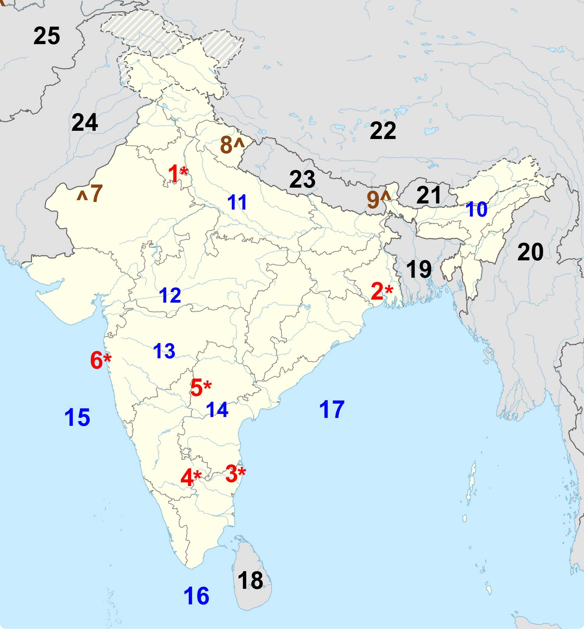
Locating India Trivia Quiz


India is one of Asia's largest and most diverse nations, known for its immense population, wide cultural variety, and dramatic physical landscapes. Can you locate some of its most important geographical features (and neighbouring regions)?

A label quiz by reedy. Estimated time: 3 mins.
  1. Home
  2. »
  3. Quizzes
  4. »
  5. Geography Trivia
  6. »
  7. Asia
  8. »
  9. India

Author
reedy
Time
3 mins
Type
Label Quiz
Quiz #
423,364
Updated
Mar 09 26
# Qns
25
Difficulty
New Game
Plays
5
Last 3 plays: bernie73 (20/25), salami_swami (25/25), MalStone (22/25).
Click on image to zoom
The Brahmaputra Arabian Sea Hyderabad Thar Desert The Krishna Bhutan Bangladesh Bengaluru Bay of Bengal Kolkata Afghanistan New Delhi Sri Lanka Nanda Devi China Kangchenjunga Chennai Laccadive Sea Pakistan Mumbai The Ganga (Ganges) The Godavari Myanmar The Narmada Nepal
* Drag / drop or click on the choices above to move them to the answer list.
View Image Attributions for This Quiz
1. Capital city  
2. Cultural capital  
3. "Detroit of India"  
4. Tech hub  
5.   
6. Bollywood  
7.   
8.   
9. Highest elevation  
10. "Red River"  
11. "Lifeline of India"  
12. "Lifeline of Madhya Pradesh and Gujarat"  
13.   
14.   
15.   
16.   
17.   
18. Formerly Ceylon  
19. Formerly East Pakistan  
20. Formerly Burma  
21. "Land of the Thunder Dragon"  
22.   
23.   
24.   
25.   

Most Recent Scores
Today : bernie73: 20/25
Today : salami_swami: 25/25
Today : MalStone: 22/25
Today : Aph1976: 23/25
Today : xchasbox: 14/25

Quiz Answer Key and Fun Facts
1. New Delhi

New Delhi serves as India's national capital and sits within the larger metropolitan region of Delhi in the northern part of the country. Designed during the early 20th century by British architects Edwin Lutyens and Herbert Baker, it was intended to symbolize the administrative heart of colonial governance when the capital shifted from Calcutta to Delhi in 1911. The city's wide avenues, formal gardens, and monumental buildings - such as the Secretariat complex and the Presidential residence - were all part of this grand urban plan.

After India achieved independence in 1947, New Delhi evolved into the center of political life for the new republic, housing the parliament, supreme court, and countless national institutions. It is home to a diverse population and blends its orderly colonial-era geometry with the lively markets, cultural districts, and academic institutions that define everyday life in the capital.

While New Delhi is known for its governmental significance, it is equally recognized for India Gate - a towering war memorial that has become one of the city's most visited public spaces and a gathering place for civic celebrations and reflection.
2. Kolkata

Kolkata is located in eastern India along the banks of the Hooghly River and was once the capital of British India during the height of colonial rule. Under the East India Company and later the British Crown, the city developed into a center of administration, culture, and education. This legacy left behind a distinctive architectural landscape, from stately government buildings to grand museums, which continue to define much of the city's character.

In the late 19th and early 20th centuries, Kolkata emerged as the heart of a major intellectual and cultural awakening often referred to as the "Bengal Renaissance," which fostered advancements in literature, philosophy, and social reform. After the capital moved to Delhi in 1911, the city reinvented itself as a hub of artistic expression, political thought, and academic life.

Kolkata is known for its vibrant festivals, particularly Durga Puja, which transforms the city every year with elaborate installations, music, and celebrations that draw millions of visitors.
3. Chennai

Chennai lies on the southeastern coast of India along the Bay of Bengal and serves as the capital of Tamil Nadu. Originally shaped by the establishment of Fort St. George in the 17th century, the city grew from a small colonial trading post into a sprawling urban center closely tied to maritime commerce and textile production. Its early development was closely linked to the English East India Company's activities, and traces of that history are still visible in the fort and surrounding neighbourhoods.

Today, Chennai stands as one of India's major cultural capitals, particularly known for its classical arts. The city is a central hub for Carnatic music, Bharatanatyam dance, and Tamil literature, drawing performers and audiences from around the world during its annual music season. Modern Chennai also plays a major role in India's automobile and technology sectors, earning it the nickname "Detroit of India."

Chennai's Marina Beach - stretching several kilometers along the coast - is one of the longest urban beaches in the world and remains a beloved public gathering place.
4. Bengaluru

Bengaluru sits on the Deccan Plateau in southern India and is known for its elevated, temperate climate (compared with many other Indian cities). Founded in the 16th century as a regional stronghold, it later came under the influence of various South Indian dynasties before becoming a key administrative center under British rule. The establishment of military cantonments and educational institutions helped shape the city's early modern character.

Beginning in the 1980s and continuing into the 21st century, Bengaluru transformed dramatically, earning international recognition as India's technology and innovation capital. The growth of software companies, research institutions, and start‑ups has attracted professionals from across India and around the world, giving the city a cosmopolitan and highly educated population. Despite this rapid expansion, Bengaluru retains a number of parks, lakes, and tree-lined neighbourhoods that contribute to its reputation as a "garden city."

One of Bengaluru's most notable spaces is Cubbon Park, a large green expanse in the city center that offers a quiet contrast to the bustling technology corridors.
5. Hyderabad

Hyderabad is located in south-central India along the banks of the Musi River and has a history shaped by nearly five centuries of rule by the Qutb Shahi dynasty and later the Nizams. These leaders oversaw the development of a wealthy and cosmopolitan capital known for its palaces, markets, and architectural landmarks that blend Persian, Indian, and Islamic styles. For many years, Hyderabad was one of the richest princely states in the subcontinent.

After joining the Indian Union in 1948, the city grew steadily as an administrative and commercial center, eventually becoming a major hub for pharmaceuticals, biotechnology, and information technology. Its modern development has taken place alongside the preservation of historic districts, creating a blend of old and new that defines the city's unique character.

The Charminar, a 16th‑century monument with four towering arches, remains the iconic symbol of Hyderabad and is located in one of the city's busiest and most colourful markets.
6. Mumbai

Mumbai lies on India's western coast along the Arabian Sea and is built on what was once a collection of islands gradually joined together through centuries of land reclamation. The city was shaped heavily by Portuguese rule in the 16th century and later by the British, who developed it into an important port and commercial center. Its natural harbour played a key role in maritime trade and contributed to the city's rapid urban growth.

In modern times, Mumbai has become India's financial powerhouse, home to major banks, stock exchanges, and corporate headquarters. It is also the center of the country's massive film industry, popularly known as Bollywood, which influences entertainment across South Asia and beyond. Despite its fast-paced commercial life, Mumbai retains a rich cultural tapestry, with diverse communities living side by side in historic districts, colonial-era neighborhoods, and modern high-rises.

One of Mumbai's most recognizable landmarks is the Gateway of India, an archway on the waterfront built in the early 20th century that remains a symbol of the city's historical and cultural identity.
7. Thar Desert

The Thar Desert stretches across the northwestern edge of India, covering much of Rajasthan and extending into parts of Gujarat, Punjab, and Haryana before continuing westward into Pakistan. It forms a natural transition zone between the fertile plains of northern India and the arid landscapes of the Indus basin. Despite its reputation for extreme dryness, the Thar is one of the world's most densely populated deserts, with small villages, seasonal fields, and grazing lands scattered throughout its dunes and rocky outcrops.

Unlike many deserts created by large rain‑shadow effects, the Thar sits in a region influenced by the Indian monsoon. The rains seldom penetrate deeply into the desert, but occasional seasonal showers help sustain hardy vegetation and support pastoral livelihoods. Over centuries, human settlements have adapted to the desert's rhythms through water‑harvesting structures, fortified towns, and traditional architectural styles designed to preserve coolness.

One of the most distinctive landscapes within the Thar is the Great Rann of Kutch along its southern reaches - a vast salt marsh that transforms dramatically between the dry season and the monsoon, creating a barren white plain that is both harsh and visually striking.
8. Nanda Devi

Nanda Devi rises within the Garhwal Himalayas of northern India and is the country's second‑highest peak (and 23rd tallest in the world). Towering at 7,817 m (25,646 ft), it stands at the heart of a natural ring of mountains known as the Nanda Devi Sanctuary, a high-altitude basin enclosed by steep ridgelines. This remote setting long kept the inner sanctuary isolated, contributing to its reputation as one of India's most inaccessible mountain environments.

Throughout the 20th century, Nanda Devi became a focal point for mountaineering attempts, though its rugged terrain and dramatic weather conditions made ascent difficult. The surrounding region was later designated a protected area to preserve its sensitive alpine ecosystems, which include rare plant species and wildlife suited to extreme elevations. Restricted access has helped maintain the sanctuary's ecological integrity, keeping it far less disturbed than many other Himalayan regions.

Among the mountain's distinctive cultural associations is its connection to local folklore: Nanda Devi is traditionally regarded as a protective goddess in the region, and numerous village festivals in Uttarakhand honor her as a guardian of the highlands.
9. Kangchenjunga

Kangchenjunga stands along India's northeastern frontier with Nepal and is the third‑highest mountain in the world. Its massive profile dominates the landscape of Sikkim, where five great peaks rise from a complex system of glaciers, ridges, and deep valleys. Although the main summit lies just across the border in Nepal, several of its subsidiary peaks and approaches fall within Indian territory, making it one of the defining landmarks of the eastern Himalayas.
For centuries, the mountain was regarded as the highest on Earth until more precise measurements in the 19th century revised global rankings. Despite its early fame, Kangchenjunga remained largely untouched by climbers due to its formidable geography and the reverence local communities hold for it. Expeditions approaching from the Indian side face strict conservation rules and cultural sensitivities.

A notable feature of Kangchenjunga's Indian landscape is the Kanchenjunga National Park, a protected region of forests, alpine meadows, and glacial terrain recognized for its ecological diversity and for its role in preserving the cultural traditions tied to the mountain.
10. The Brahmaputra

The Brahmaputra is one of India's great trans‑boundary rivers, entering the country from the eastern Himalayas after flowing for hundreds of kilometers across the Tibetan Plateau, where it is known as the Yarlung Tsangpo. Upon reaching Arunachal Pradesh, the river plunges through deep gorges before broadening into the wide valley plains of Assam. Through its Indian course of roughly 916 km (569 mi), it supports a vast system of wetlands, floodplains, and fertile islands - some of the largest river islands in the world.

Unlike many of India's major rivers, the Brahmaputra is heavily influenced by snowmelt as well as monsoon rains, making it prone to intense seasonal flooding. It eventually joins the Ganga system in Bangladesh, creating part of the world's largest delta before emptying into the Bay of Bengal.

One notable feature of the Brahmaputra within India is Majuli Island, a river island renowned for its monasteries, cultural heritage, and ongoing struggle against erosion caused by the river's shifting channels.
11. The Ganga (Ganges)

The Ganga (Ganges) originates in the high Himalayas at the confluence of glacial streams near the town of Devprayag, where the Alaknanda and Bhagirathi rivers merge to form the river's recognized headwaters. From there, it flows southeast across the Indo-Gangetic Plain for more than 2,500 km (1,553 mi), passing through some of India's most historic and densely populated regions.

The Ganga's basin is one of the world's most expansive river systems, with waters that support agriculture, cities, and millions of people across northern India. Along its journey, the river receives numerous tributaries from both the Himalayas and the plains, carrying sediments that continually renew the fertile alluvial farmland.

The city of Varanasi - situated along its banks - is among the most significant pilgrimage sites in India, drawing visitors for its ancient ghats, rituals, and cultural traditions centered on the river.
12. The Narmada

The Narmada flows westward across central India, cutting a path of about 1,312 km (815 mi) from its source in the Amarkantak hills to the Arabian Sea. Unlike the Ganga and Brahmaputra, which travel mainly eastward, the Narmada runs between the Vindhya and Satpura mountain ranges, creating a natural divide between northern and southern India.

The river's watershed includes steep valleys, basalt formations, and fertile plains, and its middle reaches are known for dramatic gorges carved through ancient rock. Several significant hydrological projects stand along its course, providing water for irrigation and electricity across multiple states.

The Marble Rocks near Jabalpur - towering cliffs of white stone along a narrow stretch of the river - are among the Narmada's most striking natural landmarks.
13. The Godavari

The Godavari is India's second-longest river, stretching around 1,465 km (910 mi) from its origin in the Western Ghats near Nashik and traveling east across the width of the peninsula. Often called the "Dakshin Ganga," or southern Ganges, it drains a vast interior region before splitting into a wide delta as it nears the Bay of Bengal.

Its basin encompasses forests, farmland, and several major reservoirs that play a crucial role in supporting agriculture in central and southeastern India. The Godavari receives numerous tributaries from varied terrain, making it a lifeline for communities and ecosystems throughout its course.

One of the river's most culturally significant points is the city of Nashik, which hosts major religious gatherings along its banks during the Kumbh Mela cycle (Hindu pilgrimage gatherings).
14. The Krishna

The Krishna River rises in the Western Ghats near Mahabaleshwar and flows about 1,400 km (870 mi) eastward until it reaches the Bay of Bengal. Its long journey crosses multiple climatic zones - from the rugged highlands of its origin to the broad plains of the Deccan Plateau - before widening into a branching delta near the coast.

The Krishna's watershed is extensive, fed by tributaries such as the Bhima and Tungabhadra, which help sustain agriculture and settlements across a large portion of southern India. Because much of the basin receives limited rainfall outside the monsoon season, the river is essential for irrigation and water storage.

A notable cultural landmark along the Krishna is the city of Vijayawada, where the river flows past a hilltop temple and has historically supported trade corridors and settlement.
15. Arabian Sea

The Arabian Sea lies off India's western coastline, stretching from the shores of Gujarat in the north down to Kerala in the south. This portion of the Indian Ocean has long served as a maritime gateway, linking the subcontinent to the Middle East, East Africa, and beyond. India's western states - particularly Maharashtra, Goa, Karnataka, and Kerala - depend heavily on this sea for trade routes, fisheries, and port activity, with Mumbai and Kochi being two of its major harbours.

Unlike the Bay of Bengal on India's eastern side, the Arabian Sea experiences notably fewer major cyclones, owing to prevailing atmospheric patterns and seasonal monsoon winds. These winds have shaped centuries of navigation, enabling ancient traders to cross between India and the Arabian Peninsula long before modern shipping routes existed.

One of the Arabian Sea's significant features along India's coast is the Gulf of Kutch, known for its extensive tidal flats and marine biodiversity, as well as for hosting some of the country's most important commercial ports and energy facilities.
16. Laccadive Sea

The Laccadive Sea lies to the southwest of mainland India, bordered by the coasts of Kerala and Tamil Nadu and framing the islands of Lakshadweep. It is one of the calmer portions of the Indian Ocean, known for its clear waters, shallow coral environments, and gentle monsoon-driven currents. The sea's name is tied to the Lakshadweep archipelago, a chain of low-lying coral atolls that rely on its waters for fishing, transport, and local livelihoods.

In contrast to the deeper basins of the Arabian Sea, the Laccadive Sea supports an extensive reef ecosystem. These reefs moderate wave energy, making the waters around Lakshadweep some of the most tranquil in the region. Seasonal monsoon patterns still influence the sea, bringing nutrient surges that support its fish populations.
17. Bay of Bengal

The Bay of Bengal lies along India's entire eastern shoreline, stretching from West Bengal southward past Odisha, Andhra Pradesh, and Tamil Nadu. This broad northeastern arm of the Indian Ocean receives waters from several major river systems - including the Ganga, Brahmaputra, Mahanadi, and Godavari - which bring heavy sediment loads that continually reshape the bay's coastal plains and deltas.

The bay is known for its warm surface temperatures and strong monsoon influences, conditions that contribute both to its rich marine productivity and to its reputation as one of the more cyclone-prone regions of the Indian Ocean. These storms have historically shaped settlement patterns, agricultural practices, and coastal infrastructure along India's eastern seaboard.

One of the bay's defining geographic features is the Sundarbans delta at its northern end, a vast mangrove forest shared between India and Bangladesh. This region is home to diverse wildlife, including the Bengal tiger, and plays a vital role in protecting inland communities from storm surges and tidal shifts.
18. Sri Lanka

Sri Lanka lies to the south of India, separated by the narrow Palk Strait and the Gulf of Mannar. Although the two countries do not share a direct land border, their closest points approach just over 30 km (19 mi), with the chain of limestone shoals known as Adam's Bridge marking the shallow divide between Tamil Nadu and Sri Lanka's northwest. For centuries this watery corridor served as a major route for trade, migration, and cultural exchange between the two regions.

Sri Lanka was under Portuguese influence beginning in the early 16th century, followed by Dutch control in the mid‑1600s. In 1815, the British formalized rule over the entire island, designating it the Crown Colony of Ceylon. After independence in 1948, the country remained within the Commonwealth, later adopting the name Sri Lanka in 1972.

Sri Lanka is renowned for its remarkable biodiversity, with several ecosystems - rainforests, highlands, and coastal plains - compressed into a relatively small landmass.
19. Bangladesh

Bangladesh borders India on nearly all sides except for a small southeastern frontier with Myanmar. The India-Bangladesh land boundary stretches roughly 4,100 km (2,550 mi), weaving through rivers, plains, and enclaves that once created one of the most complex borders in the world. In 2015, a landmark bilateral agreement simplified dozens of land fragments, easing administration and local travel.

The territory was part of British India until 1947, when it became East Pakistan during the partition of the subcontinent. Its geographic isolation from West Pakistan, along with linguistic and cultural differences, fueled growing autonomy movements, ultimately leading to the Bangladesh Liberation War. The country achieved full independence in 1971.

Bangladesh's fertile delta, formed by the Ganges, Brahmaputra, and Meghna rivers, makes it one of the most densely populated and agriculturally productive regions on Earth.
20. Myanmar

Myanmar lies to India's east, with a border stretching about 1,643 km (1,020 mi). The frontier runs through remote mountain terrain, connecting India's northeastern states - Arunachal Pradesh, Nagaland, Manipur, and Mizoram - with Myanmar's western regions. The area is historically known for cross-border ethnic communities whose cultural ties predate modern political boundaries.

Myanmar came under British rule in stages during the 19th century and was fully annexed into British India by 1886. It remained part of the Indian Empire until 1937, when it was separated and governed as its own colony. Independence came in 1948 after World War II.

Myanmar is home to the ancient city of Bagan, where thousands of temples and pagodas create one of Southeast Asia's most iconic archaeological landscapes.
21. Bhutan

Bhutan sits along India's northeastern frontier, sharing a 699 km (434 mi) border. The boundary follows the rugged Himalayan crest, creating natural isolation for much of Bhutan's territory. India surrounds Bhutan on three sides, with China forming the northern frontier; the India-Bhutan border includes several strategically important passes historically used for trade caravans.

The Kingdom of Bhutan was never colonized, maintaining its independence even as surrounding regions fell under British rule. In the early 20th century, a formal treaty established British India's role in managing Bhutan's external affairs, a responsibility India assumed after its own independence. The country transitioned from absolute monarchy to constitutional monarchy in 2008.

Bhutan is noted for its policy of measuring national development through "Gross National Happiness," emphasizing cultural preservation and environmental stewardship.
22. China

China borders India to the north and northeast along a high‑altitude frontier measuring roughly 3,440 km (2,140 mi). Much of the boundary traverses the Himalayas, Karakoram, and Tibetan Plateau - some of the world's most formidable terrain. Various segments of the frontier remain disputed, leading to occasional tensions and careful diplomatic management.

Historically, the border region was shaped by the relationship between British India and the Tibetan administration prior to the mid‑20th century. After the establishment of the People's Republic of China in 1949 and the incorporation of Tibet in the following years, China's direct control of the Himalayan boundary introduced new geopolitical dynamics.

The Tibetan Plateau, near much of the India-China frontier, is often called the "Roof of the World" due to its extraordinary elevation and expansive highland landscapes.
23. Nepal

Nepal lies along India's northern arc, with a border extending about 1,770 km (1,100 mi). The frontier spans plains, hills, and mountains, with the open border arrangement allowing citizens of both countries to travel and work with relative ease. Several rivers, including the Mahakali and Gandak, help define portions of the divide.

Nepal remained an independent Himalayan kingdom while much of the surrounding region fell under British colonial rule. Following the Anglo-Nepalese War in the early 19th century, the Treaty of Sugauli set the modern territorial limits, though some segments remain areas of differing interpretation today. Nepal abolished its monarchy in 2008, becoming a federal democratic republic.

Nepal contains eight of the world's ten highest peaks, including Mount Everest, the tallest mountain on Earth.
24. Pakistan

Pakistan borders India to the west, with a land boundary of roughly 3,300 km (2,050 mi) stretching from Kashmir down to the Arabian Sea. The border includes varied terrain - desert expanses in the south and contested mountain regions in the north. The Wagah border crossing near Amritsar is famous for its daily ceremonial display conducted by both nations' border forces.

The boundary was created during the 1947 partition of British India, a pivotal moment that reshaped the subcontinent's demographics and politics. Pakistan became a republic in 1956, later splitting into two sovereign nations when East Pakistan became Bangladesh in 1971.

Pakistan is home to the Indus River, one of the world's oldest centers of civilization and the lifeline for much of the country's agriculture.
25. Afghanistan

Afghanistan touches India indirectly through a narrow 106 km (66 mi) stretch known as the Wakhan Corridor, though the modern de facto boundary has been affected by territorial control changes in Kashmir. Historically, the slender corridor connected Central Asia with the northern edges of the Indian subcontinent, serving as a vital route for Silk Road traders and early Buddhist travelers.

Afghanistan has a long history of shifting regional powers, from ancient empires to the period of the "Great Game" in the 19th century, when British India and Tsarist Russia vied for influence. The modern Afghan state emerged in the 20th century through gradual consolidation of tribal regions and international treaties defining its borders.

Afghanistan's dramatic mountain ranges, particularly the Hindu Kush, have shaped its isolation, climate, and patterns of settlement for thousands of years.
Source: Author reedy

This quiz was reviewed by FunTrivia editor agony before going online.
Any errors found in FunTrivia content are routinely corrected through our feedback system.
Related Quizzes
1. Cities of India Easier
2. Renamed in India Average
3. Rivers of India Average
4. Namaste India Easier
5. India - Things National Average
6. India for Foreigners Easier
7. Indian States Average
8. India for Tourists Average
9. Indian States Capitals Easier
10. India Geography Average
11. Tribute to India Tough
12. Simpleton Learns Indian Geography Average

3/9/2026, Copyright 2026 FunTrivia, Inc. - Report an Error / Contact Us