FREE! Click here to Join FunTrivia. Thousands of games, quizzes, and lots more!
Quiz about A Quick Tour of Argentinas Provinces  Part 2

A Quick Tour of Argentina's Provinces - Part 2 Quiz


Welcome to my second installment of Argentina's provinces. This will cover the nine provinces created in the 20th century, with a little bonus at the end. Enjoy the trip!

A multiple-choice quiz by Gispepfu. Estimated time: 4 mins.
  1. Home
  2. »
  3. Quizzes
  4. »
  5. Geography Trivia
  6. »
  7. South America
  8. »
  9. Argentina

Author
Gispepfu
Time
4 mins
Type
Multiple Choice
Quiz #
414,048
Updated
Oct 31 23
# Qns
10
Difficulty
Average
Avg Score
8 / 10
Plays
45
Awards
Top 10% Quiz
- -
Question 1 of 10
1. The year 1951 saw the provincialization of two former National Territories. One of them is La Pampa, located in the central southern portion of the country.
All of its territorial limits were defined geometrically, except for one.

Which river marks the southern boundary of La Pampa? People from the US might be reminded of a similar one.
Hint


Question 2 of 10
2. The second former National Territory that was granted provincial status in 1951 is Chaco, located at the northeast of the country. At its creation, though, it went by a different name, honoring a notable politician who was President of the country at that time.

After which of these personalities was the province originally named?
Hint


Question 3 of 10
3. The small province of Misiones was created in 1953, and it is located at the northeastern tip of the country. Its main touristic attraction, shared with Brazil, is one of the most massive waterfalls in the world.

Drawing an estimated 1.5 million tourists yearly, which one of these can be visited at Misiones?
Hint


Question 4 of 10
4. Our last stop in the Northeast of Argentina is this province that shares its name with the former denomination of the main island of Taiwan. What is it called?


Question 5 of 10
5. It's time to go all the way south, and enter the Patagonia region. The northernmost province of the area has a palindromic name, taken from a nearby river. What is it called? Hint


Question 6 of 10
6. Heading southwards, we enter Rio Negro province. On the far west of the province you can find a major touristic city on the shores of the Nahuel Huapi lake.

Known for its beautiful mountainous landscapes and delicious chocolate, what city are we referring to?
Hint


Question 7 of 10
7. Further to the south is Chubut, the third largest province of Argentina. This province is the only one in which a European language (other than Spanish) is spoken in some regions, since Chubut is home to a small colony of people from a distant place.

People from which country, known for daffodils and leeks, have settled in Chubut?
Hint


Question 8 of 10
8. The last continental province of Argentina is Santa Cruz, being the second largest in extension, behind Buenos Aires. At its extreme west, you can find Argentina's largest national park, which is home to what chilly type of natural feature?


Question 9 of 10
9. At the remote southern tip we find Tierra del Fuego, which was granted provincial status in 1990. Its capital city claims the title of being the southernmost capital city in the world.

What is it called?
Hint


Question 10 of 10
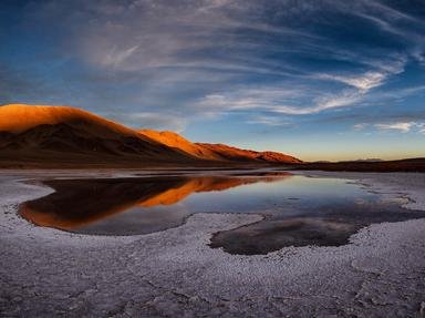
10. During the first half of the 20th century, Argentina had an extra political unit. Located within the Atacama Plateau, in the northwest of the territory, it was named after the mountain chain that forms the boundary between Argentina and Chile.

What was the name of this "province"?

Answer: (One or two words - clue in the question text.)

(Optional) Create a Free FunTrivia ID to save the points you are about to earn:

arrow Select a User ID:
arrow Choose a Password:
arrow Your Email:


Most Recent Scores
Mar 09 2024 : Guest 93: 4/10
Mar 01 2024 : GoodwinPD: 10/10

Quiz Answer Key and Fun Facts
1. The year 1951 saw the provincialization of two former National Territories. One of them is La Pampa, located in the central southern portion of the country. All of its territorial limits were defined geometrically, except for one. Which river marks the southern boundary of La Pampa? People from the US might be reminded of a similar one.

Answer: Rio Colorado

Argentina's Colorado River is conventionally considered as the northern limit of the Patagonia region. It originates in southern Mendoza, at the Andes mountains, and flows to the southeast until it empties into the Argentine Sea, slightly to the north of the Bahia Union (Union Bay), at the south of Buenos Aires Province.

As for the province of La Pampa, while not particularly remarkable concerning tourism, economy or population, it does have a rich biodiversity, including pumas, foxes, hares and the native "ñandu" (also known as rhea or South American ostrich).
2. The second former National Territory that was granted provincial status in 1951 is Chaco, located at the northeast of the country. At its creation, though, it went by a different name, honoring a notable politician who was President of the country at that time. After which of these personalities was the province originally named?

Answer: Juan Domingo Peron

The current location of Chaco province was part of a bigger area denominated "Territorio Nacional del Gran Chaco" (Greater Chaco National Territory), established in 1872. In 1884, it underwent an administrative division, after which the current limits of the province were definitively settled.

Both provinces established in 1951, Chaco and La Pampa, were originally named after Juan Peron (who was still serving a second term in office) and his then wife Eva Peron (La Pampa adopted her name in January 1952). After Peron was overthrown in 1955, both provinces reverted back to their current names.

In 2010, Chaco declared three indigenous languages as official (Kom, Moqoit, and Wichi). It is the second province to adopt more than one official language, after Corrientes.
3. The small province of Misiones was created in 1953, and it is located at the northeastern tip of the country. Its main touristic attraction, shared with Brazil, is one of the most massive waterfalls in the world. Drawing an estimated 1.5 million tourists yearly, which one of these can be visited at Misiones?

Answer: Iguazu Falls

Iguazu Falls currently have the sixth-greatest average annual flow of water, with an average rate of 1,746 m3/s. They are actually a two-step waterfall formed by layers of basalt. Most of the water falls down a massive gorge known as Garganta del Diablo (Devil's Throat).

The waterfall can be accessed through the cities of Puerto Iguazu in Argentina, and Foz do Iguacu in Brazil, with both being part of a National Park in each country. There is also an access through Ciudad del Este in Paraguay, although no National Park has been established there; the point where the river marks the borders of the three countries (known as "La Triple Frontera"; "The Triple Frontier") is also a popular tourist destination in all three of them.

Misiones' name derives from the fact that the region was the site of missionary activity by the Society of Jesus, dating back to the 17th century. The ruins of some of those mission sites (with the San Ignacio ruins being the most notable) also attract a considerable touristic flow on a yearly basis.
4. Our last stop in the Northeast of Argentina is this province that shares its name with the former denomination of the main island of Taiwan. What is it called?

Answer: Formosa

Formosa province's name has roughly the same origin as the old name of Taiwan: it stems from the archaic Spanish word "fermosa", meaning "beautiful". The explorers, upon seeing the turn of the Paraguay River on the area where the provincial capital is located, dubbed it "Vuelta Fermosa" - "Beautiful Turn". Strangely enough, even though there is no direct connection with the Asian country, part of Formosa province is the antipode to northern Taiwan.

Formosa's economy has been consistently ranked among the poorest in the country. The harsh geographic and climatic conditions, with very high average temperatures and large jungle-like areas (including the western section of the province near the limit with Salta, known as "Impenetrable"), makes it difficult to undertake most economic activities. The province relies very heavily on primary production, and it barely has any industrial activity, save for the ones related to the primary productions. It also has very few touristic attractions, compared to other nearby provinces. It is, however, home to a very rich diversity of fauna, making it very attractive for wildlife enthusiasts.

The province was part of the National Territory of Gran Chaco, with its current territory being delimitated after the 1884 division. It acquired provincial status in 1955, along with most of the Patagonia provinces.
5. It's time to go all the way south, and enter the Patagonia region. The northernmost province of the area has a palindromic name, taken from a nearby river. What is it called?

Answer: Neuquen

Neuquen is located mostly within the Andes chain, below Mendoza province. Its location makes for mostly cold weather, except in the eastern part, located away from the mountain range, and is overall dry, as the Andes block off the moist air coming from the Pacific Ocean. Its two main rivers, Limay and Neuquen, meet at the eastern limits of the province, and the capital city is located at this intersection. It was originally named Confluencia, but was later changed also to Neuquen.

One of the most prosperous provinces, Neuquen owes most of its wealth to the mining and extractive industries, with very important gas and oil reserves, some of which are in the initial phase of development.

The southern part of the province features important touristic spots, such as the towns of Villa La Angostura and San Martin De Los Andes, as well as the Lanin and Arrayanes National Parks, home to some arboreal species not found anywhere else in the country. It also shares the Nahuel Huapi National Park with neighboring province Rio Negro.
6. Heading southwards, we enter Rio Negro province. On the far west of the province you can find a major touristic city on the shores of the Nahuel Huapi lake. Known for its beautiful mountainous landscapes and delicious chocolate, what city are we referring to?

Answer: Bariloche

San Carlos de Bariloche, normally shortened to just Bariloche, is the largest city in Rio Negro, and the most famous one. It attracts a massive number of tourists from all over the world, especially in wintery months, thanks to its many ski resorts and mountaineering facilities. Aside from this, Bariloche also offers many trekking paths, and for those more fond of the urban life, the city itself has a wide variety of cafes, pubs and restaurants, and its beautiful alpine architecture is also worthy of a visit. Maybe not surprisingly, Bariloche is twinned with the cities of Aspen and St. Moritz (among others).

The remaining options are all cities located within Rio Negro, with Viedma being the provincial capital, located at the opposite end of the province, near the border with Buenos Aires province and the Atlantic Ocean.
7. Further to the south is Chubut, the third largest province of Argentina. This province is the only one in which a European language (other than Spanish) is spoken in some regions, since Chubut is home to a small colony of people from a distant place. People from which country, known for daffodils and leeks, have settled in Chubut?

Answer: Wales

Welsh people first arrived to Chubut in 1865 and settled mainly along the coast of the lower Chubut valley, to the east of the province, which remains until this day under the name of "Y Wladfa" ("The Colony"). Although it's not official, a local dialect of Welsh (referred to as Patagonian Welsh) is spoken by around 5,000 people in the area, and most of their culture is present throughout the province, including an annual celebration of the Eisteddfod festivity.

The province of Chubut, despite its large size, is one of the least populated of Argentina, mainly due to the cold, semi-arid and windy climate. Just like the rest of the Patagonian provinces, Chubut's economy relies heavily on oil and mineral extraction. Primary activities are not too prominent, with fishing and sheep-herding being the most important.

A major attraction of Chubut is the sighting of whales at Peninsula Valdez, particularly the southern right whales. They usually arrive to the zone around October or November to mate and give birth.
8. The last continental province of Argentina is Santa Cruz, being the second largest in extension, behind Buenos Aires. At its extreme west, you can find Argentina's largest national park, which is home to what chilly type of natural feature?

Answer: Glaciers

Los Glaciares National Park was established in 1937, and declared a UNESCO World Heritage Site in 1981. As its name implies, it contains a massive ice cap, being the largest outside Antarctica, Greenland and Iceland, that feeds over 40 glaciers over two lakes: Argentino and Viedma. The most famous is the Perito Moreno Glacier. The park is also notable for an area of Magellanic subpolar forests that showcase unique species within the Patagonian Biosteppe flora and fauna.

As it was the case with Chubut, Santa Cruz has a vast territory, but very low population, actually being the lowest ranked province in this matter. All of the Patagonian provinces were granted such status between 1955 and 1957.
9. At the remote southern tip we find Tierra del Fuego, which was granted provincial status in 1990. Its capital city claims the title of being the southernmost capital city in the world. What is it called?

Answer: Ushuaia

The official name of Tierra del Fuego Province is "Tierra del Fuego, Antártida e Islas del Atlántico Sur" ("Tierra del Fuego, Antarctica and South Atlantic Islands"), as the territorial extent includes nominal claims over Falkland, South Georgias and South Sandwich Islands, currently under British administrative control, and over a portion of Antarctica. However, the effective extent of the province is Tierra del Fuego itself, which is actually the eastern part of a larger island of the same name, as well as Isla de los Estados and a few other adjacent islands.

Located below the 54th south parallel, Ushuaia, the provincial capital, is sometimes referred to as the southernmost city in the world altogether, but that claim is incorrect as there are a few other towns located slightly below it. It is one of the five internationally recognized Antarctic gateway cities (meaning that they are the starting point for any personnel or cargo transportation bound for Antarctica), together with Punta Arenas in Chile, Christchurch in New Zealand, Hobart in Australia, and Cape Town in South Africa.
10. During the first half of the 20th century, Argentina had an extra political unit. Located within the Atacama Plateau, in the northwest of the territory, it was named after the mountain chain that forms the boundary between Argentina and Chile. What was the name of this "province"?

Answer: Andes

Los Andes National Territory was created in 1900 in an arid and mountainous section that was won after a territorial dispute with Chile. The zone was largely unknown to the central government, as its remoteness and harsh conditions made it difficult to explore the area.

Its first capital city was a small village, Novarro, but it was eventually abandoned since it was inaccessible during snow storms. The capital was relocated to San Antonio de los Cobres, currently in Salta Province.

Although the zone had (and still has) an enormous economic potential derived from mineral reserves, it didn't receive much attention or assistance from the central government, which was giving priority to the agricultural activity in the Pampas region. This, coupled with the difficult climatic conditions and the low population, led to the territory being dissolved in 1943.

The lands that integrated the Andes Territory were redistributed to the provinces of Jujuy, Salta and Catamarca. Ironically, in the last few years, starting from the 2010s decade, the extraction of lithium and other minerals have brought an economic boom to that region.
Source: Author Gispepfu

This quiz was reviewed by FunTrivia editor agony before going online.
Any errors found in FunTrivia content are routinely corrected through our feedback system.
4/28/2024, Copyright 2024 FunTrivia, Inc. - Report an Error / Contact Us