FREE! Click here to Join FunTrivia. Thousands of games, quizzes, and lots more!
Quiz about Wasatch You Know

Wasatch You Know? Trivia Quiz

A Sampling of Utah Geography

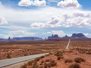
Time to journey through the Beehive State, folks... red sand, salt flats, surging rivers, winding canyons, man-made lakes, nature-made hoodoos. And of course, no quiz about Utah would be complete without a mountain or two. Good luck!

A photo quiz by JJHorner. Estimated time: 2 mins.
  1. Home
  2. »
  3. Quizzes
  4. »
  5. Geography Trivia
  6. »
  7. States U-W
  8. »
  9. Utah

Author
JJHorner
Time
2 mins
Type
Photo Quiz
Quiz #
421,278
Updated
Oct 03 25
# Qns
10
Difficulty
Average
Avg Score
8 / 10
Plays
65
Last 3 plays: etymonlego (7/10), vvicjeff (7/10), Guest 71 (5/10).
-
Question 1 of 10
1. What is the capital and largest city in Utah? Hint


Question 2 of 10
2. What famous red rock national park shown here is located near the town of Moab? Hint


Question 3 of 10
3. Which lake in central Utah was created by the Glen Canyon Dam? Hint


Question 4 of 10
4. What is the name of the vast region of mesas and canyons located in southeastern Utah? Hint


Question 5 of 10
5. Which natural wonder in southern Utah is known for its amphitheater of hoodoos? Hint


Question 6 of 10
6. What is the name of Utah's highest peak? Hint


Question 7 of 10
7. Which desert covers much of northwestern Utah, including the Bonneville Salt Flats? Hint


Question 8 of 10
8. Which of the following major rivers flows through Canyonlands National Park? Hint


Question 9 of 10
9. Utah shares its famous "Four Corners" point with which three other states? Hint


Question 10 of 10
10. Which national park in Utah is famous for its towering sandstone cliffs and the Virgin River? Hint


(Optional) Create a Free FunTrivia ID to save the points you are about to earn:

arrow Select a User ID:
arrow Choose a Password:
arrow Your Email:


View Image Attributions for This Quiz

Most Recent Scores
Today : etymonlego: 7/10
Today : vvicjeff: 7/10
Today : Guest 71: 5/10
Today : Guest 166: 5/10
Today : toonces21: 9/10
Today : Guest 76: 6/10
Today : Guest 72: 9/10
Today : Guest 73: 8/10
Today : amarie94903: 8/10

Quiz Answer Key and Fun Facts
1. What is the capital and largest city in Utah?

Answer: Salt Lake City

Salt Lake City is both the capital and the largest city of Utah, tucked 'twixt the Wasatch Mountains and the Great Salt Lake. It was founded in 1847 by Mormon pioneers led by Brigham Young, and the city became the center of The Church of Jesus Christ of Latter-Day Saints, which still heavily influences its culture today, although not without some grumblings.

The city is known for its gorgeous natural backdrop. If you don't dawdle, you can ski world-class slopes in the morning and be hiking red rock trails by the afternoon. It also was host to the 2002 Winter Olympics, which didn't hurt its reputation as an outdoor adventure hub. And yep... the famously buoyant Great Salt Lake itself remains one of the area's quirkier tourist attractions.
2. What famous red rock national park shown here is located near the town of Moab?

Answer: Arches National Park

Arches National Park outside Moab is the home of over 2,000 natural stone arches carved by time, wind, and the occasional flash flood, and good luck finding them all. The big attraction is the famous Delicate Arch which is all over postcards, license plates, and social media feeds. If you've seen a single picture of Utah, odds are pretty good it depicted this arch posing against a sunset.

The park is like a natural sculpture garden featuring fascinating works of erosion. Tall spires, gravity-defying balanced rock formations, and improbably thin stone bridges surround you, if you're willing to do the walking in the summer heat. It is truly an otherworldly experience, although at the risk of taking the fun out of it, I'd rather look at a nice picture of the arches while happily seated on my couch. (I've never WALKED so much in my life, but I did make friends with a lizard.)

Your gateway there is the town of Moab, which is also a handy setting out spot for Canyonlands. It's a cute little town with the requisite tourist traps and hotels. I've still got the knick-knacks on my mantle.
3. Which lake in central Utah was created by the Glen Canyon Dam?

Answer: Lake Powell

Lake Powell was formed in the 1960s when the Glen Canyon Dam was completed on the Colorado River, flooding Glen Canyon and creating one of the largest man-made reservoirs in the United States. It stretches across the Utah-Arizona border and is now a playground for boaters and campers.

The lake's sheer red rock walls and serpentine side canyons make it one of the coolest water destinations in the country. Its creation certainly remains a bit controversial, having permanently inundated hundreds of miles of canyons and archaeological sites. However, it also supplies water and hydroelectric power to millions across the Southwest.
4. What is the name of the vast region of mesas and canyons located in southeastern Utah?

Answer: Colorado Plateau

The Colorado Plateau is a huge geological region covering parts of Utah, Arizona, New Mexico, and Colorado. Southeastern Utah, with its mesas, canyons, and red rock formations, is a major part of this plateau. The area is home to several beloved national parks, including Canyonlands, Arches, and Capitol Reef, where erosion, rivers, and lots of time have carved landscapes that look like something from a science-fiction book.

The plateau is a geologist's dream, featuring layered sedimentary rock that tells the story of hundreds of millions of years of Earth's history. Full of deep canyons and elevated mesas, it's a region where nature shows off its muscles... and patience. The plateau isn't just a pretty face, though. It plays a major role in the Southwest's ecosystems, water systems, and even human history, with countless archaeological sites tucked in among the cliffs.
5. Which natural wonder in southern Utah is known for its amphitheater of hoodoos?

Answer: Bryce Canyon

Bryce Canyon National Park is famous worldwide for its shocking amphitheaters filled with hoodoos. I promise you, I didn't make that up. It's the name for those tall, thin spires of rock that look like nature's crude attempt at sculpting chess pieces in the desert. Despite the name, Bryce isn't technically a canyon at all. It's actually a series of giant natural amphitheaters carved into the edge of the Paunsaugunt Plateau. Geologists will eagerly point that out to you if you let them, but sentences starting with "well, actually..." generally don't win hearts and minds.

The hoodoos are formed by frost-wedging and erosion, which sounds pretty boring, but watching the rocks glow pink, orange, and gold during the sunset is anything but. It's a place where anyone with a camera suddenly becomes a professional photographer, snapping 147 shots that all look suspiciously similar.

Bryce Canyon sits at a stately altitude of over 8,000 feet (2.4 kilometers) above sea level, so it provides cooler temperatures than some other Utah parks, plus it boasts a night sky that's clear enough to spot aliens out on a late-night joyride.
6. What is the name of Utah's highest peak?

Answer: Kings Peak

Kings Peak reigns supreme as Utah's tallest mountain, standing at 13,528 feet (4,123 meters) in the Uinta Mountains of northeastern Utah. The peak is part of a rugged range that runs east-west, a bit of an oddball on a continent where most mountain ranges prefer north-south. Methinks the Uintas are looking for attention.

Reaching Kings Peak is not for the faint of heart, which is why I've never tried. The shortest route is about 26 miles (42 kilometers) round trip, making it definitely more of a backpacking adventure than a light stroll. The final push to the summit involves some scrambling over boulders, which is mountaineering-speak for "climb carefully, and try not to look down."

Despite the effort, the reward is worth it (again, I'm told): wide mountain views, clear air, and the satisfaction that comes from conquering the top of Utah. You can't be in the official secret society of super serious hikers of Utah without tackling this one.
7. Which desert covers much of northwestern Utah, including the Bonneville Salt Flats?

Answer: Great Salt Lake Desert

The Great Salt Lake Desert sprawls like a sleeping cat across western Utah, a vast expanse of white salt crust and a creepy silence that will give you pause. It's the remnant of ancient Lake Bonneville, a prehistoric inland sea that once covered much of the region. When the lake dried up, it left behind the Bonneville Salt Flats, which today serve as a raceway for cars trying to break land speed records... and occasionally tourists in rental cars trying to look cool in their vacation photos.

It's not just salt and emptiness, though. It's also a fragile ecosystem with hardy plants and even wildlife adapted to its extremes. Still, the main vibe is one of stark, almost alien beauty. Standing out there feels a bit like walking on another planet, if the other planet had the occasional RV parked nearby.
8. Which of the following major rivers flows through Canyonlands National Park?

Answer: The Colorado River

The Colorado River is the main sculptor of Canyonlands National Park, carving up the deep canyons and wild twists and turns into the red rock over millions of years. Along with its main tributary and best buddy, the Green River, it divides the park into three districts: Island in the Sky, The Needles, and The Maze. Each section offers a different kind of scenery, but all owe their existence to the endless work of moving water.

Visitors who are feeling particularly adventurous - once again excluding me - can raft sections of the river within the park, from beginner floats to raging whitewater that will definitely put your gear's "waterproof" claims to the test. If you'd rather keep your feet (and everything else) dry, the river still gives you magnificent views like the confluence overlook, where the Green and Colorado rivers meet in a swirl of delightfully colorful sediment.

The Colorado River is the water that keeps humans coming to the Beehive state, essential for drinking water and the absurd amount of irrigation required to keep golf courses green in the desert. Inside Canyonlands, however, you can forget all that and simply enjoy the way it snakes through the desert like a proud builder admiring its work.
9. Utah shares its famous "Four Corners" point with which three other states?

Answer: Colorado, New Mexico, and Arizona

The Four Corners is the only place in the United States where four states meet at a single point. Utah rubs shoulders with Colorado to the northeast, New Mexico to the southeast, and Arizona to the south. There's even a monument marking the exact spot, where you can perform the classic tourist pose of placing one limb in each state if you're into yoga.

This geographic oddity came about through 19th-century surveying and some weirdly straight boundary lines. Of course, the lines are not quite as perfect as the maps suggest, thanks to early errors by surveyors, but the monument stands where the states officially agreed the borders are. In other words, close enough to stick a monument there.

The Four Corners Monument is managed by the Navajo Nation, and beyond the singular joy of state-hopping in a single step, the surrounding area offers Native American culture, history, and some underrated desert scenery.
10. Which national park in Utah is famous for its towering sandstone cliffs and the Virgin River?

Answer: Zion National Park

Zion National Park is Utah's crown jewel of sandstone scenery, with towering cliffs that rise up to 2,000 feet (609m) and the Virgin River slicing proudly through the canyon. The park is famous for iconic hikes like Angels Landing, a tough climb that comes with chains bolted into the rock, and The Narrows, where the "trail" is just the Virgin River itself... you wade between cliffs so close they almost touch. Zion's cliffs, rivers, and secretive hanging gardens have all been shaped by water and time, making it a rare and beautiful oasis in the harsh Utah deserts.
Source: Author JJHorner

This quiz was reviewed by FunTrivia editor agony before going online.
Any errors found in FunTrivia content are routinely corrected through our feedback system.
10/3/2025, Copyright 2025 FunTrivia, Inc. - Report an Error / Contact Us