FREE! Click here to Join FunTrivia. Thousands of games, quizzes, and lots more!
Quiz about Clouds
Quiz about Clouds

Clouds Trivia Quiz


I used to be in the Weather Bureau and retain my interest in clouds (they match my thinking!).

A multiple-choice quiz by brian59. Estimated time: 5 mins.
  1. Home
  2. »
  3. Quizzes
  4. »
  5. Science Trivia
  6. »
  7. Environment
  8. »
  9. Weather

Author
brian59
Time
5 mins
Type
Multiple Choice
Quiz #
108,867
Updated
Dec 03 21
# Qns
15
Difficulty
Tough
Avg Score
9 / 15
Plays
2282
- -
Question 1 of 15
1. Clouds come in assorted types. One classification is cloud base height: low, middle-level, high. Which of these is a middle-level cloud? Hint


Question 2 of 15
2. Another classification is stratification - whether a cloud is flat, or convective uplift makes it "bumpy". Which of these is cumuliform? Hint


Question 3 of 15
3. Many clouds are difficult to categorise. A common cloud formation has equal characteristics of cumuliform and stratiform. Which is it? Hint


Question 4 of 15
4. Clouds can also be classified by the causation of their formation. This can be by orographic uplift, by frontal uplift, or by convection, and of course by a combination of causes. Which cloud is formed solely by orography (terrain)? Hint


Question 5 of 15
5. Why do most low-level clouds have flat bases? Hint


Question 6 of 15
6. In a stable airmass (little convection) with strong winds, it is possible to see which interesting cloud? Hint


Question 7 of 15
7. Dark clouds are caused by the evaporation of dirty water.


Question 8 of 15
8. You can get very wet when the main cloud is nimbostratus.


Question 9 of 15
9. High atmospheric pressure is usually associated with dry weather.


Question 10 of 15
10. The World Meteorological Organization defines standard code listings for all clouds. For example, cumulus is Cu and altocumulus is Ac. What is the code for cumulonimbus? Hint


Question 11 of 15
11. To generalise, the wettest regions of the world are the tropics, the driest, the poles. What is NOT a reason for this? Hint


Question 12 of 15
12. The driest regions always have little cloudiness.


Question 13 of 15
13. The largest cloud masses are those associated with low-pressure regions. Why is this? Hint


Question 14 of 15
14. What is a cold front? Hint


Question 15 of 15
15. What cloud is associated with tornado formation? Hint


(Optional) Create a Free FunTrivia ID to save the points you are about to earn:

arrow Select a User ID:
arrow Choose a Password:
arrow Your Email:


Most Recent Scores
Aug 30 2024 : Guest 104: 10/15
Jul 16 2024 : Linda_Arizona: 9/15

Score Distribution

quiz
Quiz Answer Key and Fun Facts
1. Clouds come in assorted types. One classification is cloud base height: low, middle-level, high. Which of these is a middle-level cloud?

Answer: Altostratus

Altostratus height varies from 12,000 feet to 18,000 feet. It's difficult to estimate the height without aircraft reports or balloon humidity traces, but we used to "have a go". Cirrostratus is high level, usually well over 25,000 feet. Nimbostratus is very thick altostratus, with lots of rain, and cloud base often below 5,000 feet.
2. Another classification is stratification - whether a cloud is flat, or convective uplift makes it "bumpy". Which of these is cumuliform?

Answer: Cumulonimbus

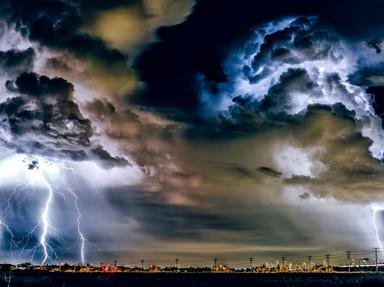
Cumulonimbus is, without doubt, the most spectacular cloud formation, with associated lightning and thunder, and a huge anvil-like top into the stratosphere at 60,000 feet or higher. It may contain a million tons of water. Obviously also the most dangerous, with lightning killing thousands across the world yearly.
3. Many clouds are difficult to categorise. A common cloud formation has equal characteristics of cumuliform and stratiform. Which is it?

Answer: Stratocumulus

I always thought stratocumulus was the most boring cloud. Very common especially in the morning, dissipating during the day as heating increases convection.
4. Clouds can also be classified by the causation of their formation. This can be by orographic uplift, by frontal uplift, or by convection, and of course by a combination of causes. Which cloud is formed solely by orography (terrain)?

Answer: Hill fog

I have to admit my favourite cloud is fair-weather cumulus. What's the use of a warm summer afternoon without cauliflower puffs of cloud to make the sky interesting? Hill fog is simply stratus cloud "on the deck" because of lifting and cooling of wind blowing up a hill-slope.
5. Why do most low-level clouds have flat bases?

Answer: All of these

Let's get this straight - you can't see water vapour. As air cools uniformly with increasing height (the adiabatic lapse rate, for the cognoscenti), it can contain less water vapour. When it can't hold any more, water condenses in tiny droplets, and lo and behold, we have a cloud!
6. In a stable airmass (little convection) with strong winds, it is possible to see which interesting cloud?

Answer: Lenticular cloud

Lenticular clouds are important to aviators, as they reveal the existence of "mountain waves" downwind of hills, good for gliders but often associated with severe turbulence and dangerous downdrafts. Scarf and cap clouds are associated with convective towering cumulus and cumulonimbus. Noctilucent clouds are weird, extremely high clouds, seen in the late evening, and may be comet dust.
7. Dark clouds are caused by the evaporation of dirty water.

Answer: False

Evaporation is the transfer to the gaseous state of water. Any particles of dirt and dust are left behind. True, cloud droplets develop around microscopic "condensation nuclei", but cloud colors are related to sunlight, shadowing, cloud thickness, droplet size etc.
8. You can get very wet when the main cloud is nimbostratus.

Answer: True

Stratus is usually very shallow, a few hundred feet, and can produce slight drizzle, but is about as dampening as fog. Nimbostratus, on the other hand, is very thick and produces continuous rain. And, there is a cloud with the unwieldy name of "fractostratus of bad weather", ragged stratus within rain from higher clouds.
9. High atmospheric pressure is usually associated with dry weather.

Answer: True

Unfortunately, as with most generalisations, there are qualifications (otherwise meteorologists would be out of a job!). High pressure is associated with descending, warming air. I've already mentioned our old friend adiabatic lapse rate. It works in reverse, too, which forms inversion layers of increasing temperature with height. These are very stable and stop clouds growing.
10. The World Meteorological Organization defines standard code listings for all clouds. For example, cumulus is Cu and altocumulus is Ac. What is the code for cumulonimbus?

Answer: Cb

Go figure!
11. To generalise, the wettest regions of the world are the tropics, the driest, the poles. What is NOT a reason for this?

Answer: More condensation nuclei in low latitudes

Self-evident, really. Even though the great deserts of the world are at relatively low latitude, they never straddle the Equator. There exists an inter-tropical convergence zone between the northeast and southeast Trade winds where convergence of moist, warm air masses causes enormously high cumulonimbus clouds due to the tropopause (the level at which the lapse rate becomes zero) being highest over the equator.
12. The driest regions always have little cloudiness.

Answer: False

As with most generalisations, there are exceptions. High and middle level cloud can overshadow the driest regions. Due to orographic peculiarities (the proximity of the Andes and the cold Humboldt current) Lima in Peru is usually cloudy but dry.
13. The largest cloud masses are those associated with low-pressure regions. Why is this?

Answer: Convergence of air in lower levels

Low surface pressure causes low-level winds to blow in from higher pressure regions, the trajectory being altered by the Earth's rotation (Coriolis force). The inward-blowing winds converge, are forced upwards, cool, and cloud droplets condense out. At the highest levels of the troposphere, there is a divergence of air.
14. What is a cold front?

Answer: Cold air sliding under warm air

Under the influence of a low pressure region, cold air is advected from higher latitudes. Cold air is dense and slides under warm, moist air, thereby lifting and cooling it, forming a line of cloud and rain called a "front". A number of meteorological terms originated during the First World War, so share some terminology.A warm front refers to warm air sliding over dense, cold air, producing the same effect of adiabatic cooling - cloud and rain. An occluded front occurs when a cold front overtakes a warm front.
15. What cloud is associated with tornado formation?

Answer: Cumulonimbus

This is also associated with other nasties like hail, squall lines, rotor clouds with extreme turbulence, and "microbursts" of descending air to knock planes down. The theory is that tornadoes originate with the coalescence of several cumulonimbus clouds, given a "twist" by upper-level jet streams, the resulting extreme updraughts and low pressure causing the rotating funnel cloud with winds up to 300 miles per hour!
Source: Author brian59

This quiz was reviewed by FunTrivia editor crisw before going online.
Any errors found in FunTrivia content are routinely corrected through our feedback system.
9/11/2024, Copyright 2024 FunTrivia, Inc. - Report an Error / Contact Us